From our friends at the National Weather Service:
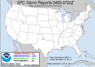
SCATTERED SHOWERS AND THUNDERSTORMS ARE FORECAST TODAY AND TONIGHT ACROSS MOST OF THE AREA...ESPECIALLY NORTH FLORIDA. AN ISOLATED SEVERE STORM WILL BE POSSIBLE TODAY...MAINLY IN THE LATE AFTERNOON AND EVENING. THE MAIN THREAT WOULD BE STRONG WINDS... VERY HEAVY RAIN AT TIMES...AND FREQUENT LIGHTNING.
Finally, a hazardous weather outlook for our area. It's been about a week since we have had one of those. I almost forgot what it was like to expect weather... The Gulf Sea Breeze looks impressive. We should get something out of that, but it'll be scattered. Spotter activation is not expected. What a shocker (lol)!!!
Let's say hello to Tropical Storm Debby as she creeps away from Africa at a whopping 15mph. Her pressure's dropping (1002 mb), and the winds are increasing (45 mph). The Tropical Prediction Center website seems to be having some difficulty this morning, so I'm not getting a graphic, but I'm sure she's coming along nicely. They anticipate she'll be a hurricane in about 72 hours. She's more than 5 days out from impacting land. Snore. I've been talking about my sense that Debby will be a big one. Let's see what she does. I invited LL to Bermuda for a storm chase... lol
As for everything else, I have been reading my camera manual again, and I am learning so much about my camera, now that I know what some of the terminology means. That certainly helps. I should be a great photographer by the end of my class. I can't wait!!!
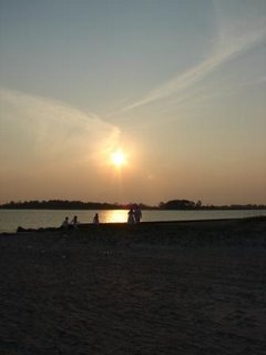
That's all I've got. Here's something from my stash of pics. I took this one in Tybee Island right before my friend's wedding there in July. I never get tired of sunsets.
~Dewdrop
Wednesday, August 23, 2006
Here Comes Debby!
Subscribe to:
Post Comments (Atom)


No comments:
Post a Comment
Dew comment, please...