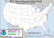
Surveys are underway of the damage path in Central Florida and initial reports are in, and here are some of the main points: ...THE LATEST FIELD REPORT FROM THE LAKE COUNTY SURVEY TEAM......WINDS ESTIMATED AS HIGH AS 165 MPH IN VICINITY OF PAISLEY IN LAKE COUNTY FLORIDA FROM FRIDAY MORNINGS DEADLY TORNADO... NOTE...THIS IS ONLY A SMALL SECTION OF THE OVERALL DAMAGE TRACK STRETCHING ACROSS NORTH LAKE AND CENTRAL VOLUSIA COUNTIES. INITIAL FIELD REPORTS ARE THAT A HIGH END EF-3 TORNADO STRUCK THIS AREA CAUSING COMPLETE DESTRUCTION OF MOBILE HOMES.. THE ESTIMATED TORNADO WINDS NEAR PAISLEY AND LAKE MACK WERE 160 TO 165 MPH WHICH RESULTED IN 11 FATALITIES. THE ESTIMATED TORNADO WINDS EASTWARD NEAR THE COUNTY LINE WERE 150 TO 154 MPH WHICH RESULTED IN 3 FATALITIES.THE EF-3 TORNADO APPROACHED THE PAISLEY AREA FROM THE WEST SOUTHWEST STRIKING LAKE MACK AT 348 AM AND THEN STRIKING THE AREA NEAR STATE ROAD 44 AT 350 AM. A TOTAL OF 14 KNOWN FATALITIES OCCURRED DURING THIS DEADLY TWO MINUTES. THE TORNADO AT PAISLEY WAS ESTIMATED TO BE ONE-QUARTER MILE WIDE... NARROWING AS IT MOVED EAST AND APPROACHED THE COUNTY LINE. THE DAMAGE ALONG THIS SEGMENT WAS CONTINUOUS.
...WINDS ESTIMATED AS HIGH AS 154 MPH IN VICINITY OF HONTOON ISLAND AT THE VOLUSIA/LAKE COUNTY LINE...INITIAL FIELD REPORTS ARE THAT A HIGH END EF-3 TORNADO MOVED EAST FROM PAISLEY (LAKE COUNTY)CROSSING THE COUNTY LINE STRIKING THE HONTOON ISLAND AREA WITH WINDS OF 150 TO 154 MPH. THE TORNADO THEN MOVED THROUGH THE DELAND AREA BECOMING A HIGH END EF-2 CAUSING COMPLETE DESTRUCTION OF MOBILE HOMES AND TREES WERE SNAPPED OFF.THE TORNADO AT HONTOON ISLAND WAS ESTIMATED TO BE ONE-EIGHTH MILE WIDE BEFORE LIFTING. THERE IS AN INITIAL INDICATION THAT EF-1 TORNADO DAMAGE OCCURRED IN NEW SMYRNA BEACH. THUS...THIS WOULD BE THE RESULT OF A SECOND TORNADO.
For complete and updated reports, follow this link: Preliminary Survey Reports out of Melbourne NWS
Had some exciting news today, truly exciting news!!! I talked with the acting Emergency Management Director, who has actually been in that position for some time now, and I told him of my background in damage assessment for the Red Cross, my passion for storms and certification in spotting, and he said that they WILL DEFINITELY UTILIZE ME!!! What they will do is when there is a storm with damage reported, they will pair me up with paid staff to travel around and do damage assessment. Yes, he did. That is a huge door open for me, and I could hardly contain myself when he told me. I am thrilled. Thanks, Hubby (for arranging the talk) and Jim (for the enthusiastic response)!
Aside from that, I had the lovely pleasure of experiencing Pavo today. Unfortunately, I think hubby is allergic, he sneezed the whole time while we were in city limits. It's a tiny little town, granted, not as tiny as Barney, where all that exists are train tracks and a Post Office, and don't you dare blink because you might miss it, great westward view over in that area though, lots of open fields, good vantage point. All these charming little blips of rural south Georgia.
Mini-Diva did well in her competition. Again, her team came in first place, and I believe that she was greatly improved since the last competition.
Current weather: COLD! That's all I have to say about that. There is talk of an unimpressive system headed this way towards the end of next week... well, at least they aren't getting my hopes up this time...
Happy Saturday. I am about to learn all about the enhanced fujita scale. Thanks, Jay R for the link Enhanced Fujita Scale Lessons. It will definitely help with my new damage assessment opportunity, cause I'm cool like that.
Toodles,
~Dewdrop
Saturday, February 03, 2007
Survey says...
Subscribe to:
Post Comments (Atom)


No comments:
Post a Comment
Dew comment, please...