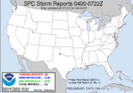
OK, so all along, I've been telling folks that I'll get plenty of sleep, that NOTHING interferes with my sleep. Well, I am here at 6:30 (been wide awake since 6:00) to tell you that I was WRONG! Let me say it again for those of you who collapsed in a heap on the floor when you read that. I WAS WRONG! Apparently, the prospect of chasing tornadoes very much keeps me awake. The force is strong! Great googaly moogaly, I hadn't counted on nerves. I usually have nerves of steel. My stomach is tied in knots. It's a good thing I have Tums (I always have Tums). Anyhow, I still have no idea where we are headed. Let me check the forecast and see what I think... OK, for today, it looks like the action is to our west, so if we're chasing, we need to go west, but here's what I'm thinking... today will probably be a set-up day, get acquainted and all that... then, tomorrow, we can chase the monster. This is the day two outlook map... has been a moderate risk since yesterday (a day 3 moderate risk means business), and the text is strong, especially coming from the SPC. I hate to bore you with details, but this is too good not to share. I'll just hit the points that excite me... (which for you fair weather - as opposed to severe weather - fans, might seem like a lot... well, you're right. The entire outlook excited me!!)
WIDESPREAD/POTENTIALLY-SIGNIFICANT SEVERE WEATHER EPISODE APPEARS LIKELY ACROSS THE PLAINS...AS A VERY STRONG UPPER SYSTEM AND ACCOMPANYING/UNSEASONABLY STRONG DEEP-LAYER WIND FIELD SPREAD INTO THE PLAINS WHERE MOIST/VERY UNSTABLE AIRMASS IS ANTICIPATED.I'm going to go ahead and say that I expect a PDS tomorrow, and I also expect to catch me a tornado!!! Woohoo!!! Outstanding CAPE, super strong shear, strong/long-lived supercells, very large hail, few significant tornadoes... OK, folks... it's showtime! I'm off to get ready!
AS ELEVATED MIXED LAYER SPREADS EWD ACROSS THE PLAINS...DAYTIME HEATING COMBINED WITH A LARGE AREA OF UPPER 60S DEWPOINTS BENEATH STEEP LAPSE RATES ALOFT WILL YIELD STRONG DESTABILIZATION -- WITH MIXED-LAYER CAPE REACHING 3000 TO 4000 J/KG ACROSS A LARGE AREA.
THOUGH CAP WILL LIKELY SUPPRESS CONVECTIVE DEVELOPMENT ALONG/E OF DRYLINE WELL INTO THE AFTERNOON...STORMS SHOULD DEVELOP NEAR THE LOW...AND AHEAD OF THE FRONT/DRYLINE ACROSS THE CENTRAL DAKOTAS BY LATE AFTERNOON.
WHILE CAPPING -- AND SUBSEQUENT POTENTIAL FOR STORM DEVELOPMENT -- APPEARS TO BE A POTENTIAL LIMITING FACTOR WITH RESPECT TO SEVERE STORMS...CAPE/SHEAR COMBINATION WILL NOT...AS INCREASINGLY-STRONG MID-LEVEL FLOW SPREADS INTO THE PLAINS THROUGH THE AFTERNOON. AS 70 KT LOW-LEVEL JET DEVELOPS DURING THE EVENING AND 60 TO 70 KT SWLY MID-LEVEL FLOW SPREADS AS FAR E AS THE COLD FRONTAL ZONE...SHEAR WILL BECOME INCREASINGLY-FAVORABLE FOR STRONG/LONG-LIVED SUPERCELLS.
OVERNIGHT...STORM MODE MAY BECOME A COMBINATION OF SUPERCELLS AND SMALL-SCALE LINES/BOWS...THOUGH A TORNADO THREAT WILL LIKELY EXIST THROUGH THE PERIOD IN ADDITION TO VERY LARGE HAIL AND DAMAGING WINDS. GREATEST TORNADO THREAT -- INCLUDING THE POTENTIAL FOR A FEW SIGNIFICANT TORNADOES --APPEARS TO EXIST ACROSS CENTRAL AND ERN PORTIONS OF NEB AND SD AND VICINITY THROUGH THE EVENING. DEPENDING UPON EVOLUTION OF STORM MODE WITH TIME... POTENTIAL FOR MORE WIDESPREAD/SIGNIFICANT WIND DAMAGE MAY ALSO INCREASE INTO THE EVENING.
Reaching for the sky! My heart really does have wings, and folks, I am fixin' to chase that dream!!!
~Storm Chaser Dewdrop


Sounds like a party! You going to have a blast!
ReplyDeleteIt looks like an awesome setup for you. I don't think you can ask for more than that. You are guaranteed to see super cells thunderstorms and meso's like never before. What an amazing experience awaits you. Enjoy!
ReplyDeleteThanks, guys! This is truly amazing!!!
ReplyDeleteIf you scare away this setup with the great powers of the Dewvoid, we are driving up there, packing you in a crate (with holes drilled for air...we're not savages...lol), and shipping you back home. LOL!!
ReplyDeleteSeriously, it's no doubt going to be a BIG event with an outbreak of tornadic supercells. On top of that with all of the instability, you should see increadible storm structures and copious lightning shows. It's a stormchasers dream. :-)
Good luck tomorrow!!
Ehem, I'm not feeling the love... on one side, I've got potentially rotating storms at home. Here, the awesome storm chasers' dream set up that I could kill... I hope I don't kill this one. lol
ReplyDeleteI cannot wait!!!
Live the dream!!
ReplyDeleteI told them chasing a storm is a like eating a hot fudge sunday with the tornado as the cherry,
i am still gonna eat and love the sunday without the cherry but i realy would love a cheery with my sunday! but iam ordering extra cherrys for you girl eat up and enjoy!!!
Thanks, girl. I'll take all the cherries I can get!!!
ReplyDeleteBest of luck to you out there tomorrow - looks like a great day to kick things off!
ReplyDeleteThanks, Steve Miller - OK. It looks to me like the perfect day to start things off. BTW, loved your blog about inspectors. Hubbby used to be one... lol!
ReplyDelete