 Here is number 6. I am not sold on this one... It is lacking something, but I am considering it.
 Weather... well, you can see from the previous posts that the Dewvoid kicked in with my wallup of a storm... well, someone else's wallup of a storm... lol Of course, everything was done by the time I got out of work, so I took a little detour after some dinner out with co-workers. Ended up mud-boggin' a little when I was traveling down a dirt road chasing the sun. Now, my fender wells are caked in mud. I am just relieved that I didn't get stuck there... Boggin' in the minivan, probably not a good idea. I was actually chasing the reflection of the sunset because I never did find a good west facing view, so I looked east, and that's when I saw the beautiful lit up clouds pictured here.
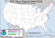
Today's forecast is similar to yesterday's. We are expecting yet another round of typical summer afternoon showers and thunderstorms, but with some drier air moving in, it will fail in comparison to what SOME experienced yesterday... nothing severe, but there could be some strong gusty winds, small hail and heavy downpours, and OF COURSE ALL THUNDERSTORMS POSE A THREAT TO LIFE AND PROPERTY BECAUSE OF LIGHTNING.
 About doggone time for some action out of the tropics, and here is the exciting news... we have two areas of interest! One is actually our 3rd named storm of the year. A big HELLO to TS Chantal. The other is potentially our 4th (pictured to the left). I have a lot of hope that he will soon become TS Dean, and he is definitely the more interesting of the two. It's very exciting. I'll keep an eye on everything.
...SPECIAL FEATURES...Finally, some weather to talk about!!!
TROPICAL DEPRESSION THREE (NOW TROPICAL STORM CHANTAL) CENTERED NEAR 37.8N 64.9W 330 NM NORTH OF BERMUDA AND ABOUT 330 NM SOUTHEAST OF CHATHAM MASSACHUSETTS MOVING NNE 18 KT. ...THERE IS THE POTENTIAL FOR THE DEPRESSION TO REACH STORM STRENGTH WITHIN THAT TIME. This is not expected to impact the US.
1010 MB LOW NEAR 10N50W POSSIBLY SPAWNED BY THE RE-LOCATED TROPICAL WAVE ALONG 58W WAS LOCATED ABOUT 650 NM E OF THE WINDWARD ISLANDS IS FAIRLY WELL ORGANIZED WITH A BAND OF SCATTERED MODERATE TO STRONG CONVECTION DEVELOPING WITHIN 120-150 NM OF THE WELL DEFINED LOW LEVEL CENTER. THIS SYSTEM IS IN A FAVORABLE ENVIRONMENTAL FOR DEVELOPMENT AND COULD BECOME A TROPICAL DEPRESSION OVER THE NEXT COUPLE OF DAYS.
Have a fabulous day!
~Dewdrop


I agree...99L looks more interesting. If it can avoid the dry air to the north it may make it. Could be a Yucatan storm down the road.
ReplyDeleteSCM
99L does look more interesting doesn't it. I am watching it on the loops over and over. Chantal could be impressive as an extra tropical low over the new 48 hours. Could be quite a view on SAT here soon. Keep watching the models, I do believe we will be busy for the next 10-12 weeks.
ReplyDeleteSCM
It's showtime!!! About time, huh?
ReplyDeleteI am just waiting for the day we can chase storms with names like "Joniqua". LOL
ReplyDeleteI don't know, Chantal is cutting it awfully close! lol
ReplyDeleteLooks like we'll come close again in 2009 with Joaquin.