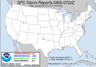
 This is not a recent picture... obviously... but it made me smile this AM, so I decided to post it. Man, was the fog ever thick this AM, as I was seeing Mini-Dew off to school this AM. I could hardly see her at her bus stop, and that is just .06 mile away. Now, that is some THICK FOG! It had lifted significantly by the time I was leaving the house, thanks to the sun rising into the hazy sky. Aside from that, looks like things are settling back down convection-wise. Lower CAPES (3000J/kg, which, might I add, is still higher than most of the days we had this spring... you know, severe weather season...) have prompted a depressing AFD...
DRY AIR AND LOWER INSTABILITY ALONG WITH SUBSIDENCE AS UPPER RIDGE AXIS SLIDES SOUTH SHOULD LIMIT COVERAGE OF CONVECTION THIS AFTERNOON.We are ridging and capping it, folks. Our only hope at relief from heat are pulse storms generated from a less-than-likely-chance that the sea breeze will get up our way. A Public Information Statement was offered up by "the guys" as the heat wave continues. Great... Fortunately, today, WE are NOT going to be at heat advisory levels. Dewpoints are finally dropping, relative to what they have been. Doesn't look like it wants to last.
 Now, to look on over at the tropics, looks like tropical wave 90L is fighting to hold on, possibly to become a tropical depression by later today if it can pull it together. Keeping a close watch on that, and it sounds like things are possibly going to develop in that area in the Caribbean in a couple of days.
  Update: Just got a comment from Storm Chasing Mikey that we now have Tropical Depression #4!!! You can get updates on the NHC website. We could have TS Dean soon. Oh yeah... GFS looking more and more believable...
  Go figure. Sure enough, "04L, No Name". and 91L in the Caribbean... Yahoo!!! The tropics are awake now!!! We have TD #4!!!!! Caribbean storm just got numbered as a wave of low pressure. 91L. It's a race now, to see which one gets the esteemed name... DEAN!
Oh, and I totally forgot to mention Hurricane Flossie churning in the Pacific. She is a CAT 4, and she is skirting by Hawaii... keeping an eye out that way, she looks to downgrade before impact, which is good news. All they need out of her is the rain since they have been hit with drought this year.
Ciao,
~Dewdrop


Lots to be watching now as we swelter!
ReplyDeleteCane Season 07... finally! I expect my tracking chart to come alive with color...
ReplyDeletewith the way the african wave train is lined up we could be busy until october. 91L and 04D will keep us busy this week for sure. The easterly shear is really hurting 04L for now, but once the center of low pressure gets under the convection, watch out.
ReplyDeleteNHC has their 5 day track up....cane in 3 days.
SCM
Got 'em on the map. We will certainly be busy with these two. I'm ready to ride that train!!!
ReplyDeleteI wish I had more leave available for hurricane chasing!
ReplyDeleteI know! I used all mine up in the plains... not that I am complaining... ;-)
ReplyDeleteI'm saving it as much as possible...if something heads for the FL panhandle or AL coast, I may have to think about it!
ReplyDeleteSwing by and get me if you do that???? lol
ReplyDeleteno one knows where this thing is gonna go...
ReplyDeleteI like to try to predict. I am thinking a cut across the peninsula and back into the GOM... not getting a gut feeling past there.
ReplyDelete