 I think I have come to terms with the bus driver hitting the tree situation. Thanks to Carrie and Annie for offering some great insight there, but I did sit with a mom yesterday who FREAKED when she heard about why the bus was late the other day, so I don't think my reaction was too out-of-line. Yesterday, when I picked up Mini-Dew, she announced that she was 10 minutes late for school yesterday because a tow-truck had to come and pull the bus out of the mud. Mud bogging in the cheese wagon!!! LOL! I am ok with the tow truck situation. Hard to prevent that in south Georgia on some of these dirt roads. It did get me curious about mud bogging though, and that got me looking online, where I found that Goochland, VA, has a "mud bogging" emergency ordinance in place...
 Emergency Mud Bogging Ordinance: On a motion by Mr. Pryor, seconded by Mr. Eads, the Board unanimously voted 5-0 to approve the following Emergency Ordinance as presented All ages.
Seriously... they have outlawed mud bogging?! Give me a break!
EMERGENCY ORDINANCE - TO PROHIBIT THE ACTIVITY KNOWN AS “MUD BOGGING”, PURSUANT TO TITLE 15.2, CHAPTER 14 AND CHAPTER 22 OF THE CODE OF VIRGINIA, AND INCLUDING SPECIFICALLY VIRGINIA CODES §15.2-1427(F) AND §15.2-2286(A)(7). OK, I have talked long enough about school buses and mud bogging this morning. Onto the weather... I have been talking to my friend, Melissa (the newest Meso Momma), who coordinates CoCoRaHS in the region, and it looks like Georgia will be going live in May!!! Woohoo! I am "Cuckoo for CoCoRaHS!!!" She shared that slogan with me. Isn't it great?! I plan on signing up as a volunteer as soon as it becomes available in Georgia. If you have it available in your state, you should consider volunteering. Here is some information about the collaborative effort of CoCoRaHS.
 What is CoCoRaHS??
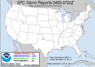
Now, onto current weather... Yep, that low pressure system is sweeping across the central US, with its squall-line tail, whipping around toward me. Already, the SPC has issued a Tornado Watch for southern portions of Texas and Louisiana.
CoCoRaHS is an acronym for the Community Collaborative Rain, Hail and Snow Network. CoCoRaHS is a unique, non-profit, community-based network of volunteers of all ages and backgrounds working together to measure and map precipitation (rain, hail and snow). By using low-cost measurement tools, stressing training and education, and utilizing an interactive Web-site, our aim is to provide the highest quality data for natural resource, education and research applications. We currently operate in many states across the country. If we are not in your state please drop us a line and let us know that you have an interest in participating. This helps us know where a desire exists for the network and where to focus our future expansion efforts. This system is moving fast, and it looks like I am now just barely east of the "slight risk" area (barely, but nonetheless, much closer) outlined by the SPC, so I will be prudent to monitor the weather today and later into tonight, when things are most likely expected to intensify... night time on Thursday... of course. The perfect combination for me being unable to chase the storm, so it's the only obvious choice. Here is the wording that relates directly to my part of this storm...
 THE SVR THREAT SHOULD CONTINUE E ACROSS PARTS GA TONIGHT AND EARLY FRIDAY. INCREASING UPR DIFFLUENCE IN SE QUADRANT OF UPR SYSTEM AND WIDESPREAD INFLUX OF MOISTURE SUGGEST THAT BY THAT TIME THE STORMS WILL HAVE EVOLVED INTO AN EXTENSIVE SQLN. EMBEDDED SUPERCELLS WITHIN THE LINE WILL CONTINUE TO POSE A RISK FOR ISOLATED TORNADOES...IN ADDITION TO DAMAGING WIND.
The wording out of the SPC is strong for this whole system. **INCREASINGLY FAVORABLE ENVIRONMENT FOR SFC-BASED SUPERCELLS
Keep those weather radios nearby, folks. It's headed this way! Skywarn spotters, activate! It's weather time!
**STRONGLY-SHEARED ENVIRONMENT
**POTENTIAL WILL EXIST FOR STRONG TORNADOES
**BOWING SEGMENTS WITH DAMAGING WIND AND HAIL
2:45 Updated Outlook from the SPC... AS WARM SECTOR CONTINUES TO SHIFT INLAND... THERE WILL BE AN INCREASING THREAT FOR MORE DISCRETE SUPERCELL DEVELOPMENT BOTH ALONG THE WARM FRONT AND WITH STORMS MOVING ONSHORE IN THE WARM SECTOR. GIVEN MOIST INFLUX WITHIN THE WARM SECTOR AND STRENGTH OF LOW LEVEL SHEAR...THE POTENTIAL ALSO CONTINUES FOR A STRONG TORNADO.
The HWO from the guys at the NWS has also been updated to reflect a little more potential for some action in my neck of the woods...
COLD FRONT TRAILING SWD FROM SERN OK SURFACE LOW IS EXPECTED TO OVERTAKE PRE-FRONTAL CONVECTIVE LINE LATER THIS EVENING ACROSS THE CENTRAL GULF COAST REGION. INCREASING UPPER DIFFLUENCE IN SE QUADRANT OF UPPER SYSTEM AND INFLUX OF MOISTURE SUGGEST THAT A LINE OF TSTMS ALONG THE COLD FRONT SHOULD CONTINUE EWD ACROSS PARTS OF SRN AL/FL PANHANDLE AND GA OVERNIGHT. EMBEDDED SUPERCELLS WITHIN THE LINE WILL CONTINUE TO POSE A RISK FOR ISOLATED TORNADOES...IN ADDITION TO DAMAGING WIND.THIS HAZARDOUS WEATHER OUTLOOK IS FOR SOUTH CENTRAL GEORGIA
...SEVERE WEATHER POSSIBLE TONIGHT...
A WARM FRONT WILL MOVE SLOWLY NORTH ACROSS THE REGION LATE THIS AFTERNOON AND TONIGHT...AS A STRONG COLD FRONT APPROACHES FROM THE WEST. SCATTERED SHOWERS AND EVEN A FEW THUNDERSTORMS WILL CONTINUE TO DEVELOP THIS AFTERNOON...BUT WILL BECOME NUMEROUS TONIGHT AND EARLY FRIDAY MORNING. CONDITIONS APPEAR FAVORABLE FOR SOME OF THESE THUNDERSTORMS TO BECOME SEVERE TONIGHT...WITH DAMAGING WINDS BEING THE PRIMARY THREAT. A FEW TORNADOES WILL ALSO BE POSSIBLE...ESPECIALLY IF THE WARM FRONT MOVES INLAND FAR ENOUGH TO BRING IN WARM MOIST AIR FROM THE GULF. THE STORMS WILL BE ENDING FROM WEST TO EAST FRIDAY MORNING AS THE COLD FRONT SWEEPS THROUGH THE AREA.
.SPOTTER INFORMATION STATEMENT...
SPOTTER ACTIVATION MAY BE NEEDED TONIGHT. SPOTTERS SHOULD CONSIDER THEMSELVES ACTIVATED WHEN A WATCH OR WARNING IS ISSUED. Snapshot of what's going on in Louisiana/Mississippi, could be dropping a tornado right about now. Be on alert folks over that way.
Happy Dew Dance,
~Dewdrop
Thursday, January 31, 2008
Severe weather ripping across the southern US
Labels:
CoCoRaHS,
Severe weather event
Subscribe to:
Post Comments (Atom)


This system looks to me like it will still be very dynamic when goes through your area...
ReplyDeleteI guess this one could be the true test of the Dewvoid. ;O)
ReplyDeleteWe all have made it through January. I can smell spring storm season coming and the south is about to begin the show the next 72 hours.
ReplyDeleteWoohoo! I just wonder if it can stand up to the strength of the Dewvoid... I will keep a close watch on it tonight. Y'all call me if you see something.
ReplyDeleteThis will put the Dewvoid to the test... I will be in the Birmingham area tonight for the "Storm Alert" tour...
ReplyDeletehttp://www.jamesspann.com/wordpress/?page_id=5153
...so I may not have a chance to watch the storms....
Whatever, Mike... you're going to be with a bunch of weather geeks, and you think you won't be watching this mess. It's the biggest game in town. You guys won't be able to focus on anything else... kind of like me, now, watching this cell in Clinton/Greensburg, LA.
ReplyDeleteCoCoRaHS sounds quite interesting!
ReplyDeleteCan't wait for all the rain to move in, as usual it will hit as I'm going to and/or coming home from work tonight, love that drive. I thought dd was going to get blown over when she got off the bus, the wind was crazy!!
You should volunteer, Nicole. That area definitely needs a good handle on rainfall totals.
ReplyDeleteI hope you don't have to drive in the bad weather.
Wow, they were ONLY ten minutes late? A mud bogging bus looks like fun! A lot more fun than a tree striking bus. LOL
ReplyDeleteThey probably have tow trucks standing by for Mini-Dew's bus... lol
ReplyDeleteIt does look fun, doesn't it? We should see if they offer rides. :O)