 Currently, I barely fall within the outer edge of a severe thunderstorm watch. Some key details for this weather watch include a statement that actually made me laugh out loud...
SEVERE THUNDERSTORMS CAN AND OCCASIONALLY DO PRODUCE TORNADOES.
Really, is that normal? LOL... I shouldn't pick on the SPC guys because they do a fantastic job, and they are generally making public statements for people who don't know much about weather, not really for me. A BAND OF STRONG/SEVERE STORMS WILL CONTINUE TO MOVE QUICKLY (to the tune of 55 - 60mph across the southeast) EWD FROM SE AL INTO SW GA...AND ADDITIONAL WARM SECTOR STORM DEVELOPMENT MAY OCCUR ACROSS THE FL PANHANDLE. THE STRONGER EMBEDDED STORMS AND BOWING SEGMENTS WILL BE CAPABLE OF PRODUCING DAMAGING WINDS. THOUGH LOW-LEVEL SHEAR SHOULD PEAK BY MID-LATE MORNING...THIS AREA WILL ALSO BE MONITORED FOR ANY INCREASE IN THE TORNADO THREAT WITH EMBEDDED OR DISCRETE STORMS BY LATE MORNING OR MIDDAY.
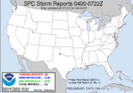
Yes, this squall line is racing across the southeast. The squall line has strengthened through the morning hours thus far, actually showing some signs of rotation on that leading edge up in central Georgia, proving the SPC's forecast to be completely accurate. Here are side-by-side images of the radar presentation... on the left is in my area, and what I have approaching... the right is up in central Georgia, up near Macon, Georgia.

With the strength of this squall and the outrageous speed with which it is moving across the country, we can expect damaging winds to be the main threat today. There is talk of hail and... tornadoes, but I expect that wind will dominate the report board. I will keep one eye to the radar through the morning. Talking about this storm... TWC was offering its take on the weather locally... the report was that some of the thunderstorms could be strong (downgraded from yesterday's warning of some being potentially severe), but then they contradicted that by announcing that we can expect strong damaging winds and large hail... perhaps, Weather Channel folks should review the parameters for a severe thunderstorm classification...
A storm is considered severe when...
1. Winds reach over 50 knots (58 mph)
2. Hail is ¾ inch (2 cm) diameter or larger
3. A funnel cloud or tornadoes are spotted Enough about that... I am in weather watch mode. Keep your eyes to the sky. Keep your weather radios on (incidentally, guess who accidentally left hers at home today... oopsies.) This is a fast moving squall line. There is potential for outlying cells to generate ahead of the line and form supercells with dangerously devastating consequences. If you hear of a tornado warning in your area, seek shelter immediately, check for accuracy later. Some of the worst weather conditions can appear "out of the blue". I am looking forward to perhaps a "backyard" (at the office) chasetunity. This storm is not really one to chase, heavy precipitation, fast moving storm, heavily wooded area (South Georgia) with limited visibility and signs of rotation on the leading edge. It will chase you, just stay put. BTW, this picture was taken in July, but it made me smile, so I thought I would share...
Update 10:30: This issued in a Meso Discussion from the SPC: 
ADDITIONALLY...THE THREAT OF A TORNADO OR TWO APPEARS TO BE INCREASING OVER CNTRL/ERN PARTS OF WW 79. CONVECTIVE TRENDS ARE BEING MONITORED FOR A POSSIBLE UPGRADE TO A TORNADO WATCH OVER NRN FL AND SRN GA.
I am currently supporting Rick who is chasing... updates on the team site. Lots of CG around him, and we just got our tornado watch. 11:30 Update:
 Ciao,
Ciao,
~Dewdrop
Tuesday, February 26, 2008
Severe Thunderstorm Watch again...
Labels:
severe thunderstorm watch,
Slight Risk
Subscribe to:
Post Comments (Atom)


Nice cloud photo--and I love that you added Sunshine on My Shoulders to your blog songs! Where's that Queen song?
ReplyDeleteThanks... which Queen song?
ReplyDeleteIt's raining... It's pouring...
ReplyDelete:( No severe weather... though you have a better chance of getting some.
I'll have to check my gauge after the line passes..
It's not raining here now, but is almost here. The squall is almost here. I might try to shoot lightning during lunch.
ReplyDeleteSo are the lakes starting to fill up now that you are getting some storms through there this year?
ReplyDeleteThe cups runneth over.
ReplyDeleteBohemian Rhapsopdy! Remember? Thunder bolt of lightening, very very frighteningly! Galileo!
ReplyDeleteI totally forgot... sorry. I will get on that as soon as possible.
ReplyDelete