Well, several members of the Southern Weather Brigade are abuzz with life, after a long bout with SDS (Supercell Deprivation Syndrome), since the arrival of the MODERATE RISK in my neck of the woods. Yes, folks, I WILL be storm chasing tomorrow! At this time, I am charging up the batteries for my still camera, as well as on my video camera... thanks Rick. I have spoken briefly with Rick and Meso Mike, who are both geared up for a chase tomorrow. I have been in touch with Jay, who will be visiting his mom deep in the moderate risk area (looks like whether he planned it or not Jay will be chasing), and am trying to get in touch with Alabama Mike (Alabama Mike, your mailbox is full... could you call me?) to coordinate support. Of course, I will have my chase partner, bf, with me, who I need to remind about the dangers of driving under wall clouds. Don't know yet if we are going for the divide and conquer approach or what, but we are all geared up and ready to go. Here's the discussion out of the SPC.
COMBINATION OF INSTABILITY/SHEAR STRONGLY SUGGEST ANY DISCRETE STORM STRUCTURES WILL ROTATE POSING A THREAT FOR TORNADOES. GIVEN THE FORECAST STORM MOTIONS MANY OF THESE STORMS COULD EASILY BE LONG-TRACK AND POSSIBLY DAMAGING.
So, Happy Mother's Day to me! I will be chasing tomorrow.THE WEATHER WILL BEGIN TO GET QUITE INTERESTING AS THE STORM SYSTEM IN THE PLAINS MOVES INTO THE OHIO VALLEY. AS HAS BEEN STATED MANY TIMES... THIS EVENT LOOKS TO COMBINE SOMETHING WE RARELY SEE IN THE COLD SEASON...HIGH CAPE AND HIGH SHEAR. MODEL SOUNDINGS FOR SUNDAY SHOW SBCAPE IN EXCESS OF 2500 J/KG IN THE GFS...WITH AROUND 2000 J/KG IN THE NAM. 0-6KM BULK SHEAR APPROACHES OR EXCEEDS 50 KNOTS ACROSS OUR FORECAST AREA. THESE PARAMETERS ARE MORE THAN SUFFICIENT TO GENERATE SEVERE WEATHER.
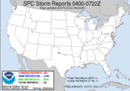
 Today, there is a HUGE area of moderate risk covering a large part of the south. In fact, a Public Severe Weather Outlook (click here) has been issued for folks living in CENTRAL AND NORTHERN ALABAMA, MUCH OF ARKANSAS, MUCH OF GEORGIA, FAR SOUTHERN ILLINOIS, FAR WESTERN KENTUCKY, NORTHERN LOUISIANA, SOUTHERN MISSOURI, CENTRAL AND NORTHERN MISSISSIPPI, FAR EASTERN OKLAHOMA, WESTERN AND MIDDLE TENNESSEE, FAR EASTERN TEXAS. (Oh, is that all?)
 THE GREATEST THREAT FOR STRONG TORNADOES WILL OCCUR THIS AFTERNOON AND EVENING OVER CENTRAL AND EASTERN ARKANSAS...NORTHERN MISSISSIPPI AND WESTERN TENNESSEE.
This is a large area of moderate risk, and folks within green should be watchful, but the folks in the the red outlined area, should be especially vigilant! In other words, keep your weather radios on. Have you safe spot ready. If warnings are issued, seek shelter immediately, check the validity later! Seriously, this is not a drill!!! As active as this season has been, today could very easily be the day that they think it might be... THOSE IN THE THREATENED AREA ARE URGED TO REVIEW SEVERE WEATHER SAFETY RULES AND TO LISTEN TO RADIO...TELEVISION...AND NOAA WEATHER RADIO FOR POSSIBLE WATCHES... WARNINGS... AND STATEMENTS LATER TODAY.
Be safe! Bf and I are headed to the drag races tonight. I should get some good pics from that. LOL... unless it's rained out... or better yet, severe weathered out... meso discussion... 
GIVEN THE PRESENCE OF 3000 J/KG OF MUCAPE...40-50 KTS OF EFFECTIVE VERTICAL SHEAR...ANY TSTM THAT DOES BECOME SFC BASED WILL LIKELY TAKE ON SUPERCELL CHARACTERISTICS WITH THE THREAT FOR LARGE HAIL/DMGG WINDS. MAY SUPPORT THE THREAT FOR ISOLATED TORNADOES.
Toodles,
Dewdrop
Saturday, May 10, 2008
Finally, a MODERATE RISK for me... tomorrow!!!
Subscribe to:
Post Comments (Atom)


Strong wording by the SPC, gonna be a real outbreak, i just hope nothing above an F3 drops. Be safe and have fun!
ReplyDeleteSCM
Well, and almost anywhere around here that something drops, something will be damaged... not too many large open fields in my neck of the woods. This could be really awful.
ReplyDelete