 I thought I would start this post with a sunny beach day, in honor of the excruciatingly hot summer-like weather we have been experiencing down here in south Georgia... but... for the first time in weeks, we are actually looking at a hefty shot at rain and thunderstorms in my neck of the woods today. As I mentioned yesterday, we have been experiencing the pop up summer-like VERY ISOLATED thundershowers daily for a while, but they have ALL missed my house. Today looks to be the best shot in a while for some actual precipitation. We shall see. All I can think about is that Sesame Street theme song, "Sunny days, sweeping the clouds away..." So, of course, I had to add that song to the blog... :O)
 Anyways, I have some unfortunate news... A tornado watch was just issued for much of the western part of New England. With this watch comes a 40% chance that they will have some tornadoes, and a 20% shot at major tornadoes. The unfortunate part comes with population density. We are talking about New England, which is a great deal different from the plains as far as the placement of people throughout the area. A moderate risk for severe weather has been issued with its accompanying Public Severe Weather Outlook.
THE AREAS MOST LIKELY TO EXPERIENCE THIS ACTIVITY INCLUDE
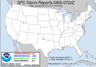
Not the typical "severe weather area", but it's not unheard of... people in those areas should vigilantly stay abreast of the weather around them, take in all the clothes off their lines and strap down their roosters... (sorry, Troy, had to...) Here's what the map looks like...
EXTREME WESTERN MASSACHUSETTS
EXTREME NORTHWESTERN NEW JERSEY
CENTRAL AND EASTERN NEW YORK
CENTRAL AND EASTERN PENNSYLVANIA
MUCH OF VERMONT
THE DEVELOPMENT OF BOW ECHOES AND BRIEF SUPERCELL STRUCTURES WILL BE LIKELY WITH A LARGE NUMBER OF DAMAGING WIND GUSTS POSSIBLE OVER THE MODERATE RISK AREA. IN ADDITION...HAIL AND AN ISOLATED TORNADO OR TWO CAN ALSO BE EXPECTED...PRIMARILY OVER PORTIONS OF CENTRAL AND EASTERN NEW YORK...EXTREME WESTERN MASSACHUSETTS AND PARTS OF VERMONT. Well, hopefully everyone stays safe.
I have heard some horrible stories about the flooding in Wisconsin, Illinois and Indiana (predominantly) resulting from the, in some places, over a foot of rainfall. Four homes have been swept away into the river, and 9 people have died in storms and flood waters. What's worse is that the same area is expecting MORE RAIN through FRIDAY, in some parts of that area, a slight risk for severe weather has been identified for the next several days. God bless them. Sure wish we could transfer rain to the drought filled areas and offer up relief to those in the flooded areas.
Toodles,
~Dewdrop
Tuesday, June 10, 2008
Sunny days till the clouds come home...
Subscribe to:
Post Comments (Atom)


Great picture to start the post Dew.. I hope this weather peters out or turns... I watched the news last night of the floods you mentioned and saw a beautiful home fall in the river. I hope folk are going to be OK, but nature can be cruel at times.
ReplyDeleteI'll catch younext time for sky watch.
I agree with Old Wom Tigley... Nature can really be cruel most of the time... :)
ReplyDeleteAnd yes, another wonderful shot Dew! :D
Well if the transfer of rain to drought places is possible... :(
Tom, It has been quite a wild year. Hard to believe just how much devastating weather we have experienced. Ma Nature can definitely be cruel at times.
ReplyDeleteIce, If only it were possible... you never know. If we can imagine it, it can happen. THANKS!
Yes... Hot indeed it is! Hmmm... now that bus stop is a sight. Whatever works I guess. Enjoyed your pix of the waterfall and rappel experience... too cool! :o)
ReplyDeleteCourtney... and it's not even summer... Thanks, it was quite a cool experience. :O)
ReplyDelete