I mean, this thing was seriously racing by us with incredible "Phelps-like" speed. Occasionally, we would witness little swirlies in the clouds that spun up in the mass rolling little swirlies, but they were short-lived, and super cool! Now that I've shared the ending, let me go ahead and fill in the details of how it all came about... I awoke yesterday at 4AM, when my weather radio blared information about a tornado watch in my area. That meant it was a day to carry my weather radio, which I had suspected would happen. While my wonderful gtb and I were sharing lunch yesterday, my weather radio went off announcing that the National Weather Service in Tally had issued a significant weather statement for a storm approaching my neck of the woods. Conveniently enough, we were finishing up lunch and directly across the street from a great viewing spot. We could see the storm (literally) rolling in. It was phenomenal, the wind pounding our bodies, rocking the van, howling through the sky and the trees, the racing clouds, whizzing by with unbelievable speed and determination, pounding forward in a sea of turmoil, boiling eastward on its quest for severity... the occasional lightning pulsing south of us. The experience was powerful and invigorating. Happy Sky Watch Friday!! Here's my post!!! (Please visit Tom, Klaus, Sandy and Imac's SKY WATCH BLOG (click here or on the logo to participate) to participate in Sky Watch Fridays. It really is so much fun and interesting to see skies all over the world!!! I highly recommend it!) As I mentioned in yesterday's post, my gtb and I had the exciting pleasure of watching a gust front approach and pass over us yesterday afternoon. With this gust front, at the leading edge, we got to experience an arcus cloud, specifically a roll cloud, which is similar to a shelf cloud which I have posted before, except that they are not attached to the storm.
 Unfortunately, I don't have a wide-angle lens, but this thing went on FOREVER, it seemed. It was constantly turmoiled, turning and boiling as it raced toward us and quickly past us.
 Arcus Cloud
An arcus cloud is a low, horizontal cloud formation associated with the leading edge of thunderstorm outflow, or occasionally with a cold front even in the absence of thunderstorms. Roll clouds and shelf clouds are the two types of arcus clouds, slight variations in their generation and look being the difference.
Roll Cloud
A roll cloud is a low, horizontal, tube-shaped, and relatively rare type of arcus cloud. They differ from shelf clouds by being completely detached from the thunderstorm base or other cloud features. Roll clouds usually appear to be "rolling" about a horizontal axis. ~source See the expression on my gtb's face. He LOVED it! Look at the roof of my van, too. You can see the clouds!!! :O) Complete Awesomenewness! Below is a video of the roll cloud. You can see how very cool it was.
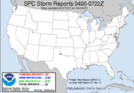
Aside from that... let's give a quick look at the tropics. The wave being watched there by the Lesser Antilles has really boosted up convective activity overnight and will likely earn the title of Tropical Depression 6 today. The Hurricane Hunters will be exploring that. Subsequently, this system will likely become Fay, in some form, not Fran as Marshall Seese suggested this morning, incorrectly. Incidentally, I think Marshall Seese is losing it. Behind that in the central Atlantic, we have a broad area of low pressure with very little convection that has a slim shot at development... finally, there is the very convectively abundant (who writes this stuff? Oh, that was me... lol) wave off the coast of Africa that is looking promising for development in GFS runs... Hurricane Gustav (or Hanna) Party at Mikey's end of August!!! jk. 1:30 Update: Apparently, the NHC wants to wait until she's a hurricane before they issue any public information statement... but I'm thinking she'll skip TD and go straight to TS Fay when they wake up... you can click on the image for a link to the current loop.
4:50PM: Special Tropical Disturbance StatementDATA FROM NOAA AND AIR FORCE RESERVE HURRICANE HUNTER AIRCRAFT... ALONG WITH SURFACE OBSERVATIONS AND SATELLITE IMAGERY...INDICATE THAT THE LOW PRESSURE AREA LOCATED OVER THE VIRGIN ISLANDS HAS NOT DEVELOPED INTO A TROPICAL DEPRESSION.
Have a fabulous day!
~Dewdrop
Thursday, August 14, 2008
Roll Cloud! Sort of like Roll Tide but (dare I say???) BETTER!
Labels:
gust front,
roll cloud,
sky watch Friday
Subscribe to:
Post Comments (Atom)


That is an awesome cloud!
ReplyDeleteThanks, Beth. It blew us away... tee hee.
ReplyDeleteAwesome cloud, but you should NOT say that. Glad you saw something!
ReplyDeleteI suspected I might get a response from you for that one... ;O) It was a spectacular cloud, certainly better than nothing if not better than Roll Tide. hee hee.
ReplyDeleteGreat, this roll cloud! Lookes spectacular!
ReplyDeleteDirkjogt, Belgium
I do like your image of the storm and your description. I love a good storm - especially when they pass right on over!
ReplyDeleteA very comprehensive post. I learned a lot.
ReplyDeleteNice photography.
Abraham
what an enormous cloud!! that is really neat you took a photo and made a video, so we can see every bit!!
ReplyDeletewow...awesome
ReplyDeleteMy SWF : Up and Down Thanks
Cool! When ever I dew drop in - you got something interesting to learn!
ReplyDeleteThat's why I dew comment! As it happens though, I dewd got infected with some kind of spelling dwesability on this site.
Hmmmm!?
Cheers, Klaus
It DOES look exciting! I'm glad everthing is OK though.
ReplyDeleteGreat shots. They just get better and better.
ReplyDeleteCome visit,
Troy and Martha
Awesome Dewdrop!
ReplyDeleteThe photos didn't do it justice - the video was awesome. It looked so low.
Partly cloudy, hot, humid and still. Rain chances pick up this weekend. We really need the rain.
ReplyDeleteHope you are well,
Troy and Martha
Great photos and great info too.
ReplyDeleteWe used to live in the Panhandle, north of Amarillo. Never knew what to expect at 3000' elevation there.
ReplyDeleteToronados (lots), 2' snow sometimes, wind all of the time, dust storms, 20" rain per year, hot and dry, desolate. That's why we moved to Ft. Worth.
Interesting weather over your way today.
Troy
There's disadvantages to living so close to the rocky mountains... I never see clouds associated with storms... they just come right on top of me when I least expect it... to see these swirlin' and churnin' like this would be spectacular!
ReplyDeleteGreat post!
Mountain Retreat
Fantastic Dew... I always get a buzz coming by here and if I'm showing Sky Watch off to my friendsI show them your blog and tell them about your weather watching...
ReplyDeleteGreat Sky watch posting.. and great that YOU join in each week
Nice post...again!
ReplyDeletegreat pictures and video. Looks like a bad storm
ReplyDeleteBeautiful photos and videos! I think the first one does look like a ...roll.... Great job!
ReplyDeleteThese are wonderful. I wish I was there with you. I love to watch storms coming in. The clouds, like yours here, are, lets use your words, Complete Awesomenewness.
ReplyDeletecool pics and video!! that cloud is amazing!! great post! Happy SWF!
ReplyDeletethose are great photos
ReplyDeleteThat's another freaky shot. Awesome though.
ReplyDeleteThat storm front is amazing...what power is present in those things.
ReplyDeleteWow... Beautiful photo. What an amazing cloud. Pretty cool to see it reflected on the roof of your van too. Thanks for the video too.
ReplyDeleteI love storms and all that they offer. You got some really great shots here and you give such interesting info to go with the photo's. Great SWF!!
ReplyDeleteHubby told me we should thankful whatever weather we have because that is a blessing. Some place wants some rain some wants some sunny day...Happy SWF!
ReplyDeleteGreat post..almost like being there in person watching that video!
ReplyDeleteGreat shots and video for sky watch! Well done.
ReplyDeleteAn enormous cloud - wow! I'm happy that I was not there... :(
ReplyDeleteOnce again, thanks to all who left very kind comments regarding my photograph for this week's SWF.
ReplyDeleteJulie... ME TOO!
Abe, So glad you did!
Rachel, Glad you enjoyed the video.
Klaus, Dew you want me to tell you there is a cure? Cheers.
YEGTG, Everything was terrific! It was incredibly invigorating!
Carletta, It WAS SUPER low!!!
Michele, you have the heart of a chaser! Come chase with me sometime... side-by-side in our jeeps.
Tom, You are so uplifting. Showing off me? So honored to know you.
Tommy, The storm got worse later, but it was pretty non-eventful over us.
Kelly, I agree.
Villa Girl, Come on over. Another storm chaser at heart! Awesomenewness... :O)
Babooshka, Freaky... lol
CaBaCuRl, So much power. It blows me away... ;O)
Raven, Glad you liked the video.
Joyce, Aren't they fantastic?!
Genny, True enough.
Dot, Come on down, anytime!
Maria, It wasn't so bad. It was amazing.
Great photos as always! I hope you get some of our thunder and lightning there. Best thing with the type of weather we have been having is just sit on the balcony, eat some icecream and enjoy the show!
ReplyDeletethis is so exciting! a cloud with an attitude!
ReplyDeleteI don't think I have ever seen a cloud like that before. It reminds me of the endless roll of cotton batten that the oldtime doctors pulled out of a glass dispenser!
ReplyDeleteMy Sky Watch Photos are posted Here and Here
Quite amazing clouds. I always learn something from your blog.
ReplyDeleteSystem Operator, Thanks. Sounds like a good approach you have to awesome weather... ice cream and a thunderstorm.
ReplyDeleteLara, Definite attitude...
Kahshe, Cotton batten.... interesting.
Chanpheng, Glad you do.
Sorry, I’m a little late because I was sailing this weekend.
ReplyDeleteSo I stop by and say thank you for a nice SWF.
Torsdag, Stop by anytime!
ReplyDelete