 It's Sky Watch Friday post time!! Please visit Tom, Klaus, Sandy and Imac's SKY WATCH BLOG (click here or on the logo) to participate in Sky Watch Fridays. A huge thank you to Dot, the mother of this fabulous blogging event!!! It is so interesting to see skies from all over the world!!! I highly recommend not just checking it out, but considering participation! You are certain to meet an extraordinary group of people!!! Once again, I would like to extend my heart-felt gratitude to the 200+ folks who offered compliments and encouragement regarding the sky watch intro and my regular post last week. It truly is an honor being a part of such an inspirational group of folks! This week, I have chosen a photograph of the birth of a wall cloud, since several people asked about wall clouds vs. shelf clouds after the Sky Watch intro showed my favorite shelf cloud picture last week (click on the link to see a shelf cloud).
A wall cloud, or pedestal cloud, is a cloud formation associated with thunderstorms. It is a marked lowering typically beneath the rain-free base (RFB) portion of a deep cumulus cloud (normally cumulonimbus but on occasion cumulus congestus), and indicates the area of primary and strongest updraft which condenses into cloud at altitudes lower than that of the ambient cloud base. Wall clouds may form as a descending of the cloud base or may form as rising scud consolidates and organizes (such as in this case). Most strong tornadoes form within wall clouds.
Wall clouds can be anywhere from a fraction of a mile wide to over five miles across, and in the Northern Hemisphere typically form at the south or southwest end of a supercell. Wall clouds form in the inflow region of the storm coinciding with the direction of the steering winds. Rotating wall clouds are visual evidence of a mesocyclone.
~Source
 Except for the potential for dangerous straight line winds, generally a shelf cloud will not develop tornadoes. A wall cloud, on the other hand, is actually a very dangerous part of the storm. This is a very likely spot for tornadogenesis to occur. This particular cell was a tornadic supercell, and though this wall cloud was just being formed as the accompanying wall cloud dissipated and fed to the inflow of this one (see image below), it actually formed 3 funnel clouds while I was watching it (feel free to click on the image to the right to view it enlarged. You'll see the funnel better that way!) :O)
 Above, you see the dissipating wall cloud on the right giving way to rain and feeding its remaining scud into the inflow of the newly forming wall cloud on the left. It truly was fascinating and thrilling to watch the birth of this wall cloud and rotation under my own little mesocyclone. On the same day (June 6, 2007), during the same line of storms, not too far from where I was (yet far enough for me to miss it... sigh), a tornado (photograph by Gene Moore) occurred in Kyle, SD.
 Wall cloud vs. shelf cloudWhile I am talking about tornadoes and such, and since the Atlantic basin tropics have settled a bit for the moment, I am going to offer an update on the historic tornadic year we have experienced in the United States so far, which seems appropriately timed as we are facing the secondary tornado season.
Occasionally people see a shelf cloud and think they have seen a wall cloud, which is an easy mistake, since an approaching shelf cloud appears to form a wall made of cloud. Generally, a shelf cloud appears on the leading edge of a storm, and a wall cloud will usually be at the rear of the storm, though small rotating wall clouds associated with mesovortices can occur within the leading edge on rare occasion. Wall clouds will tend to slope in, or toward the precipitation area, whereas shelf clouds as outflow clouds will jut outward from the storm. Wall clouds are inflow features with (often warm) air moving towards them whereas as shelf clouds are an outflow feature with cool air moving away from the storm, often as a gust front.
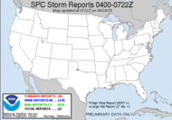
 With a ten year average of less than 1400 tornadoes in ONE YEAR, it is easy to see that 2,091 reports prior to the secondary tornado season (which could offer hundreds more tornadoes to this year's tally) is an outrageous number! Granted, tornado reports overstate the actual confirmed count (they estimate by 30%; however, through June 2008, it looks to be only about 24% overstated). The reason that reports out-number actual tornado counts is because of duplication (several people calling about the same tornado) or false reports (possibly damage resulting from straight line winds reported as a tornado). I have been amazed over the course of the year watching this line rise. We knew right off the bat, in early February, that we were in store for an extraordinarily tornadic year. We'll see what the change in season has in store for us this year.
Have a wonderful day!!!
~Dewdrop


what an amazing cloud formation, one that i have not seen around these parts [san fran bay area]. thanks always for the education.
ReplyDeletehappy skywatching.
Ohhh, so beautiful and great information! Thank you!
ReplyDeleteSuch beautiful pictures.
ReplyDeleteTill I joined Skywatch, I never knew people study clouds, and there are distinct patterns and types. I loved to watch the sky but never knew I'd come across a whole community of people who were already masters in the field.
Thank you for the educative information.
Happy Skywatch Friday.
Great post Dew!! One of my favorite subjects as you know!;).
ReplyDeletebeautiful post Dewdrop, love the pics also your great info.
ReplyDeleteI can only dream about shooting such wonderful pictures. Amazing. Great SWF :-)
ReplyDeleteWhoa! I have never seen such an interesting cloud formation!
ReplyDeleteAmazing clouds! I can't believe how beautiful clouds can be.
ReplyDeleteBeautiful shots! As usual thanks for the information:) My SWF is posted HERE. Happy Sky Watching!~
ReplyDeleteI certainly hope this is NOT going to be a bad second half of the tornado season. 'NOUGH already! ;-)
ReplyDeleteAs always Dewdrop - great info and images!
ReplyDeleteI was amazed at the tornado image as well.
Lovely pics. and as usual, your explanations are most edifying.
ReplyDeletewow..cool shots
ReplyDeleteI hope you stop by at my SWF post also in HERE. Thanks
awsome and interesting clouds !!
ReplyDeleteWatch mine + windmills here:
www.joannwalraven.blogspot.com
What a great post and wonderful wonderful photo's!!
ReplyDeleteTake care
Dewd - here you are again. You're so clever. I saw clouds today that made me think of you. Big fluffy clouds with wispy clouds floating over/around them. It was very cool. I tried to take a picture with my blackberry - will see how they turned out.
ReplyDeleteDew: Neat information about the clouds and a cool capture of the tornado forming. You do spread continuing great information.
ReplyDeleteFantastic sky Watch-post!
ReplyDeleteHi Jenn
ReplyDeleteThis really is another fantastic, informative post and your picture are awesome..
Tom
This was a great lesson about clouds. I had never seen a funnel cloud, now I know what one looks like.
ReplyDeleteI have learned so much from your informative posts both on the sky watch site and here. Your skywatch shot as host was unbelievable and these are also great shots. I like the way you can see the mailbox in the first site. For some reason that was a nice touch for me with the whole scene.
ReplyDeleteWhat great pictures you have captured again dewdrop. Thank you for sharing and for the information in support of what we are viewing.
ReplyDeleteThis is fascinating. I don't think I've seen this in Florida before our thunderstorms, which makes it even more interesting. Weather is such a neverending source of wonder.
ReplyDeleteWhat a powerful image. I'd be concerned, but also kind of exhilarated to drive into that kind of weather.
ReplyDeleteThanks for learning me something and providing so many wonderful images.
ReplyDeleteWOW! What a picture! The clouds seems so low. Gorgeous!
ReplyDeleteYour weather info is very important and motivates all of us.
ReplyDeleteThanks.
What is a sky without clouds? Just blue. Sky with clouds is changing every second, and that is amazing.
ReplyDeleteThanks for your "CLOUD-PHILOSOPHY".
Have a nice weekend.
Hartmut
Love your photo and post! My English isn't so good so it take me a while to read it, but I always like them:)
ReplyDeleteI love learning on this site and your photos are fantastic. I'd still fail the test, though. Well, maybe not.
ReplyDeleteThanks for visiting my Picture A Day site and telling me the name of that cloud.
Thank you so much for yours Sky Lessons! Everyone seems to appreciate them. I know I dew!
ReplyDeleteGreat SWF!
Cheers, Klaus
It' just a learning curve coming here each week. I love the wall cloud rolling in. Brilliant introduction again on the skywatch site.
ReplyDeleteAmazing shots and wonderful clouds formation.
ReplyDeleteI agree with well everyone very cool cloud formation and informative post. I always learn something new when I come here thanks.
ReplyDeleteStunning photos and great information. Growing up in Kansas it was rare that we decided to chase a tornado. Only happened once. Spent most of those events in a basement!
ReplyDeleteNice photo for SWF.Thanks for the information. Have a nice weekend.
ReplyDeleteAmazing photos (here and SWF page) and very cool to be able to read what they actually are called :) I just call them amazing and beautiful!
ReplyDeleteLaura
wow its a terrific shot cool one. Thanks for sharing...
ReplyDeleteAwesome cloud formation! And another interesting post. I live in east central Arkansas, in the Mississippi River delta and I keep my eyes on each and every cloud. I've only ever seen one funnel so far, but since my husband is a farm manager, he's seen several and some tornadoes.
ReplyDeleteIt's always interesting to read your posts. Nice pictures and interesting information.
ReplyDeleteGreat photo of the crepuscular rays and your info on the cloud formations is very informative.
ReplyDeletebeautiful pictures and interesting information...
ReplyDeleteThank you for yet another well-presented, illustrated lesson on clouds. I also liked your photo and info on the SkyWatch site.
ReplyDeleteVery informative, and beautiful pictures. Funny detail is the postbox on the first picture :-)
ReplyDeleteSo exciting pics and information, thank you:)
ReplyDeleteLove the rotation. I have always wanted to chase tornados. call me crazy..
ReplyDeleteVery interesting information and beautiful photos to go with it.
ReplyDeleteNot only great photos but an incredible wealth of knowledge.
ReplyDeleteI am utterly fascinated with all your explanations! It so helps to understand the meanings and processes of clouds!
ReplyDeleteAnd delightful pics! I keep trying to connect them with ones I see!
Beautiful, yet frightening in a way, photos.
ReplyDeleteThank you for the lesson. :)
I'm always impressed with the rich information you give on your blog dear Drewdrop! Have a very nice Friday and week-end! :-)
ReplyDeleteHey there! Another great and educational post! I'd have totally missed the "funnel cloud" if you hadn't have identified it for us! Love the interesting knowledge that you share with us! Great post!! Also, another great intro photo too!!
ReplyDeleteThank you everyone for your wonderful feedback. I am leaving now for my wonderful waterfall chase weekend. I will respond in better depth when I have more time! I'll have lots of pics on my return. :O)
ReplyDeleteThanks for the information. I love looking at clouds, but I rarely know what I'm looking at.
ReplyDeleteYour pictures are amazing!
Thanks for the lesson from a Brit' in tornado alley. Great piccies too
ReplyDeleteA late visit (but still on a Friday) from ViennaDaily.
ReplyDeleteAn awesome cloud formation who beautifully captured! It looks as though the clouds are ready to strike out with lighting! Happy weekend!
What a great shot! I also love all the information you added.
ReplyDeleteThat is absolutely beautiful clouds! Thanks for the info!
ReplyDeleteI would never have seen the funnel cloud if you hadn't told me one was there. That's incredible spotting and great photography.
ReplyDeleteYou always have the most interesting post. I enjoyed the photos. Please stop by and visit my post for this week. I have done sunset at gettysburg PA
ReplyDeleteMore wonderful photos and fascinating info! When I was a kid, we called Crepuscular rays "sun drawing water" - like sipping moisture back up into the sky to make more rain. when I got older, I decided I didn't like the official term; didn't think it was pretty enough a word to go with the phenomena, so I invented the word "heliospouts" to describe them.
ReplyDeleteI grew up in MO and went to college at KU. Love where I live now, but miss the skies of the midwest. We never get the weather the midwest does!
ReplyDeleteThanks for the lesson. I always learn something new when I visit you!
It's taken me long enough to respond to these wonderful comments left by all of you terrific people.
ReplyDeleteThank you, thank you, thank you who offers kind words regarding my pictures and the lesson. I love to share what I have learned. I think that education is the best means of preparedness.
YEGTG, For the sake of potential victims, I have to agree with you!
Deirdre, Dewd... love it. Thinking of me when you see clouds... wow, that's super sweet!
Carver, I liked that mailbox too! Very charming.
Mike, Come chase with me sometime... Given your name, it's no wonder you're interesting in the more adventurous side... many storm chasers named Mike. lol
Country girl, I think you'd do great!
Klaus, Glad you dew!!!
Mary, YOU CHASE?! Come join me sometime. I can understand staying in the basement though. Safest place to be!
Brenda, where you are, you definitely need to keep your eyes to the sky!
Cathy, if you're crazy, I'm crazy...
Deborah... heliospots... love it!
TSannie, Can't imagine leaving those skies!!!