 Well, my dear Colorado friend passed along this book after a visit with her and her hubby. She didn't say anything about it except that she wanted me to read it... well, I have a pile of books on a waiting list, and when someone gives me a book, it gets put on the list. It is finally time to read William P. Young's, The Shack, and so far... only about half-way through, I have been moved once again by God's perfect timing. Though I haven't finished, I feel comfortable recommending this book to you. I am confident that if you allow it to, it will move you like it has me. Give it a whirl. Anyways, the reason I bring that up, is because this morning, I was reading from it, and I read the author's WONDERFUL depiction of (of all things) DEW!
 Dew, sparkled everywhere, diamond-like tears of early morning reflecting the sun's love.
Isn't that beautiful?! Well, that set the stage for my morning.
~William P. Young, The Shack
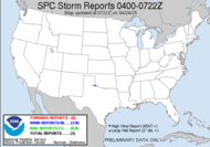
Onto weather... we're looking a quite a little storm working it's way across the south this morning.  Looks like things will get into the "strong" parameters for my neck of the woods, but most of the severe stuff should stay well off to the west (what a surprise...)
  Thunderstorms should arrive here after midnight. I don't chase night-time events (especially not squall line strong thunderstorm events), so I will be looking at the back of my eyelids around that time. Best wishes to Meso Mike (who hasn't posted anything since August) and Rick (who will probably post another dewvoid post in the LATE morning, after most likely, "chasing" into the wee hours), who are hoping to snag some lightning shots. Try to stay dry, guys.
0943 AM CST TUE JAN 06 2009
Well, during that 1-3 hours later, we saw nothing... that is until the first TORNADO WARNINGS started appearing:
AREAS AFFECTED...SERN LA/SERN MS/SRN AL/WRN FL PANHANDLE
CONCERNING...SEVERE POTENTIAL...WATCH LIKELY
A SLOW INCREASE IN CONVECTIVE INTENSITY IS FORECAST OVER THE NEXT COUPLE OF HOURS... ALONG WITH A CORRESPONDING INCREASE IN THREAT FOR LOCALLY-DAMAGING WINDS/ISOLATED TORNADOES. TORNADO WATCH WILL LIKELY BE REQUIRED IN THE NEXT 1-3 HOURS.159 PM CST TUE JAN 6 2009
...(which happens to be relatively near Alabama Mike's neck of the woods, but I just talked to him, he's good.) Now, of course after the first warnings (so much for preparing the people), a tornado watch has been issued... yeah? Ya think?!
THE NATIONAL WEATHER SERVICE IN BIRMINGHAM HAS ISSUED A
* TORNADO WARNING FOR...
NORTHERN JEFFERSON COUNTY IN CENTRAL ALABAMA... THIS INCLUDES THE CITY OF GARDENDALE... SOUTHEASTERN WALKER COUNTY IN CENTRAL ALABAMA... THIS INCLUDES THE CITY OF SUMITON...
AND
153 PM CST TUE JAN 6 2009
THE NATIONAL WEATHER SERVICE IN HUNTSVILLE HAS ISSUED A
* TORNADO WARNING FOR...
EASTERN DEKALB COUNTY IN NORTHEAST ALABAMA...205 PM CST TUE JAN 6 2009
THE NWS STORM PREDICTION CENTER HAS ISSUED A TORNADO WATCH FOR PORTIONS OF
CENTRAL AND NORTHEAST ALABAMA
SOUTHEAST MISSISSIPPI
EFFECTIVE THIS TUESDAY AFTERNOON AND EVENING FROM 205 PM UNTIL 700 PM CST.
TORNADOES...HAIL TO 1 INCH IN DIAMETER...THUNDERSTORM WIND GUSTS TO 70 MPH...AND DANGEROUS LIGHTNING ARE POSSIBLE IN THESE AREAS. That's it for today!
Tewdles,
~Dewdrop
Tuesday, January 06, 2009
A reflection of the sun's love, Dew
Subscribe to:
Post Comments (Atom)


No comments:
Post a Comment
Dew comment, please...