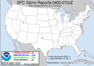
Well, after that exciting and very low cloud yesterday, I have little local weather to talk about, so I will take you on a journey elsewhere... My storm chasing pal and Southern Weather Brigade member, Storm Chasing Mikey, sent me some video footage of a funnel cloud he shot that was right over his beach house. It's really spectacular video from Virginia Beach. I have posted that for him to our team website. Be sure to hop over there for a look. Aside from that, the biggest stories are on the west coast... with one of the biggest wild fires near LA, blazing through southern California, causing thousands to be forced from their homes, as the flames engulf residences. There is concern that it may take weeks to get these fires under control.
  With that going on, you would think that a moisture rich hurricane headed toward Baja would offer some relief. Unfortunately, the moisture from major Hurricane Jimena (almost a category 5 hurricane) won't likely be benefiting southern California. It is headed further east, but this 155 mph very dangerous hurricane (156 mph is a category 5) has its sites set on Baja California.
 ...EXTREMELY DANGEROUS HURRICANE JIMENA HEADING TOWARD THE BAJA PENINSULA...
Hurricane Jimena is expected to still be a major hurricane at landfall, which is expected tomorrow evening. There hasn't been a landfalling major hurricane since the 80's... Here in the Atlantic basin. We have a broad area of low pressure which is lacking well-defined circulation, at this time. The expectation is that, at any moment, it will become a tropical depression or tropical storm.
  Should it become a named storm, it will become Tropical Storm Erika.
Have a splendiferous day!
~Dewdrop
Tuesday, September 01, 2009
Wildfires ravage southern California, as a major hurricane targets Baja California
Labels:
Hurricane Jimena,
wildfires
Subscribe to:
Post Comments (Atom)


I pray that everyone stays safe during the storm.
ReplyDelete