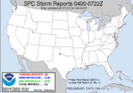
I hope everyone had a wonderful Thanksgiving, full of family, friends and lots of blessings. We certainly did, and it was absolutely wonderful.  As a result, I've been away from the blogosphere for a slight time, which encouraged a weather hiatus of sorts, leaving me refreshed and excited about today's severe weather potential in the south. Currently, I am at over 2" of rainfall since last night, and there doesn't appear to be any relief in sight. If we get a clearing in this before the main storm line approaches, we can expect some volatile weather today. Welcome back to weather watching Dewdrop... just barely outside a tornado watch box.
 The current tornado watch covers a portion of the southeast, including an area of south west GA, to my west, the FL panhandle and lower AL. I expect that threat to travel eastward with the movement of the system. We are told to expect flooding rain, hail and tornadoes.The current tornadic threat is a significant 10%.
  We don't generally see that kind of probability in my neck of the woods. You can click on the tabs on the link that the graphic brings you to, to see probabilities for hail and wind. The text of the outlook isn't powerful, but the chance exists, and they have highlighted that. Be vigilant and watchful, ready to get to safety.
I have a lot of catch up to do, but I'd like to get a chance to share some Thanksgiving shots soon.
Have a great day!!!
~Dewdrop
Wednesday, December 02, 2009
Welcome back weather
Subscribe to:
Post Comments (Atom)


No comments:
Post a Comment
Dew comment, please...