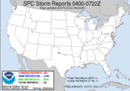
 Given the rise in water and the persistent flood watches being issued by the National Weather Service, we decided to check out water levels and see what was going on with everything around the rivers, creeks and so forth. So, Saturday afternoon, we headed out toward the river. My wonderful groom's kids are great adventurers, so it's fun to go out exploring when they are with us and see what we stumble upon.
 We went by several areas that are known to flood, including the YMCA, which took 4' of water inside the building during the April flooding. Fortunately, it's only up as high as the parking lot for now, which is a common occurrence, and it doesn't appear that the Meadowbrook area is taking on much water (thank God, since some of those folks are still remodeling from the April flood... others just got moved back in...)
 We also checked out Skipper Bridge, which was completely under water during April's major flood, and has since been closed, as it is deemed unsafe for vehicular travel. We walked out there to the Hydrologic Monitoring Station there on the river. It was interesting.
  The water levels were high, but not anything close to what we saw in April.
 The area behind us in this shot is what it's like on the other side of the river from the Y. We got permission from Dr. Devine to travel onto his property to check things out. Unfortunately, with areas north of us experiencing 3 inches of rain in just one day, as the water trickles down, we might see a different story play out, but for now, we are ok down here in south Georgia.
~Dewdrop
 Given the rise in water and the persistent flood watches being issued by the National Weather Service, we decided to check out water levels and see what was going on with everything around the rivers, creeks and so forth. So, Saturday afternoon, we headed out toward the river. My wonderful groom's kids are great adventurers, so it's fun to go out exploring when they are with us and see what we stumble upon.


I saw that one of your links was not working - Trent Topeka.
ReplyDeleteWhich one, Trent? I will try to fix it.
ReplyDelete