 Several big stories in weather today... first of all, the rain, rain and more rain that fell and continues to fall with this approaching system is causing all sorts of problems in several states. I saw this map on TWC this morning, which is published by the Missouri Department of Transportation (MO DOT). Of course, they listed the source site incorrectly... You know, I am getting so aggravated with the inaccurate information that rapidly disseminates... fortunately, my CNN friend Courtney, has kindly offered to send me periodic "important news" updates... such a dear.
  Anyways, I was shocked by the information they shared about road closures associated with the astronomical rainfall totals, which are just through the roof, almost 12 inches of rain in parts of Missouri... (the photo to the right is an AP photo taken by Mark Schiefelbein found on a weather.com blog) 10 inches of rainfall was reported in Cape Girardeau on the CoCoRaHS website. Well, with those outrageous rainfall totals, you can imagine how bad flooding is, and tremendous rainfall spans all the way to New England! Unfortunately, there have been 2 flood-related fatalities.
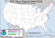
Also, as part of that system, during yesterday's portion, 2 tornadoes were reported... one in Corpus Christi, TX. This has been an exceptionally tornadic year. I really hope that this trend does not continue to follow the typical trend because we are so far above average. With 462 tornadoes so far in 2008, we have almost had half of all the tornadoes we usually have in an entire year, and we are ONLY halfway through March. Folks, we have not even reached the "peak tornado season". Granted, the graphic is based on local storm reports, which overestimates the number of actual tornadoes, and it definitely exceeds confirmed tornado counts since many tornadoes aren't ever fully realized because they cannot be rated due to a lack of damage... (the ideal tornadoes), but the trend is very close to accurate. It's shocking.
 Now, for today, the slight risk for severe weather has once again been expanded, and I have almost been drawn out of it. Already a lengthy squall line is developing and cutting through Alabama and the Panhandle of Florida. Locally, I am seeing sunshine, which should boost our shot at instability, which shouldn't be too plentiful for this weather event elsewhere. The current concern is the expectation that damaging winds will accompany this line. The embedded cells within the squall line are racing across the country at speeds in excess of 60 knots. This system is MOVING!!! and should be here before we know it. I will keep one eye on that as it tracks across the southeast. I can already hear the strong winds crashing against the side of my building.
I will update if something happens.
Update 2:45: Just got word from my non-storm chasing friend, Michael... that in the March 14th downtown Atlanta tornado the 72-story Westin Peachtree Plaza was moved a couple of feet (along with many of the windows). Here is a link to the story. They got a manager saying, "It's designed to move a couple of feet and I think it did... (chuckling)."
It's in the video. Very interesting. So, yes, the tornado shifted the Westin a couple of feet... weird.
Also, locally, we have been placed under a Wind Advisory. They are saying that 40-45mph gusts are expected. Wow.
Toodles,
~Dewdrop
Showing posts with label Missouri DOT. Show all posts
Showing posts with label Missouri DOT. Show all posts
Wednesday, March 19, 2008
Flooding in the Central States, Severe Weather Headed for the Southeast
Subscribe to:
Posts (Atom)


