The heavens declare the glory of God;
the skies proclaim the work of his hands.
-Psalm 19:1

Do you know that God controls the clouds and makes his lightning flash?
-Job 37:15


Showing posts with label Tornadoes. Show all posts

Wednesday, August 27, 2014

Storms Don't Scare Me!

Why don't storms scare me? 

I don't really know.  I can't say that it's my faith because I haven't always had faith, but I have always had a passion for weather.  I know people who are terrified of weather (kind of like my brother under the bed hiding from the "lightling").  I know people who beg me to do something about the storms, make them go away.... ummm... I know I've got tremendous Dewvoid.  I know people who pray the storms away... OK, I do actually get that.

Dewvoid: (noun) The absence of significant weather events within a close proximity of me... only cause I think significant weather is really cool.
Perhaps there is an opportunity there to sell my services (storm stopping) to wedding planners and bar mitzvah  coordinators.  You want pretty weather for the event, just invite me, guaranteed sunshine! "Stopping severe weather in a single bound.  It's a bird, it's a plane... no, it's Dewdrop."

I have actually had a conversation recently with a friend at the National Weather Service office who was discussing with me a solid squall indicating severe parameters of wind, and "they" had placed me in the severe warning box. HA!  I told him that it looked like they forgot the Dewvoid in forecasting, and he jokingly said that he should make sure the radar guys draw out a significant Dewvoid parameter... moments later, I was drawn out of the severe warning when the storm completely pulsed down.  You see, it's scientifically proven.  But, I digress.

So, why are so many people terrified of "bad" weather, while I face it head on without a care in the world??

I guess it's not fair to say I don't have a care in the world in the face of severe weather.  I have a healthy respect for flash flooding and would definitely turn around rather than drown.  It simply isn't worth it.  I definitely have a strong respect for lightning and its death inducing potential.  When thunder roars, you should head indoors.  I do that most of the time, OK, OK, some of the time.  Sometimes, I go out on the porch, in the back yard, or in the garage (with the door open) trying to nab a shot. Talk about role reversal, my daughter is usually the one trying to drag me inside.  I know better. I have storm chasing friends who have had some bad experiences. I have been known to seek out rotating wall clouds just to watch them spin, but I did freak out a bit when I ended up in the Drop Zone, this one time on accident because south Georgia roads twist and turn so much and you have really limited visibility for all the trees (Disclaimer: storm chasing in south Georgia is not safe, at all)I have a healthy respect for all things destructive in weather.  Heat, flooding, lightning, wind... gosh even big enough hail can kill a person.  I get that.  The threat is real.

But then... I see a sky like this one here.  This is what showed up after a severe warned thunderstorm rolled through one evening, recently. Do you SEE that?!  It's amazing. 

I guess, for me, it all comes down to striking beauty.  There are times when I look to the sky, and my breath is literally taken away.  My eyes are lured to it; I find myself enthralled with the splendor and glory of His creation.  Sure, the severe stuff is dangerous and can be quite ominous, but the beauty I see seems to outweigh the danger.  I mean, I have seen shelf clouds that look like the mother ship, slinking across the sky, all it's layers and colors and texture.  I have seen cloud to ground lightning, light up a sky in brilliant shades of purple, as its web-like tendrils scatter through the atmosphere, cleaning the air.  I have seen rotating wall clouds, mere feet above the ground, wider than a football field, just barely moving, not hurting anything, just being stunning.  The beauty keeps me seeking more; it draws me in.

I am Dewdrop, and I am obsessed with weather, cause it takes my breath away.  I can't get enough.

I am not scared.  I love it too much!

Till next time,
~Dewdrop

Friday, January 22, 2010

Crazy January Weather!

I have gotten away from posting on Friday's, but with all the relatively near tornado activity yesterday, and the severe weather we had locally, I feel like an update is in order. Today, we have beautiful blue clear skies.

The big story was the well-covered (EF2 rated) tornado in Huntsville, AL yesterday, fellow Southern Weather Brigade members were chasing the cell as it moved across northern Alabama, until Mike had to leave to take care of his fatherly duties. JB and Mike parted ways, neither watching the cell anymore. Unfortunately, that's when that stubborn cell decided to produce a tornado. Photo of Huntsville tornado as captured by LeAnn Shady Reid, Mike's neighborPoor Mike, his neighbor was actually taking pictures of the tornado from her front porch, since it passed his house within a mile. Holy cow, that sounds like my kind of luck! Poor Mike and JB. So close. I won't even bother posting coverage, as it would pale in comparison to what Mike has posted on his blog, with extensive continuing coverage of "the one that got away." Seriously, check out Mike's blog.

It was a very active storm day. The rotating cell that had once been tornado warned and then approached us, just missing to the south, caused downed power lines in my county. The same system moved across Florida and wreaked havoc all over the northern part of the state. This morning, I noticed that tornado warnings were being issued near Cocoa Beach (which has generated a tornado report for today). All in all, I would like to commend the Storm Prediction Center and the National Weather Service for being on the ball. Job well done, guys!You see the damage report dots on the graphic above. You can click on the map for a detailed list of the storm reports, including several tornado reports in Arizona and California. Crazy January weather.

Be safe.
~Dewdrop

Thursday, May 14, 2009

Deadly tornadoes ripped through Missouri yesterday

SKY WATCH FRIDAY time! Our hosts: Klaus | Sandy | Ivar | Wren | Louise | Fishing Guy

SKY WATCH FRIDAY (click the word to link and participate!)
Thanks to Dot and Tom, who were instrumental in the success of this blogging event. You should definitely come fly with us!Hope???My capture today demonstrates some teasing skies. My skies have been filled with these gorgeous swelling cumulus clouds, some growing and climbing so fast that it is easily visible. All the while, I'm chanting, "climb, climb, climb...", the National Weather Service is seeing, come on... don't make liars of us again... AND NOTHING HAPPENS. Folks, every single day since Sunday (when I encouraged my wonderful husband to put on the doors and put up the top), the guys have forecasted rain, and only one night... just one night while I was asleep we got 0.06" of rain. Yesterday, I was able to report a whopping trace after feeling a sprinkle the day prior. It's insane, and they persist in this forecast. yeah... rightA comic depiction of this phenomenon was generated by Rick... Thanks, Rick... lolLOL! It's going to be a long summer, indeed.

Unfortunately, the Storm Prediction Center didn't miss the mark at all when they forecasted a likelihood of tornadoes in the Kansas/Missouri/Illinois area, where 20 tornado reports were offered for yesterday's fatal outbreak. The red dots on the graphic represent tornadoes reported during yesterday's event. There were 3 lives lost in Missouri tornadoes. One of those lives were lost when the tornado hit a mobile home. Mobile homes are no match for a tornado or even strong winds. They aren't sturdy and should not be considered a safe place during a severe thunderstorm or tornado warning. An overturned car sits in the lot of Jim Robertson car dealership after it was hit by a tornado Wednesday, May 13, 2009, in Kirksville, Mo. Multiple tornados hit the area as severe storms tore through the state. (AP Photo/L.G. Patterson)If you live in a mobile home, you should have a plan to go somewhere safe when bad weather is imminent. Two others were located in a neighborhood near the car dealership depicted here, as captured by L.G. Patterson. This apparent tornado caused significant destruction in the hardest hit city, Kirksville, Missouri. A home in the Lakeside Estates is badly damaged after a tornado ripped through Adair County Wednesday evening May 13, 2009, causing extensive damage to Kirksville, Missouri. The city of Kirksville apparently took the hardest hit. Police Det. Sgt. Ron Celian said about 30 to 40 homes were damaged, one was destroyed and an auto dealership sustained significant damage. Two people were injured near the dealership when their car was blown off the road, Celian said. (AP Photo/Al Maglio)(AP Photo/Al Maglio)
Here is a link to video footage of the Kirksville, MO tornado shot by SevereStudios.com's Bart Comstock. He was too close, and worse, he didn't seem to realize it until he saw it right next to him after encountering lots of debris. Not good. Lucky the outcome wasn't a fate much worse. My thoughts and prayers go out to all of those impacted and for the families of those whose lives were lost.

It looks like today's forecast is a lot more tame. The remnants of the system that caused the deadly outbreak has lost much of its energy. The line coming across toward the eastern part of the country is a thinning squalled out line of wind, rain and lightning. Take notice that southwestern Texas still has an area highlighted with a slight risk for severe weather, so don't let your guard down.

Have a great day!
~Dewdrop

Wednesday, May 06, 2009

Tornadoes and mosquitoes in Georgia

It appears that the SPC is now forecasting the Dewvoid. All severe weather area have been drawn well to my north.

A tornado watch has just been issued for most of north and central Georgia until 7PM. This morning, the same line wreaked havoc in Mississippi and Alabama, with a tornado reported in Cullman, AL, (Alabama Mike's neck of the woods.. who was incidentally in Huntsville), has destroyed mobile homes and trapping people inside with injuries, downed trees and caused significant damage. Today's event features a typical Georgia squall line with embedded supercell potential is approaching the area in north and central Georgia. Unfortunately, conditions allow for discrete supercells to form ahead of the line of storms as the air mass destabilizes with day time heating. As this occurs, tornadoes could form seemingly out of the blue. Please take all weather warnings seriously. Keep those weather radios turned on.

1030 AM EDT WED MAY 6 2009

THE NWS STORM PREDICTION CENTER HAS ISSUED A TORNADO WATCH FOR PORTIONS OF:

LARGE PART OF NORTHERN AND CENTRAL ALABAMA
MUCH OF NORTH AND PARTS OF CENTRAL GEORGIA
PARTS OF WESTERN SOUTH CAROLINA

TORNADOES... HAIL TO 2.5 INCHES IN DIAMETER (TENNIS BALL SIZED)... THUNDERSTORM WIND GUSTS TO 80 MPH... AND DANGEROUS LIGHTNING ARE POSSIBLE IN THESE AREAS.
2.5" hail can be deadly and destructive to property. If large hail starts to fall, seek shelter. Try to park your vehicle under a covering.

Aside from that, locally, since it is now May (regardless of when the mosquito population becomes a problem, locally spraying for mosquitoes starts in May), they have starting spraying for mosquitoes. We have had one confirmed case of West Nile Virus, Eastern Equine Encephalitis (EEE) Virus in a human (little girl) here in town in the past, and with recent flooding, the threat is greatly increased, especially since according to this graphic,... a mosquito has already tested positive for West Nile Virus in my county, despite what might have been said. My dear mother-in-law has said that they sprayed her Valdosta Meadowbrook neighborhood... the recently majorly flooded area (speaking of that, the local FEMA office will close here on Thursday at 7PM)... twice already. I shot these this morning. They were in my home. They are no longer with us... Some consider the mosquito the state bird! Not surprising considering how large some of them are.
Health authorities in south Georgia have declared a health emergency for Lowndes County because of an extremely high volume of mosquitoes in the area.

South District Health Director Dr. Lynne Feldman said recent flooding has caused the increase. The number of mosquitoes caught in traps in Lowndes County has increased from an average of nine per trap a month ago to an average of 786 per trap now.
~source
It's not like I didn't warn them... link to blog, where I suggested not enough was being done to control the mosquito population locally. Averages of 9 per trap a month up to 786 per trap!!! An 8733% increase!
A Declaration of Health Emergency for Ben Hill, Berrien, Brooks, Cook, Echols, Irwin, Lanier, Lowndes, Tift and Turner Counties has been made by Lynne Feldman, M.D., MPH, District Health Director for the South Health District.
UNBELIEVABLE! Some helpful tips suggested by the South Health District:
**Using an insect repellent containing an EPA-registered active ingredient when outdoors.
**Stay indoors during dusk and dawn, when mosquitoes are most active. If you have to be outdoors during these times be sure to use insect repellent and wear long sleeves and pants.
**Make sure screens on your windows and doors fit properly and are not ripped to keep mosquitoes out.
**When weather permits, wear long-sleeves, long pants and socks when outdoors. Mosquitoes may bite through thin clothing, so spraying clothes with repellent will give extra precaution.
According to our county, we should observe the 5D's...
Be Mosquito Smart! - Prevent mosquito-borne diseases. Follow the 5 D's:
Dusk and Dawn (avoid being outdoors when mosquitoes are seeking blood)
Dress (wear clothing that covers skin)
DEET (use mosquito repellents including DEET on skin or clothing when outside)
Drainage (dump standing water where mosquitoes lay eggs)
Bottom line is they are now a threat to be taken quite seriously. Be Mosquito SMART!

~Dewdrop

Wednesday, February 18, 2009

Powerful wording out of the Tallahassee Weather Service

It's all just going nuts... as expected, storms popping up all over the place, being tornado warned. Alabama Mike is near Tuscaloosa, AL, awaiting a cell coming out of MS and whatever else pops up... currently, a cell just east of his house is tornado... go figure.Tallahassee's National Weather Service Office has issued a revised outlook for my area. The whole thing is cool, so I will share it here... though our overcast skies seem that they would inhibit sufficient instability. We would need a decent dry slot for anything to initiate.

147 PM EST WED FEB 18 2009

...MODERATE RISK OF SEVERE THUNDERSTORMS THIS AFTERNOON AND TONIGHT WITH TORNADOES POSSIBLE...

THIS HAZARDOUS WEATHER OUTLOOK IS FOR SOUTHEAST ALABAMA... SOUTHWEST AND SOUTH CENTRAL GEORGIA...THE FLORIDA BIG BEND AND PANHANDLE...AND THE ADJACENT GULF COASTAL WATERS.

.DAY ONE...THIS AFTERNOON AND TONIGHT...
THE STORM PREDICTION CENTER HAS PLACED SOUTHEAST ALABAMA...AND MUCH OF SOUTHWEST GEORGIA AND THE FLORIDA PANHANDLE UNDER A MODERATE RISK FOR SEVERE STORMS FROM THIS LATE AFTERNOON THROUGH THE OVERNIGHT HOURS. THE REMAINDER OF THE AREA IS UNDER A SLIGHT RISK FOR SEVERE. MODERATE RISK ASSIGNMENTS ARE A FAIRLY RARE OCCURRENCE...AND GENERALLY OCCUR ONLY ONE OR TWO TIMES A YEAR IN THIS PART OF THE COUNTRY.

MOISTURE HAS BEEN RAPIDLY RETURNING THROUGH THE DAY TODAY ACROSS THE REGION. THIS LOW LEVEL MOISTURE WILL CONTINUE TO INCREASE AS WILL THE INSTABILITY. WITH VERY FAVORABLE WIND PROFILES... THE FORECAST AREA IS BEING PRIMED FOR A SEVERE WEATHER OUTBREAK... POSSIBLY A MAJOR ONE. INITIALLY DISCRETE SUPERCELL THUNDERSTORMS ARE EXPECTED TO DEVELOP WELL AHEAD OF THE APPROACHING COLD FRONT LATE THIS AFTERNOON. THESE WILL BE CAPABLE OF PRODUCING TORNADOES...PERHAPS EVEN A STRONG TORNADO. ONCE THE COLD FRONT CATCHES UP TO THE STORMS... THE CONVECTION IS EXPECTED TO DEVELOP INTO A MORE LINEAR MODE...IN OTHER WORDS A SQUALL LINE. THE PRIMARY THREAT WILL SHIFT TO DAMAGING STRAIGHT LINE WINDS AT THIS TIME...BUT ANY STORMS THAT DEVELOP OUT AHEAD OF THIS LINE COULD BE TORNADIC SUPERCELLS. THE SEVERE WEATHER THREAT WILL END FROM NORTHWEST TO SOUTHEAST OVERNIGHT.
THE FORECAST AREA IS BEING PRIMED FOR A SEVERE WEATHER OUTBREAK... POSSIBLY A MAJOR ONE... DISCRETE SUPERCELL THUNDERSTORMS ARE EXPECTED TO DEVELOP WELL AHEAD OF THE APPROACHING COLD FRONT LATE THIS AFTERNOON. THESE WILL BE CAPABLE OF PRODUCING TORNADOES...PERHAPS EVEN A STRONG TORNADO. WOW! Spotter training should be interesting.

Also, it hasn't been updated yet, but we are under a tornado watch...
TORNADO WATCH OUTLINE UPDATE FOR WT 25
NWS STORM PREDICTION CENTER NORMAN OK
335 PM EST WED FEB 18 2009
... including Lowndes County, which is where I am.

3:49EST Funnel Clouds being reported on the cell Mike didn't go after... Tornado warned in Birmingham...This is the cell Mike is going after. Should be warned any minute...
Rick is in Bainbridge... chasing.

~Dew

Tuesday, January 29, 2008

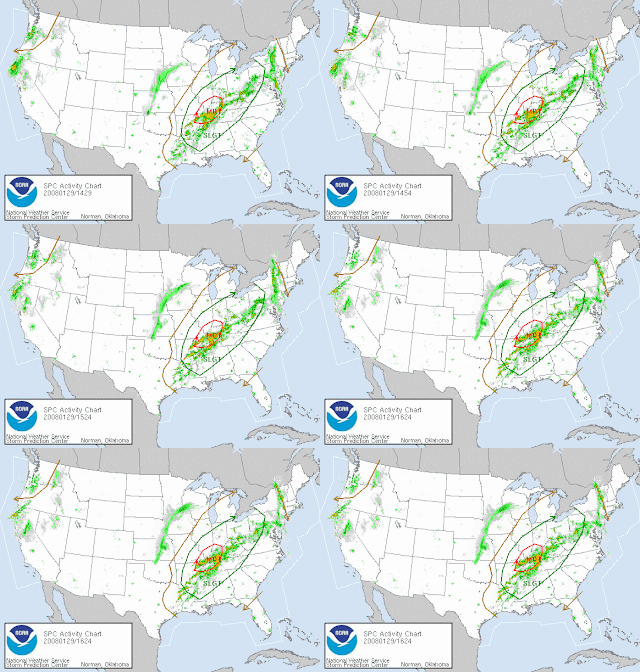
Severe weather headed east across much of the US, dropping snow and tornadoes...

Well, another freezing morning. At least this time, the bus arrived on time, so we didn't have to sit out there for forever-and-a-day this time, which is nice. It was a beautiful sunrise. It was nice to sit and watch it for once. There were layers of varied textures painting the sky, and as the sun rose on the eastern horizon (behind a patch of trees in my case), shades of golden yellow, salmon, pink and purple dressed the clouds in layers of magnificent brilliance, striking them at each moment with a fresh new color. I knew my camera wouldn't do it justice, so I just sat and absorbed the ambiance of the moment. What a glorious way to begin my day! Later in the morning, I decided to take a pic of what I was seeing through my sunglasses, and I snapped the picture above of the sun through my sunglasses. I think it's cool how the corner hasn't behind the sunglasses, so you can see the actual coloring of the sky in the same shot with the polarized view, very cool. Kind of interesting and not necessarily picturesque, but I like it, so you are stuck with it. Until I can get out and do a real shoot to get some wonderful pics, I will be posting spontaneous whim shots such as that one. SDS is bad. To see the full effects of SDS, check out a SDS treatment facility future patient's blog. Jeff's blog demonstrates the full impact and symptoms of SDS. You crack me up, Jeff! Thanks for the backlink. You rock! ;O)

This morning, I have seen two meso discussions released by the SPC. One was about a blizzard in the northern plains... ewww... the other talked about severe weather in Arkansas/Louisiana. Looks like Arkansas already has some powerful squall events rolling across that state. The SPC actually has much of the CONUS in a slight risk for severe weather, with the system moving across the nation. Looks like it's building some moisture now. We actually have the thunder line incorporating my neck of the woods, and Rick has been trying to pursuade me to plan to go after it tonight, but with Mini-Dew, it's just not likely. If anything, I can shoot from the backyard. I have had tremendous success with that in the past, so I will just go with what works. I would love for one of these systems to set up during a time when I can actually pursue them and a better photographic locale, but the Dewvoid prevails. The SPC still has a slight risk area highlighted to my west for Thursday (of course). With the speed that these early weather producers have had, I wouldn't be surprised if that area changes drastically as we get closer to Thursday, but it is all expected to deteriorate overnight. They mention that it could be strong to severe, but it looks like that will be more to the southwest of me...

FOR TIMING AND LOCATION OF THE GREATEST CHANCE OF SEVERE WEATHER ACROSS THIS AREA WILL BE LATE THURSDAY AFTERNOON THROUGH THE EVENING HOURS...OR TOWARD MIDNIGHT. THE MAIN THREAT WILL BE DAMAGING WINDS AND TORNADOES...MAINLY ALONG THE COASTAL AREAS.
Heck, they are mentioning a strong to severe possibility here for tonight, but come on... We know it will fizzle out before it gets here. It's the nature of the Dewvoid. They rather expect everything tonight to happen well to our Northwest. This looks like Alabama and Tennessee Mikes' system. Sorry, Rick and Meso Mike, looks like the Dewvoid might be "stealing your thunder"... again.

Anyone see that news story about the man who got 42 months in prison for using a stun gun on his 18 month old, supposedly to "toughen" him up? What kind of monster...? Anyways, I was completely repulsed by the story. What is wrong with some people?!

11:30 updated outlook (moderate risk added):1:30 update: Oh yeah, it is hitting the fan in the plains. A tornado watch has just been issued, and I just noted 3 mesos on one line tracking through Arkansas. Busy day out there.Toodles,
~Dewdrop

Saturday, December 15, 2007

MDs getting closer... it's beginning to look a lot like chase day!!!

MESOSCALE DISCUSSION 2225
NWS STORM PREDICTION CENTER NORMAN OK
1247 PM CST SAT DEC 15 2007

AREAS AFFECTED...SRN AL...FL PANHANDLE...SWRN GA
CONCERNING...SEVERE POTENTIAL...WATCH POSSIBLE

VALID 151847Z - 152015Z

DEEP CONVECTION HAS GRADUALLY INCREASED OVER THE NCNTRL GULF OF MEXICO INLAND INTO SRN AL/FL PANHANDLE IN ASSOCIATION WITH MARITIME TROPICAL AIRMASS...SFC DEW POINTS AOA 70F...THAT IS RETURNING ACROSS THIS REGION. LOW LEVEL WARM ADVECTION APPEARS TO BE PRIMARILY RESPONSIBLE FOR MUCH OF THIS DEVELOPMENT WITHIN AN OTHERWISE WEAK
LAPSE RATE ENVIRONMENT. GIVEN THE WARM ADVECTION REGIME...SEVERAL LONGER-LIVED UPDRAFTS HAVE EXHIBITED ROTATION...MAINLY WITHIN THE OFFSHORE ACTIVITY. ALTHOUGH INCREASING THUNDERSTORM CLUSTERS INLAND ARE SOMEWHAT LIMITED REGARDING INSTABILITY...A BROAD ZONE OF PRESSURE FALLS IN EXCESS OF 3-4 MB OVER THE LAST TWO HOURS SUGGESTS THIS CONVECTION IS EVOLVING WITHIN AN ENVIRONMENT OF FAVORABLE CONVERGENCE/ASCENT. EMBEDDED SUPERCELLS COULD CERTAINLY DEVELOP ACROSS THIS REGION...PERHAPS GENERATING ISOLATED SEVERE WIND GUSTS OR EVEN A TORNADO. WILL CONTINUE TO MONITOR FOR A POSSIBLE TORNADO WATCH.

~Dew

It's Chase Day... Storm Chasing in South Georgia!!

(Hey, if you click on the graphic above, it will loop for you.) OK... woke up late this morning... was hoping to get some stuff done ahead of the approaching storm. Granted, I will still get stuff done, just not as much as I had initially hoped. Looks like a squall set up, with some embedded cells. The line now is being briskly moved through Louisiana. One long tracking warned cell looks to have lined out. I am thinking it will die soon. Locally, I am looking at overcast skies with a steady mist (SPC refers to this as the maritime tropical air mass/boundary layer which is slowly creeping it's way up, spreading itself through the Southeast, offering up some moisture reserve), but a quick look at the radar loop tells me that it's scattered and could... read that... COULD clear up enough to let a bit of heating in. As you can see, the SPC has added a slight risk area and expanded mine. Here is the cool wording...

LONG ANTICYCLONICALLY CURVED HODOGRAPHS WITHIN THE NARROW INLAND WARM SECTOR APPEAR SUPPORTIVE OF EMBEDDED SUPERCELLS AND BOWING SEGMENTS CAPABLE OF PRODUCING DAMAGING WINDS AND A COUPLE OF TORNADOES. THE SEVERE STORM THREAT WILL BEGIN THIS AFTERNOON ACROSS THE FL PANHANDLE AREA AND SPREAD NEWD ACROSS SE GA BY THIS EVENING...REACHING THE COASTAL CAROLINAS TONIGHT.
Here is what the guys are saying in Tally...
WE ARE LEFT WITH THE SAME OLD QUESTION FOR THESE LOW END EVENTS. WILL WE HAVE THE NECESSARY SURFACE BASED INSTABILITY TO SUPPORT SEVERE WEATHER? AT THIS POINT IN TIME...IT STILL REMAINS A LITTLE UNCERTAIN. IT IS EXPECTED THAT AS THE WARM FRONT MOVES NORTHWARD...WE`LL SEE A FEW BREAKS IN THE LOW DECK THAT WILL ALLOW FOR SOME HEATING TO TAKE PLACE. THIS WILL BE THE KEY. HOW MUCH HEATING OCCURS WILL BE THE DETERMINING FACTOR FOR OUR SEVERE WEATHER PROSPECTS THIS EVENING. THE DYNAMICAL FIELDS ARE SUFFICIENT TO YIELD SEVERE STORMS.
Looks like Rick and I will be in for an evening chase. Too bad Meso Magnet Mike is busy shooting birds... we could use his help against the storm killing powers of the Dewvoid. Now, I just need to line up some radar support, perhaps one of the guys from the team... Oh yes, there it is, the Happy Dew Dance... Nothing like a little slight risk area over your region to aid in the treatment of those overwhelming SDS symptoms.

I will keep you posted. Got bunches to do...

Happy Chase Day!
~Dewdrop