I am psyched!!! I met with the Amateur Radio club locally last night, and they truly are a terrific and welcoming group. (They are actually thinking about hosting a blood drive soon - hello, can you say meant to be??? I give every 56 days) They are very interested in getting me licensed. I will work aggressively toward a Technician's license, and then as I learn CW, I'll get my General. I am hoping to get involved in ARES, especially with my expereince with the Red Cross in Damage Assessment, not to mention, I just like to help people. My main passion and emphasis though, of course, will be on the Skywarn stuff... Weather. It's a beautiful thing. Phenomenal acts of nature and science. I am hooked. Last night, I was dubbed a "weather groopie". Can I help it if a cumulus tower gives me chills? Is CG not a remarkable demonstation of God's awesome power? A hurricane, phew... don't even get me started. Anyway, they will have a radio class, which I plan to attend on August 26th. I will start studying now for the technician test using the question pool. I am on my way. See my wings?
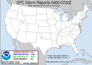
Speaking of wings, TS Chris is really taking flight. I expect he will be a hurricane by this afternoon. 65 mph winds now, and I can see an eyewall wanting to form on the satellite image (see the picture). How awesome!!! He's beginning to look like he might follow in Rita's footsteps. Rita was a phemonemal power house of a storm. Cat 5, 175 mph winds, 897 mb. Glad she settled down before land fall. I can't imagine the devastation had she not. It's too far out to really know. He could reach the gulf and take a swing to the Northeast. Then, we'd see some action.
My thoughts and prayers go out to those who have been impacted and who will be impacted by the storms this year. I only hope that people will listen to Emergency Management and get out of harm's way. The beautiful thing about these storms is that we know ahead of time that they are coming, research tells us where they are likely going. Please people, get out of harm's way.
Locally:
.DAY ONE...TODAY AND TONIGHT...
ISOLATED TO SCATTERED SHOWERS AND THUNDERSTORMS ARE EXPECTED TO DEVELOP ACROSS THE REGION TODAY...MAINLY IN THE AFTERNOON AND EVENING HOURS. THE AFTERNOON SEA BREEZE WILL ENHANCE THE DEVELOPMENT OF SHOWERS AND THUNDERSTORMS THIS AFTERNOON AS IT MOVES INLAND OVER NORTH FLORIDA. ANY SHOWERS AND THUNDERSTORMS THAT DEVELOP ARE EXPECTED TO MOVE SLOWLY AND MAY PRODUCE LOCALLY HEAVY RAINFALL. ADDITIONALLY...AN ISOLATED STRONG TO SEVERE STORM CANNOT BE RULED OUT WITH THE MAIN THREATS BEING GUSTY WINDS AND HAIL. THESE SHOWERS AND THUNDERSTORMS WILL DIMINISH SHORTLY AFTER SUNSET.
Uh, helloooo, it's like de'ja vu...
~Dewdrop
Wednesday, August 02, 2006
Amateur Radio and the future"Hurricane" Chris
Subscribe to:
Post Comments (Atom)


No comments:
Post a Comment
Dew comment, please...