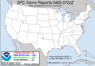
Just back from the hospital... Mediacom tech was at the door just as I escorted hubby in... he has us up and running on both phone and internet. We will call the Dr. at 2:00 to find out the final pathology results. If all is well, he is done until tomorrow morning, when they remove the drain from his neck. He had a left lobectomy and partial thyroidectomy. If not, he goes back in for the rest of the thyroid... He's doing well... recovering peacefully at home, now with phone service. The hospital was awful... my bed/chair was really bad. My neck muscles are aching, but I am sure they are not as bad as Hubby's. Poor guy. I was just catching up on blogs and saw where Jeff G. had pointed out a moderate risk... WHAT?! It figures, doesn't it, I absolutely cannot miss work tomorrow after missing yesterday and today... and tomorrow is a better chance than last week of severe weather...?! How insane it that?! The moderate risk out by the SPC is slightly to my west, but it's there, and I'll watch it; however, there is no way I can chase it. Doesn't that just figure... Appreciate the heads up though, Jeff. I've been out of pocket. It's nice to know that the season's picking up, so there are more opportunities on the horizon. STILL CLOSELY MONITORING POTENTIAL FOR SEVERE WEATHER FOR THURSDAY AND THURSDAY NIGHT. IMPRESSIVE LOW LEVEL WIND FIELDS COMBINED WITH REASONABLE INSTABLITY AND DIVERGENCE ALOFT ARE SETTING THE STAGE FOR A POTENTIALLY MORE WIDESPREAD EVENT THAN THE PREVIOUS FEW. THE FRONT PRECEDED BY AN INTENSE SQUALL LINE WILL DRAG EAST INTO OUR CWA THURSDAY THROUGH THURSDAY NIGHT. ALL THE NECESSARY PARAMETERS FOR A THREAT OF SEVERE WEATHER COMING TOGETHER AS MODELS SHOW VERY DEEP MOISTURE...STRONG DIFFLUENCE ALOFT...DEEP LAYER SHEER AND 50 TO 60 KT LOW JET ACROSS OUR REGION DURING THE THURSDAY THROUGH THURS NIGHT TIME FRAME. IN FACT... SPC HAS JUST UPDATED THE DAY 2 CONVECTIVE OUTLOOK AND PLACED MOST OF OUR GA AND SE AL ZONES IN A MODERATE RISK AND THE REMAINDER OF OUR CWA IN A SLIGHT RISK FOR SEVERE THUNDERSTORMS. Life... I'll tell you...
One bit of exciting news, Kelly has the NWS-TLH Spotter Blog up and running. I haven't really gotten much of a chance to check it out, but I will... Thanks, Kelly.
I'm going to have to go now. I have to pick up some pain meds we dropped the RX off at the pharmacy on the way, and I have to pick up the doggone dog, who was boarded during our lovely stay at the hospital. Not to mention, I just need to check on hubby and get off the computer. More tomorrow about that weather headed our way... tomorrow. I'll be watching when I can.
Toodles,
~Dewdrop
Wednesday, February 28, 2007
Moderate risk... hey, what'd I miss?
Subscribe to:
Post Comments (Atom)


No comments:
Post a Comment
Dew comment, please...