 Talk about withdrawals... after today, I don't know when I'll get a chance to be on a computer until Tuesday. Maybe, I'll be staying at a hotel that offers short internet visits. If so, I might blog then... otherwise, I won't be able to update for a while. sigh. It's hard to imagine 4 days without a blog... I don't think it's been that long since I starting keeping this blog. Oh well, I'll survive. As for the pic... I figured, it's spring, time for some color in my blog.
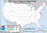
Weather remains... you guessed it - BORING! More talk af the possibility for a little something in the near future: EJECTING UPPER LOW WILL SHEAR OUT LATE IN THE WEEKEND AND SLIDE NORTH OF THE AREA MONDAY INTO TUESDAY. THIS MAY BEAT DOWN THE RIDGE ENOUGH FOR A FEW SHOWERS AND THUNDERSTORMS BUT NOT EXPECTING ANYTHING WIDESPREAD AS DYNAMICS ARE WEAK. Nothing I dispise more than weak dynamics. How unfair! That system in the plains has lost a lot of its pizazz, only a few, small embedded cells near the Kentucky/Illinois line, though a nice little pocket of storms is kicking up in the Texas panhandle heading into Oklahoma and Kansas. According to the newly issued MD (was it 320?): 
NEW CONVECTIVE DEVELOPMENT IS ALREADY UNDERWAY ACROSS THE EASTERN TEXAS PANHANDLE INTO WESTERN OKLAHOMA. Some supercells (SUPERCELLS!) expected out of that but not much more. Again, it's a whole lot more than what we've got going on here...
That's all I've got. I hope you have a wonderful weekend! I'll update when I can.
Toodaloo,
~Dewdrop
Thursday, March 22, 2007
Possibly a while before I can blog again... so...
Subscribe to:
Post Comments (Atom)


No comments:
Post a Comment
Dew comment, please...