 What a night... got a call from my friend in San Antonio.... Florida that she was on her way up. Her ex-father-in-law was put in ICU up here, and he isn't doing so well, so she came up to say her goodbyes. We went to the hospital to visit, and he is fortunately in stable condition... having very alert moments where he tells them exactly what he wants and when, typical for him... sounds like he's doing better than was let on when she was called. She will visit him today, and we will have lunch together. I am glad to have gotten to see her... and I'm glad that he is doing better than was suggested.
Weather here, as forecasted, was really, super cold. I slept with two sets of jammies on, two pairs of socks... I tend to run cold, which is actually why I choose to live in South Geoergia. I don't like the cold weather... It needs to go away. We have another cold night in the forecast, and then, by Wednesday, we should be back in the 70's with temps... Yep, sick weather. The models are inconsistent this far out for the approaching back door cold front consequences... the NWS has backed off POPS to slight based on a lack of moisture and lift. I guess we shall see.
IT WOULD BE NICE TO SEE SOME RUN TO RUN CONSISTENCY WITH THE GFS IN THE EXTENDED... EVEN THOUGH THERE ISN`T MUCH GOING ON THIS FAR OUT. THE 04/00Z GFS YESTERDAY HAD INDICATED A BACK DOOR COLD FRONT SLIDING DOWN THE EAST COAST INTO OUR AREA BY THURSDAY. THIS IS ONCE AGAIN INDICATED IN THE LATEST (05/00Z) GFS AND TO A LESSER EXTENT IN THE 04/12Z EURO. NET RESULT OF THIS BOUNDARY WILL ONLY BE TO SWING THE WIND DIRECTION TO NORTHEASTERLY WITH ONLY A MINOR INCREASE IN CLOUDS. AT THIS TIME... MOISTURE AND LIFT ARE NOT SUFFICIENT TO WARRANT INCLUDING POPS FOR THURSDAY. NOW... HERE IS WHERE THINGS WILDLY DIVERGE. THE MID LEVEL DISTURBANCE THE GFS INDICATED WOULD MOVE ACROSS THE SOUTHEASTERN CONUS LATE THURSDAY INTO FRIDAY HAS
GREATLY DEAMPLIFIED IN THE LAST TWO MODEL RUNS TO THE POINT WHERE IT IS ONLY A BROAD WAVE IN THE MEAN FLOW. THIS DIFFERS COMPLETELY FROM THE 04/12Z EURO. GIVEN THE UNCERTAINTY IN THE MODELS BETWEEN A DRY SOLUTION IN THE GFS AND A WET ONE OFFERED BY THE EURO...WILL ONLY DROP INHERITED POPS BACK TO THE SLIGHT CHANCE CATEGORY FOR FRIDAY. IF THE GFS TREND CONTINUES OF LESS AMPLIFIED FLOW...POPS MAY BE ABLE TO BE REMOVED ENTIRELY FOR FRIDAY.
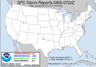
It is most definitely not going to compare to the event last week, which is good for the sake of everyone recovering. My thoughts and prayers are still with all those impacted by the blast of storms that trampled through. The tornado damaged areas in Enterprise and Americus, I am hearing, have been declared federal disasters, so that opens the doors to them for some extra help in the recovery. It'll be a long road to recovery. I can't imagine how difficult it must be.
As for me, I am looking forward to the upcoming time change... On some days, I hope to be able to use the extra daylight to seek out some spectacular sunsets. It's been a while since I have chased the sun. It's long over due... I am getting bored with my current collection of photographs. Time for something new...
Also, I have set up a meeting with the local EMA Director to discuss the local Skywarn Spotter class that I am trying to get going. He's the same one who offered me a spot in Damage Assessment locally. It's looking like spotter class might just become a reality in the latter part of the month, perhaps March 31st, but I'll update with details as they become available.
Have a Happy Monday!!
~Dewdrop
Monday, March 05, 2007
Soon... I'll be able to chase the sun again...
Subscribe to:
Post Comments (Atom)


No comments:
Post a Comment
Dew comment, please...