 Busy day for me with Relay creeping up on me this afternoon. I will be out there early, so I can get the money trailer all set up for optimal functionality. I like to have things in order. As smoothly as bank night went, I think that the system works, and I will only do a few tweaks to the process to really keep things running smoothly. Oh, and if anyone sees anything in S. Central, GA, please give me a call... I won't have anything, no radar, no nothing... call.
Smoke this morning from the Atkinson County fire is going away from us, but we are still contending with a haze... As I write this, I am looking through my jimmy rigged mirror to the outside... My fake window... and there are actually two men in the window replacing the glass with a less tinted glass, so now, my westward view will look less ominous on storm days, more true to life, which is good. Good news is that the smoke should "mix out" during the morning hours and clear the air some, so to speak...  Reading through the AFDs, I thought about how much I love the cool words some of the guys use to describe what's going on... I bet it brightens their life to add a little flavor to the discussion, and it makes it much more pleasurable to read. Mark, in the wee hours, wrote for example: THE DRY WX THAT HAS HAD A STRANGLEHOLD ON THE FORECAST AREA FOR A WHILE WILL FINALLY GIVE GRUDGINGLY AWAY TO AT LEAST MODEST RAIN CHANCES OVER THE NEXT FEW DAYS... MOST MODELS AGREE THAT THE GREATEST LIFT AND MOISTURE WILL BE OVER OUR ERN MOST ZONES THIS AFTERNOON.(wait just one cotton picking second... you're telling me that our area has the best shot at real weather on the one day of the whole year when I really don't want it?! Now, I know the secret to attracting desirable weather, just schedule a huge, outdoor fundraising event... yep, that's the trick. They've only included slight POPS though, so maybe it'll be OK.) ISOLATED THUNDERSTORMS WILL BE POSSIBLE TODAY AND TONIGHT. WHILE MOST AREAS WILL NOT GET RAIN...THE LIGHTNING FROM ANY STORMS THAT DO DEVELOP COULD POSE AN ADDITIONAL WILDFIRE THREAT FOR TONIGHT, WE HAVE SLIGHT CHANCE POPS IN FOR EVERYONE DUE TO BOUNDARY COLLISIONS AND THE WEAKENING SHORT WAVE TROUGH. FOR SAT, WE KEPT POPS IN THE LOW CHANCE (30) RANGE AS PREVIOUSLY ADVERTISED. and Sunday's front pushed in by a ridge to our North will BRING US OUR BEST CHANCE FOR RAIN. That's what I'm talking about and precisely when I want it. Things should cool off some at that point... That'll be nice, and if I've recovered from the Relay at that point, perhaps something chaseable. ;-)
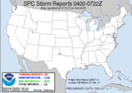
 The plains chasers are gearing up for a big event this weekend. Everyone is getting in position, in a noble attempt to avoid 2X4 repercussions... The SPC has issued a Public Severe Weather Outlook for Colorado, Kansas, Oklahoma, Nebraska, and the Texas Panhandle, with all storms in the region expected to become supercells, producing large hail, damaging winds and tornadoes (15% shot), some tornadoes should be strong. I know there will be some great video shot today and tomorrow. I am anxious to see it, especially since I won't even be able to arm chair chase... sigh... Be safe, you lucky dogs! What a way to kick off the official chase season!
Happy Hunting!
~Dewdrop
Friday, May 04, 2007
PSWO in the plains... and rain here - seriously.
Subscribe to:
Post Comments (Atom)


No comments:
Post a Comment
Dew comment, please...