 This morning, Tropical Storm Dean was upgraded to a Hurricane... since then, he has strengthened even more, now packing winds at 80mph, and a minimum pressure of 987mb. Most of the models carry Dean through the Yucatan Peninsula and into Southern Texas/Northern Mexico. Only time will tell, but most of them are falling in line now. At least if he does make landfall on the Yucatan Peninsula, that will help slow him down (take the wind out of his sails, so to speak)...
  should Dean emerge into the GOM without interaction with any substantial landmass, he would have the potential to become an unbelievably powerful force. Our first hurricane of the season, and all eyes are watching, anticipating what we might be dealing with. I had predicted (most likely, wrongly) that Dean would cut through the Floridan peninsula and reemerge in the Gulf (I think one model still clings to the "Dewview")... looks like he went way south of that likelihood, but my strong feeling of a Gulf storm from the get-go, seems to be panning out.
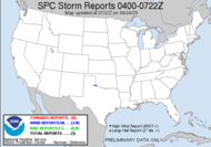
 Looking over at the depressed Erin... she made landfall in Texas this AM, very near Corpus Christi... (am I good or what?) She was a minimal Tropical Storm at the time and was immediately dropped down to a Tropical Depression. She is now dropping buckets of rain on the Texas coast.
  Texas, already having been soaked over this summer is now getting an even larger dose, and if some of those models pan out with Dean, The Texas coast could become a large lake. Dean, following the course of Erin, could generate catastrophic results. The flooding would be horrendous, but if Dean becomes the major hurricane that I suspect he might, it would result in a devastating disaster. My thoughts and prayers are with all those who are to be adversely affected by Dean, or the possbile Erin/Dean combo.
 Locally, things won't be AS hot as yesterday, but they will still be ridiculously hot, so it's really a mute point. Hot is hot. I am grateful that I have the luxury of A/C. There are some typical isolated afternoon showers and potentially strong thunderstorms in the forecast, but the heat is the kicker. There was some encouragement offered in the HWO though:
FRIDAY THROUGH WEDNESDAY... A WEAK FRONTAL BOUNDARY WILL MOVE INTO THE SOUTHEAST AND STALL JUST NORTH OF THE REGION FRIDAY AFTERNOON. SOME STORMS THAT DEVELOP ACROSS SOUTH CENTRAL GEORGIA COULD BRIEFLY BECOME STRONG WITH GUSTY WINDS BEING THE MAIN THREAT. A RETURN TO HOT AND DRY CONDITIONS WILL BEGIN ON SUNDAY AND INTO THE UPCOMING WEEK WITH ONLY SLIGHT CHANCES FOR THUNDERSTORMS EACH AFTERNOON.Well, it started out encouraging... I might have a chase-tunity on Friday afternoon, so that is exciting news, but then a hot and dry Sunday through whenever... seems like I've heard that forecast before... sigh. It sure would be nice if we could have a tropical storm roll over us dropping buckets of rain... my shower is back to a trickle. Have you ever tried to shower in a trickle???
Have a lovely day. If any major changes occur with Dean, I will post... otherwise... Toodles,
~Dewdrop


Thank God for the A/C!!!
ReplyDeleteErin is still leaving it's mark on Texas. As well all mentioned on our blogs, the flooding to Texas is extensive and already 7 people are dead.
ReplyDeletehttp://wx5tvs.com/content/view/55/82/
Gosh, David. That is just just awful to hear! I sure hope it doesn't end up being a 1,2 punch, especially with the way Dean is looking.
ReplyDelete