 Finally, TD 8 has turned into a tropical storm. Welcome to the scene, Tropical Storm Ingrid. We only made it to Isaac last year, so one more named storm would put us over last year's count. Tropical Storm Ingrid is looking better this morning, but still lacks the "pretty" tropical cyclone look. It does look like she is trying to build up some convection now. In fact, they suspect higher intensity, but are holding off until hurricane hunters, currently en route, can gather more accurate data. There is a shot at some strengthening before hitting a heap load of shear, which could very well take care of Ingrid before she even has a chance to make something of herself. It's a tough environment out there for her. I'll be watching to see how she fairs. They are actually forecasting that she will weaken to a tropical depression by Tuesday AM. Otherwise, not much other tropical action. Humberto did his damage in Texas and is now dumping buckets of rain on folks across the southeast as a "remnants of...", but rain is the main threat.
  Locally, I could see some beautiful flashes of lightning that were occurring in the thick clouds off to the distance yesterday evening, driving Mini-Dew home from practice. I couldn't make any bolts out, but the clouds lighting up was breathtaking. It continued on into the night... No chase for me.
Today, the bands of the remnants of Humberto, should offer us a good shot at much needed rain. With the cold front approaching from the northwest, could make for some interesting dynamics. Great AFD from Kelly this AM, always ending with his very cheerful, "HAVE A GREAT DAY!" Thanks for that, Kelly! Could get a little something today, but I am not expecting much. Besides a Tom-Tom, a laptop, a DSLR, and WxWorx, I have added something to my Christmas list... check it out, a tornado in a jar!!! I imagine that would do wonders for the severe SDS that I appear to be suffering from... Here's a really cool write up about it... Thanks Jason for causing my wants to expand. lol!
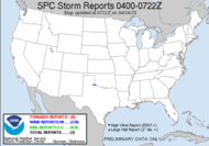
From my friends at the SPC for tomorrow: INSTABILITY WILL LIKELY BE STRONGEST ACROSS FL AND SRN GA SATURDAY AFTERNOON AS SUGGESTED BY MODEL FORECASTS. HOWEVER...VERTICAL SHEAR SHOULD NOT BE ADEQUATE FOR A MARGINAL SEVERE THREAT.
Toodles, oh, and have a great day! It's Friday!
~Dewdrop
Friday, September 14, 2007
It's about cotton pickin' time...
Subscribe to:
Post Comments (Atom)


I have had something similar to that for quite a long time. I call it my tornado lamp. I need to bring it to work.
ReplyDeletePics man. I needs pics!!!
ReplyDeleteWeather Weenies online!! sheeesh....
ReplyDeleteThat'll take some time as it is at my parents' place. It's not as impressive as the one you have your eye on. It does deserve an eventual mention on my blog under the category "weather geek". If not that, under the category cha cha cha...
ReplyDeleteWeather weenies, online... what are you saying, Rick?
ReplyDeleteMike, you don't have possession of the really awesome lamp? Inconceivable! That must change... cha cha cha!
No comment....I am evil, remember?
ReplyDeleteEvil-looking... sheesh...
ReplyDelete(Yawn)....
ReplyDelete