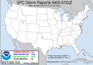
 Well, the SPC just issued a meso discussion that places me right in the middle of an upcoming severe thunderstorm watch. It looks like the dynamics are lining up for a DYNAMIC afternoon. The fog has dissipated almost completely, and the sky is actually showing some breaks allowing for the heating to break through.
 ISOLATED TORNADOES WILL STILL BE POSSIBLE...ESPECIALLY NEAR THE WARM FRONTAL BOUNDARY WHERE BACKED SURFACE FLOW WILL BE MORE SUPPORTIVE OF ROTATING UPDRAFTS. EXPECT THE STRONGEST ACTIVITY TO BE NEAR AND SOUTH OF THE WARM FRONTAL BOUNDARY WHERE INSTABILITY WILL BE MOST FAVORABLE.
Strong wording... stay tuned! 12:35 Update: Oops, there it is!
 This is a picture of where bf is right now in mesocyclone world. Yep, chasing without me...
Update 2:00: I am about to leave here and chase... hopefully. I am trying to talk Meso Mike into chasing with me...
~Dew
Friday, February 22, 2008
South Central GA Severe Thunderstorm Watch coming right up!!!
Labels:
MD 293,
upcoming tornado watch
Subscribe to:
Post Comments (Atom)


Good luck with the chase!! Just rain here today.
ReplyDeleteAwesome, Dew! Good luck!
ReplyDeleteYeah... well... we had rain. In all seriousness, I had some awesome structure rolling in, but nothing came of it. Of course, I have a funny story to share...
ReplyDelete