Another update from a resident of Mountain View:My family and I live in Mtn. View, and were here for the storms last Tuesday. My wife weathered out the storm in Harps' meat cooler, where she works, and heard the tornado pass a half-mile from the store. As for myself, I work at the nursing home, in dietary, and had taken our two daughters there for shelter during the storm. As a coworker and I were checking out the storm from the front deck, we could hear the tornado ripping through the east end of town. It's been rough, but we all praise God that no more than what'd passed had occured. I want all that have family in our facility to be assured that they are being well-taken care of by all of the staff. The displaced hospital staff are also working with us there, and are of a tremendous help.
I appreciate those who have been providing updates about the areas impacted by the February 5 Tornado Outbreak. I hope it is serving as a comfort to those who are curious about their family and friends in the areas impacted in the February 5th storm.
Power has been restored in most, if not all, of Stone County, so now we'll be able to get a better handle on the clean-up.
Pray for all that've lost their lives, homes, or loved ones during this trying time...not just in Mtn. View, but wherever this storm has affected.
Rob Holt I got an email from Peggy, sharing a link to Little Rock's National Weather Service site containing a comprehensive report about the tornado that bulldozed its way through much of Arkansas on February 5th, during that memorable event. It was among the links to storm reports that I posted a few days back... not only did she compliment the explanation of the synoptic set-up for the day, but she pointed out an interesting bit of information regarding one specific tornado during that event... it tracked for 123 miles! As she put it, "that is almost unheard of!" In fact, that is the longest tracked tornado in Arkansas's history since 1950, sadly, with that tornado and one other being responsible for 13 deaths that day. Here is a link to a story about the tornado that wreaked havoc from Atkins (Pope County) to Clinton (Van Buren County), Mountain View (Stone County) and Highland (Sharp County). These are areas that were affected by that long track tornado (rated EF4).
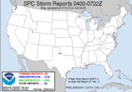
  Currently, another severe weather system has set-up for its track across the country. A substantial squall line event is already producing large hail in Texas and Louisiana... Hail and wind are the main damaging attributes expected out of today's severe weather event; however, there is some risk of pre-frontal supercells/tornadoes with this system, as it travels east across the Gulf states. That story changes in Florida, where a subtropical impulse is expected to move inland off the Gulf of Mexico. Unlike the mainly hail and wind event expected to our west... the Floridian pensinsula modeled dynamics, vertical shear profiles are actually conducive to the development of severe supercellular storms with damaging winds and a few tornadoes being the main threat. Unfortunately, according to the Storm Prediction Center:
 POTENTIAL FOR SEVERE STORMS SHOULD CONTINUE TO INCREASE OVERNIGHT AS LOW LEVEL WINDS STRENGTHEN AND HODOGRAPHS ENLARGE. HAVE OPTED TO INCREASE TORNADO PROBABILITIES OVER THE SOUTHEAST PENINSULA FOR LATE TONIGHT...WHEN/WHERE MODEL GUIDANCE APPEARS TO SHOW GREATEST THREAT OF TORNADIC SUPERCELLS.
 A night-time tornadic event in Southeastern Florida... Jeff will have his work cut out for him tonight. Be careful as you chase in the dark, Jeff, and people in Florida, if you do not have a weather radio, GO BUY ONE NOW! Of course, my neck of the woods is expecting to experience just a rainy yucky day (we need rain, so I am not really complaining). They talked about thundershowers possible for tonight, but we shall see. One thing that I found to be particularly interesting was that this is a double headed monster, this storm passing through... the southern section is dealing with severe storms, where the northern part has a major winter weather event to contend with... good thing we have our own groundhog, right? I saw a report on TWC about floodwaters in Indiana actually freezing! Crazy weather.
2:45 Update: Uh oh, counting 8 Tornado Warnings in Louisiana and Mississippi at this time... so much for a mostly hail and wind. Also a tornado warning on the east coast of Central Florida.
 Have a great day!
~Dewdrop
Tuesday, February 12, 2008
Tornadoes in the forecast for Florida... plus, an update on the Arkansas tornado
Subscribe to:
Post Comments (Atom)


No comments:
Post a Comment
Dew comment, please...