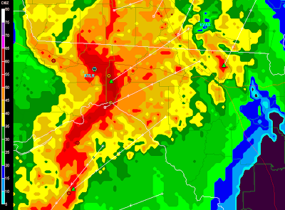
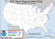
 This is a current radar snapshot of what is headed my way. Already lightning is started to feed in ahead of the bowing segment of the strong squall line...
  which just got solid after just an hour to two hours ago having had a more subtropical low type presentation on radar. Just had a TVS pop up on GR southeast of Appalachicola and several of the cells have doppler indicated mesos on them. Folks, we have got ourselves a storm. A tornado watch was issued for the county to my east.
The bus driver was kind enough to go door to doo, too. How nice.
Update 8:00AM: My weather radio is going bezerk... severe thunderstorm warning has been issued for the southern part of my county. Mesos more and more frequent in this line. Lightning still about the same up here.
More coming up...
~Dewdrop
Friday, March 07, 2008
Incoming potential severe thunderstorm...
Labels:
thunderstorm
Subscribe to:
Post Comments (Atom)


nice storms :)
ReplyDeleteYes, they are! Thanks for stopping by.
ReplyDeleteAwesome Dew, you chasing from the CPU today? Shear looks real strong right over top of me here in Southeastern Va from 09-12am tomorrow. I'll be out.
ReplyDeleteSCM
I am definitely arm chair chasing today... these pulse storms are moving way too fast for me to even consider going after them in this heavy precipitation. We are getting some rotation out of it, but I don't like the set-up from a South Georgia chase perspective. Be safe while you chase, Mikey! :O)
ReplyDelete