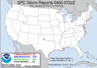
 Well, the mysterious Tropical Storm Fay has finally been, at least temporarily, beaten into submission. For some reason, yesterday, she didn't realize that the land was supposed to reduce her intensity, crazy chick was intensifying over Florida (what kind of storm does that...? Well, besides Erin last year)... having the radar presentation of a well defined hurricane, producing relatively strong tornadoes (for a tropical storm, especially), wreaking all sorts of havoc, doesn't sound much like any Tropical Storm I've heard of... Many homes in Florida now are uninhabitable, as a result of some rotation in the outer bands of Tropical Storm Fay.
 Currently, Tropical Storm Fay with a weak wind field, exhibits strong satellite presentation but a rather weakly convected radar presence, and the projected path is still radically uncertain. So many people have asked me for my opinion about Fay, and I withhold response. She is wildly unpredictable, breaking the norm, going against the grain. It truly is "up in the AIR" with her. As you see in the 5 day projection below, the cone of possibilities is widely expansive to incorporate a very large area, a huge window of possible outcomes...
 Notice the white bubble, that is the 3 day cone... even that covers such a large area that EVERYONE in the southeast needs to keep a watchful eye on this one. Look at the possibilities...
 I should point out that, days ago, I discussed the 4 models that claimed this system would pass through the southern peninsula, into the Atlantic, build up into a hurricane and make a 4th landfall (3rd U.S. - more specifically Floridian - landfall) in northeast Florida somewhere, cut across the state into the Gulf of Mexico and possibly making a 5th (4th Floridian) landfall! This is not the official forecast, mind you, but some of the models suggest such a scenario. I hope that if we have learned nothing else about tropical cyclones, it's that you can expect the unexpected. I have no official thoughts on this one; I guess what I just typed is the closest I will get to that, but please don't plan any vacations based on that... don't turn off your automatic sprinklers... just watch Nature at her best. She's putting on quite a show...
In fact, speaking of shows... while Mini-Dew and I were getting ready this morning, she caught a radar graphic of dear old Fay, which showed some of the outer bands extending up into our neck of the woods... Mini-Dew pointed that out saying, "It's getting AWFULLY CLOSE!" I reminded her that a landfalling hurricane (which it's not) on that side has to go through a lot of land and is a much more significant threat to the shore. We would most likely have rain, some wind and a random tornado, but even that is less likely in the northwest quadrant of a cyclone. The cool part occurred when we got outside to meet the bus. I was able to show her the low cumulus caught up in the outer rotational bands of Tropical Storm Fay as they whizzed by... She thought that was pretty cool. Another show is the pre-hurricane sky. While moisture is being sucked from our atmosphere toward a nearby (yet far enough away ) tropical cyclone, the remaining sky is a stunning, crisp blue, which I am quite fond of... This is an untouched photograph. It was THAT blue!
11AM Update: As TS Fay is moving her center over the Atlantic, she has already very slightly increased her windspeed, while reducing slightly in intensity... what?!
3:30PM Update: Tropical Storm Fay is basically just sitting there on the east coast of Florida... probably trying to figure out which model to follow. My wonderful gtb just let me know that the rain smells like the sea. How cool is that?!
Have a lovely day...
~Dewdrop
Wednesday, August 20, 2008
It's all up in the Air with Fay... get it? LOL!
Labels:
Tropical Storm Fay
Subscribe to:
Post Comments (Atom)


I really wish Fay would just go away, we are supposed to be heading to Tybee Island Friday!!
ReplyDeleteGreat blog! I came in through the Bland and White group and will add your link on my blog. Keep up the good work.
ReplyDeleteoops, Black not Bland!!
ReplyDeleteThanks Silver Solo! I appreciate the add!
ReplyDeleteDew: What a wonderful view of a scary time.
ReplyDeleteJust beautiful
ReplyDeleteYou always whip me up into afrenzy reading these posts. Brilliant writing, and images. Natural is always best.
ReplyDelete