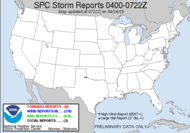
 Well, Hurricane Gustav, a weak category 3 hurricane, is rapidly approaching the Louisiana coast. Gustav allowed quite a bit of dry air into the system while moving across the Gulf preventing him from growing up into the storm they feared he might have become. The fear was that he would continue to intensify as he moved across the ripe conditions of the Gulf of Mexico after passing through Cuba. That has not happened. Don't get me wrong, this is still a major hurricane. Hurricane Katrina struck Louisiana as a category 3 hurricane, which is what Gustav is now. Fortunately, the storm was taken seriously, and in many of the low lying areas, a large majority of the populations have been evacuated well ahead of time.
  My fear is that memories of Katrina will be overtaken by this "false alarm" (if you will with likely just some strong wind and rain with it quickly moving ashore, likely less devastation than Katrina, praise God), and people will feel they evacuated for nothing and become less proactive and responsive next time. The worst of it hasn't come, and I could be way off base regarding the impact, but I don't think I am that far off.
 That brings us to the runner up... Tropical Storm Hanna, still meandering her way around the western Atlantic... looking like a big pile of mess yesterday but seeming to get her act together this morning. Now that she has ruined a few vacations to the Bahamas, she is set to make a turn to the northwest, and head up this way.
  She's not moving very quickly on that journey, but she is eventually expected to make landfall around the Georgia/South Carolina coast line as a hurricane.
 ALL OF THE GLOBAL MODELS HAVE NEARLY IDENTICAL FORECAST SCENARIOS OF THE MID-TO UPPER-LEVEL FLOW PATTERNS.
ALL INTERESTS IN FLORIDA SHOULD CLOSELY MONITOR THE FORECASTS FOR HANNA SINCE ONLY A SLIGHT DEVIATION TO THE WEST OF THE OFFICIAL TRACK COULD BRING THE CENTER OF HANNA MUCH CLOSER TO THE FLORIDA EAST COAST AND THE BAHAMAS THAN CURRENTLY INDICATED.
 With Gustav about to make landfall, Hanna trying to get her act together for a potential upcoming landfall as Hurricane Hanna... you might think that's all, well... no. There are a few areas of interest out there with one between the African coast and the Leeward Islands looking like it might become Tropical Depression 9 during the course of today. Another off the African coast has some potential for development.
 Hang onto your hats folks, looks like we've got quite a year brewing.
11AM Update: 1000 AM CDT MON SEP 01 2008
Hurricane Gustav is making landfall in Cocodrie, LA as a strong category 2 hurricane, headed for Houma, LA.
...CENTER OF GUSTAV MAKES LANDFALL NEAR COCODRIE LOUISIANA...
1100 AM AST MON SEP 01 2008
Could become... Tropical Storm Ike...
...NEW TROPICAL DEPRESSION FORMS HALF WAY BETWEEN AFRICA AND THE LEEWARD ISLANDS... COULD BECOME A TROPICAL STORM LATER TODAY...
1:30 Update: Hanna is now a Hurricane!!!130 PM AST MON SEP 01 2008
Have a wonderful Labor Day!
...HANNA BECOMES THE FOURTH HURRICANE OF THE SEASON...
~Dewdrop
Monday, September 01, 2008
Hurricane Gustav, Bark Worse than Bite?
Subscribe to:
Post Comments (Atom)


The reason the Hurricane is headed for Houma, is because that hurricane magnet, Jim Cantore, is there. (grin)
ReplyDeleteHe was on the Weather channel, on the phone, and the eye wall was collapsing around Houma.
It looks like a train of storms lined up from Africa to the US.
I like your concise posts. thanks and keep them coming.
Troy
The media and local government went overboard this time.
ReplyDeleteThe local government down there wanted to prove that they could evacuate people, so they scared them out by calling this "storm of the century" (which it is far from), and the media has nothing else to hype up except this storm, which has now made them look really, really stupid as it only landed as a category 2.
Category 1's and 2's are party storms! Evacuations not necessary.
What a joke.
Troy, It does look that way. You're welcome! Glad you enjoy them.
ReplyDeleteAnonymous, I think you are way off base. Most of the models were forecasting a category 4 hurricane at landfall. Evacuations began Thursday based on that forecast in order to ensure that all residents were able to get to safety should that have happened according to forecast. The local government did EVERYTHING right based on the BEST forecast available at the time, and the fact that it wasn't necessary, as it turns out... after the evacuation, is a blessing. I hope you will not perpetuate that attitude you shared here, hence creating the complacency I described here. People need to respect the local authorities and the forecasts that are based on the best technology we have available. It's all we've got. It COULD have been as bad as they feared. Thank God it was not.