No, I was not in the Valdosta area on Saturday evening when the National Weather Service in Tallahassee issued this tornado warning for my house...BULLETIN - EAS ACTIVATION REQUESTED
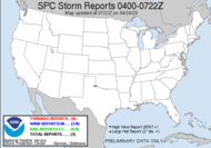
Here is the storm report...
TORNADO WARNING
NATIONAL WEATHER SERVICE TALLAHASSEE FL
625 PM EST SAT FEB 28 2009
THE NATIONAL WEATHER SERVICE IN TALLAHASSEE HAS ISSUED A
* TORNADO WARNING FOR...
EXTREME SOUTH CENTRAL BERRIEN COUNTY IN SOUTH CENTRAL GEORGIA...
NORTHEASTERN BROOKS COUNTY IN SOUTH CENTRAL GEORGIA...
SOUTHERN LANIER COUNTY IN SOUTH CENTRAL GEORGIA...
THIS INCLUDES THE CITY OF LAKELAND...
NORTHERN LOWNDES COUNTY IN SOUTH CENTRAL GEORGIA...
* UNTIL 715 PM EST
* AT 619 PM EST...NATIONAL WEATHER SERVICE DOPPLER RADAR INDICATED A DEVELOPING TORNADO ABOVE 3 MILES WEST OF HAHIRA...OR 11 MILES NORTHWEST OF VALDOSTA...MOVING EAST AT 35 MPH.
* THE TORNADO WILL BE NEAR... MOODY AFB BY 640 PM EST... LAKELAND BY 655 PM EST...
IN ADDITION TO THE TORNADO...THIS STORM IS CAPABLE OF PRODUCING QUARTER SIZE HAIL AND DESTRUCTIVE STRAIGHT LINE WINDS IN EXCESS OF 70 MPH.
 [Eric Bennett, captured tornado in Lowndes County on February 28, 2009] Yes, my neck of the woods. Yes, first Lowndes County tornado in YEARS! Yes, this is the first daylight tornado warning (tornado) in my county on a weekend day when I don't have Mini-Dew that I have had since I have been chasing, and yes, I was in the Gulf of Mexico, playing with dolphins and watching an AMAZING sunset. Incidentally, it was actually captured on Eric's camera phone in my absolute favorite storm chasing spot. I missed it all... except, thanks to the new county Code Red with Weather Alert (if you're in Lowndes County, you can follow the link to sign up... make sure you check the new Weather alert option), I was notified on my phone, while in the middle of the Gulf of Mexico.
  Of course, being that I had reception to get the warning, I was able to call around and find out information about where and what was going on, which allowed me to tell everyone what was going on, and I got calls from bunches of people asking me what was going on, including Mini-Dew, who was panicking because her friend's mother was sleeping at the time, when I notified her. I told many folks to get into closets, into concrete holes in the ground, into their safe spot. According to the Valdosta Daily Times, and with supporting pics taken on Eric Bennett's, there was a daylight tornado in Valdosta, Georgia, while I was in the Gulf of Mexico. Dewvoid confirmed.
There were several other reports of damage from winds associated with this same system, but the only Georgia tornado that day was about 3 miles southwest of my home, which didn't cause any significant damage. Granted, with it being a still shot, it could be an exceptionally low wall cloud. What?! It could be. When you can't see rotation, you can't confirm a tornado. It could be very low scud, but if it was a rotating column of air on the ground, it was a tornado.
An interesting side-note... while I was in CPR class on Saturday, the emergency manager jokingly said that he wasn't going to attend any more training with me because we always have a slight risk when I am at the training. lol. Dewvoid. Also, while I was in CPR class, at 11:24AM, I got this text from Mini-Dew: "Is there going 2 be a tornado 2day"... then, at 6:39PM: "where in lowndes county is the tornado"
Not long after this storm, snow was reported throughout Georgia, as far south as Tifton with flurries, accumulating snow in the Atlanta area, cancelling school, and causing significant power outages, since the weight of the snow on spring growth caused trees to fall on power lines. At last report, I heard 100,000 in Georgia are without power. "Snow days" are being used all up the east coast with this monster storm.
Have a lovely day... grrrr...
~Dewdrop
Monday, March 02, 2009
Tornado captured in Valdosta, Georgia, on February 28, 2009
Labels:
tornado in Georgia,
tornado in VALDOSTA
Subscribe to:
Post Comments (Atom)


That looks like a violently rotating column of air in touch with the ground, as far as I can tell from a still picture. Wow.
ReplyDeleteI guess that is part of the same general storm system that produced the confirmed tornado near Auburn, Alabama.
It does look like very low scud but its a still shot. Still an awesome pic anyway! It stunk that i was having to work that day. Dewvoid confirmed? Looks like it. Sorry I wasn't very much help that day. I had GRS running at the station, but with all the calls coming in, not much time to look at it.
ReplyDeleteI think this is where Murphy's Law kicks in, right? LOL Looks like I'll be chasing on Saturday in West-Central Oklahoma, unless things change drastically between now and then.
ReplyDeleteMike, I am not sold, but I think it was definitely worthy of the tornado warning. I wish I could have seen it!
ReplyDeleteRick, I knew you were working. I was just desperate for information.
Ken, You're not kidding. Be safe!