Yesterday, the little area of clustered storms off the Leeward Islands was given a low probability of development into anything significant. This morning, all that has changed. That area ow has a high probability of developing into a tropical cyclone during the next 48 hours. If this system develops into a named storm, he would earn the name Danny.
  As the current shear environment settles some, the environment will become much more favorable still for the development of this tropical wave. As such, Air Force Reconnaissance will investigate things this afternoon. I bet they find him "depressed". Incidentally, he does have great satellite presentation and appears to be at the spot where major Hurricane Bill just past by less than a week ago. Looking at the graphic, you may have noticed the other area highlighted off the coast of Nicaragua and Costa Rica. There is little chance that that area of disturbed weather will gather sufficient organization to earn an official title before it moves inland today.
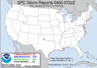
I was just looking at the reports for yesterday, which were less than exciting, when another graphic caught my eye... check out the cumulative severe weather reports so far for 2009... Red dots represent tornado report, blue signify wind reports and green dots are hail reports. The 2009 map seems rather blue, wouldn't you say (perhaps a little "depressed", like 92L. Incidentally, I think 92L might skip TD 5 and go straight to TS Danny)??? Well, here is the 2008 graphic for comparison (remember 2008 was a wild tornado ravaged year)...
 You can click on the various tabs for specific reports.
Have an effervescent day!
~Dewdrop
Tuesday, August 25, 2009
Another tropical disturbance ready to roll...
Subscribe to:
Post Comments (Atom)


No comments:
Post a Comment
Dew comment, please...