 SKY WATCH FRIDAY time! Welcome all sky fans!!! I truly appreciate your visit and comments. I might not have time to respond to you, but I will try my best to visit!!!
Our hosts: Klaus Sandy Sylvia Wren Louise Fishing Guy
Thanks, also,to Dot and Tom, who were instrumental in the success of this blogging event. You should definitely come fly with us!
By now, most of you have heard of the huge coastal storm that is inundating the mid-Atlantic coast, most likely causing a historic flooding event, as the remnants of Ida merge with a high pressure system, creating a powerful pressure gradient, which is currently generating tropical storm force winds, causing ferocious waves, dropping buckets of rain and raising water levels, leading to flooding. 
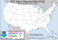
 The graphic the the left demonstrates the warnings and advisories being issued by the National Weather Service. You can click on the image for an updated depiction. Currently, there is flooding along the coast of North Carolina and Virginia from the surge combined with high tide overnight. Unfortunately, we expect that trend to move up the coast as subsequent high tides occur and the very slow storm motion, which in and of itself is going to cause rainfall totals 3x greater than a typical total rainfall for a wet November. Almost 10 inches have already been reported in some places.
 Precipitation
  This system is offering basically the most destructive elements of a hurricane, without it being a hurricane. The areas affected will have flooding far inland due to excessive rainfall, which will be bad, but as the water level of the coastal water rises (storm surge--the pressure gradient will be drawing in storm surge), the waves grow in height, and high tide approaches again (4-5PM today), we can expect a devastating flooding event.
THE GREATEST THREAT FOR SEVERE FLOODING CAN BE EXPECTED DURING THE HIGH TIDE CYCLES THIS AFTERNOON AND FRIDAY MORNING.Please join me in praying for all those who will be impacted (or have already been impacted) by the system formerly known as Ida, now just a no-name storm.
God bless those involved in the coastal storm.MOST FLOOD DEATHS OCCUR IN AUTOMOBILES. NEVER DRIVE YOUR VEHICLE INTO AREAS WHERE THE WATER COVERS THE ROADWAY. FLOOD WATERS ARE USUALLY DEEPER THAN THEY APPEAR. JUST ONE FOOT OF FLOWING WATER IS POWERFUL ENOUGH TO SWEEP VEHICLES OFF THE ROAD. WHEN ENCOUNTERING FLOODED ROADS MAKE THE SMART CHOICE...TURN AROUND...DON'T DROWN™
3:20PM EST Update:

 Unfortunately, the remnant low of Ida has aligned with high tide to create a nightmare scenario. Fellow storm chaser and Southern Weather Brigade member, Mikey is located about 1/4 mile from the coast in Norfolk. Please include his family and friends in your prayers.
~Dewdrop


that's very interesting I didn't know that. Great photo as well.
ReplyDeleteGill in Canada
That's a beautiful puffy cloud on the blue sky and very informative post.
ReplyDeleteVery interesting post again and a great photo of clouds!Have a nice weekend!
ReplyDeleteLike all of us, I always worry about people I don't even know when I hear news like this! Hope it's over soon, and that everyone pays attention to the signs and is safe!!
ReplyDeleteNice shot of that beautiful sky and clouds. I just talked to my sister who lives on the coast in MD and she said the winds were strong last night and its still pouring today...
ReplyDeleteTerrific shot and such beautiful clouds! A friend of mine in West Virginia said it was pouring rain there last night! Hope all goes well! Holding good thoughts for all!
ReplyDeleteTake care!
Sylvia
Gorgeous cloud and sky photo. I have heard that here in Maryland they are calling for flooding and big waves on the coast.
ReplyDeleteVery good advice about not driving through water. This storm sounds quite scary and widespread so I imagine there will be many horror stories in the news.
ReplyDeleteDew: Nice capture of the incoming weather.
ReplyDeleteWe are a bit warmer, drier and sunnier here in South Australia. Interesting as always.
ReplyDeleteYour post keeps us well informed. Great photo, too.
ReplyDeleteNow that is a scary scenario. Is it heading up the coast?
ReplyDeleteThe blue in that sky is pretty intense... really amazing clouds too!!! Great picture. happy skywatch =)
ReplyDeleteI always know I am in store for somethign great when I logon your site, this one is a beaut.
ReplyDeleteAll the best
Guy
Regina In Pictures
that's a terrific sky. have a great weekend!
ReplyDeleteIntense sky shot.
ReplyDeleteIda came through here, Pensacola, and did little else but the favor of knocking the pecans out of the trees. I always feel bad for those that are effected by these storms but after what we went through in 2004 & 2005 I'm so relieved when we miss the worst of it. I hope it moves on out to sea soon.
ReplyDeleteHi Dewdrop,
ReplyDeleteI really enjoy your postings and appreciate the passion you put into them. Residing in South Florida I've seen more of these monster storms than I care to remember...but I certainly understand the facination for them. Thanks for sharing!
You teach me to respect the elements!
ReplyDeletewow those clouds are very eye opening and thanks for all the detailed information.
ReplyDeleteAwesome cloud formations...powerfull sky.
ReplyDeleteEaglesbrother
What a burst of clouds!
ReplyDeleteHope the mid-Atlantic coast gets a break!
all the best for a wonderful weekend!
~Maria
Great clouds, Ivé got some good ones this week too.
ReplyDelete