 SKY WATCH FRIDAY time! Welcome all sky fans!!! I truly appreciate your visit and comments.
Our hosts: Klaus Sandy Sylvia Wren Louise Fishing Guy
Thanks, also,to Dot and Tom, who were instrumental in the success of this blogging event. You should definitely come fly with us! As I mentioned in yesterday's post, a Thursday pretty much makes things a shoe-in for severe weather if the parameters are anywhere near present. That area that was merely a "See Text" area on the graphic yesterday, has been given a slight risk for severe weather today, which my neck of the woods is included in... In fact, we fall within an area of a 5% chance of tornadoes spawning. If you start to see anything like to shot above, we could be in for a doozy! We could be in for a doozy even if not though.
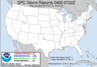
 This same system produced destructive tornadoes yesterday. There were 5 tornado reports, including reports of injuries in Arkansas and Louisiana. Several homes were destroyed. Another big story with this monster storm was the hail. Severe hail fell all over the storm ravaged area with some reports that hail was 2 3/4" in size. Here's what the Storm Prediction Center has to say about today's threat:
DESPITE MODEST CAPE (which is being limited by the overcast skies)...GIVEN INCREASINGLY MOIST LOW-LVL ENVIRONMENT AND DEGREE OF BOTH LOW-LVL AND DEEP SHEAR...SETUP WILL SUPPORT SHORT LINES/CLUSTERS OF STORMS WITH EMBEDDED LEWPS/SUPERCELLS. THESE MAY PRODUCE BOTH TORNADOES AND DMGG WIND GIVEN STRENGTH OF LWR TROPOSPHERIC FLOW AND LARGE LOW-LVL HODOGRAPHS...ESPECIALLY DURING THE AFTN. WHILE THE SVR THREAT MAY DIMINISH THIS EVE...THE THREAT MAY INCREASE AGAIN LATER TONIGHT/EARLY FRI AS THE LLJ REDEVELOPS AHEAD OF APPROACHING UPR IMPULSE.Incidentally, a similar area of severity is mapped out for tomorrow.
 If not for the Dewvoid, I would expect that area of slight risk to expand to my area. We shall see... I could actually chase tomorrow.
Have a safe day!
~Dewdrop


Guess you will be busy sky watching then.
ReplyDeleteHave a great weekend.
We had 2 1/2 inches of rain overnight and this morning in North Florida.
ReplyDeleteI'm in Tallahasse and yes we received your rain.....we do not want any twisters around here. Last year my husband watched one rip off the roof at the school he was working at...all he had was his little job trailer to sit in and pray!
ReplyDeleteBeautiful photo of clouds!Thank you for sharing and have a nice weekend!
ReplyDeleteIt came out of know where...well, so they say..
ReplyDeleteLooks like bad skies over a fairly large area. I guess this is your busy season!
ReplyDeleteI love those huge clouds! We had some of those here in the past few days, too. Terrific shot as always! Hope you have a great weekend!
ReplyDeleteSylvia
This is Scary, Gorgeous!! Great shot!!
ReplyDeleteI like the sepia use in this one, I bet you get a lot of severe weather in Georgia. Thanks for sharing with us Dewdrop:)
ReplyDeleteDewdrop, what a gorgeous photo!
ReplyDeleteits raining here now but at 11.00pm I cant see the clouds we have had either blue cloudless sky or wall to wall cloud this week here in Margate in the UK. XXX Don
ReplyDeleteGreat shot
ReplyDeleteMy Entry Here
Looks like an awesome thunderhead.
ReplyDeleteGorgeous tone of light in those rolling clouds! Great photo!
ReplyDeleteWow wow wow! Amazing and dramatic clouds!
ReplyDeleteAwesome looking cloud photo! We are expected to have a couple inches of rain this weekend. Thank God it is not snow.
ReplyDeleteFantastic cumulus! is it cumulus?
ReplyDeleteI'm learning now:)
I went out of town last weekend. It rained there and cloud seeding only:(.
Still warm around here.
Wishing you a lovely weekend.