 That about sums it up... What a ridiculous day I have had today. It started early. I headed out to the Mini-Dew's school for a program that she said she was in. Yep, she was in it. Her grade had to stand up when it was their turn to sing... sigh. Then, I realized I forgot her clothes for practice today. Coach called it yesterday, and I have too much on my mind to remember stuff like that, so I had to run home and get the clothes. As I am approaching my neighborhood, I see smoke pouring out of the area where it would likely be, and I start to get a little nervous. Fire, big smoke... and it's right up against my neighbors' property line flaming biting at the sky and dancing in the wind amongst these red flag warning conditions... A RED FLAG WARNING MEANS THAT CRITICAL FIRE WEATHER CONDITIONS ARE EITHER OCCURRING NOW...OR WILL SHORTLY. THE COMBINATION OF WIND AND LOW RELATIVE HUMIDITY WILL ENHANCE FIRE GROWTH POTENTIAL. (OK, so what Einstein allowed a burn permit during Red Flad Warning conditions...?) sigh, so I pull up at my house which has a State Prisoner detail bus parked in front of it (in the middle of suburbia) and they all watch me knowing I am driving up to a vacant house. I run inside to call 911 about the fire and retrieve the clothes, making certain to lock the doors behind me. I pick up the phone, and wouldn't you know it, no dial tone... phone company problem, they'll send a technician... so I am wandering frantically around my house, trying to get reception, and LL calls just when I get reception, asking about our lunch date... yes, yes, lunch, no not BBQ, it's Friday during lent... how about pizza... anyway, I tell her I have to call 911 about a fire that is burning by my neighborhood. I call them, tell them... and head out. Insane morning... Hubby talked to the fire chief and as it turns out, it was the Georgia Forestry Division that issued the permit... dummies.
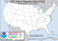
As for weather: ...SOUTHEAST... A BROKEN PRE-FRONTAL SQUALL LINE SUSTAINED BY RELATIVELY STRONG DYNAMIC FORCING FOR ASCENT IS FORECAST TO BE ONGOING EARLY SUNDAY
FROM THE SRN APPALACHIANS SWWD TO THE FL PNHDL. LATEST GUIDANCE INDICATES THAT THIS CONVECTION WILL LIKELY ENCOUNTER ONLY WEAK INSTABILITY ON THE LARGE SCALE AS IT SPREADS EAST ACROSS THE CAROLINAS...GA...AND NRN FL THROUGH THE DAY. STRONG DEEP-LAYER WIND FIELDS ACROSS THE REGION SHOULD SUPPORT FAST-MOVING CONVECTION WITH SOME POSSIBILITY OF WIND DAMAGE IF STORMS CAN COINCIDE WITH GREATER LOCAL DESTABILIZATION. ADDITIONALLY...STEEPENING MID LEVEL LAPSE RATES NEARER STRONGER HEIGHT FALLS MOVING ACROSS THE CAROLINAS COULD SUPPORT MARGINAL HAIL. LACK OF GREATER FORECAST INSTABILITY...AND GENERALLY FADING LARGE SCALE SUPPORT FOR STRONG FRONTAL ASCENT...PRECLUDE THE ISSUANCE OF GREATER SEVERE WEATHER PROBABILITIES AT THIS FORECAST RANGE. Weak and wussy at our end. Is that what I am reading? ... another sigh... THE DYNAMICS FOR ANY STRONG TO SEVERE STORMS WILL LIKELY REMAIN TO OUR NORTH AND WEST FOR THIS EVENT. Regardless, I will continue to watch and wait. They have been wrong before, right?
That's all. I'm out of here.
~Dewdrop
Friday, February 23, 2007
Come on....
Subscribe to:
Post Comments (Atom)


No comments:
Post a Comment
Dew comment, please...