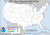
..SOUTHEAST STATES... BEST CHANCES FOR SEVERE STORMS APPEAR TO EXIST FROM MIDDAY THROUGH EARLY EVENING TUESDAY ACROSS MISSISSIPPI/PARTS OF ALABAMA ..POSSIBLY IN GEORGIA. THIS IS WHERE/WHEN LOW-LEVEL MOISTURE RETURN WILL FINALLY BECOME MAXIMIZED...IN PHASE WITH MID-LEVEL COOLING ASSOCIATED WITH LEAD SHORT WAVE TROUGH. CONDITIONAL AND CONVECTIVE DESTABILIZATION ARE EXPECTED TO BECOME FAVORABLE FOR BOTH VIGOROUS UPDRAFTS AND DOWNDRAFTS...IN DEEP LAYER SHEAR MORE THAN SUFFICIENT FOR SUPERCELLS. MODELS SUGGEST THAT THERE MAY BE A TENDENCY FOR LOW-LEVEL HODOGRAPHS TO SHRINK WITH TIME AS LOW-LEVEL FLOW VEERS/WEAKENS DURING THE AFTERNOON. BUT... ISOLATED TORNADOES APPEAR POSSIBLE AT LEAST WITH INITIAL DEVELOPMENT...IN ADDITION TO RISK FOR DAMAGING WINDS/LARGE HAIL. Just a possibly in Georgia note... GULF SYSTEM APPEARS TO BE ROBBING THE SOUTHERN END OF THIS SYSTEM OF SOME MOISTURE AND ENERGY WHICH SHOULD DECREASE THE SEVERE THREAT FROM WHAT IT APPEARED SEVERAL DAYS AGO. We're being robbed!!! Love the wording there. That's the way the cookie crumbles. It's OK. We still have a shot at hail and downbursts. I'll watch it tomorrow.
Tonight will be rough for Louisiana and Southern Florida. Looking like tornado chances through the night. Keep those weather radios in the alert mode, folks. To be forewarned is to be forearmed. Night storms are the worst.
~Dewdrop
Monday, February 12, 2007
Night storms
Subscribe to:
Post Comments (Atom)


No comments:
Post a Comment
Dew comment, please...