 Great googaly moogaly... how many floral pictures do I have? I think this is the last one I'll post for a while. I know you'll miss them, right? lol
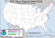
 The SPC still gives text for tomorrow, but they are offering a good shot at thunderstorms for us today. Last night was a doozy offering incredibly frequent CG (everyone was chattering about it this AM). I can't believe I wasn't able to get an isolated bolt. We are looking at a day very similar to yesterday, still dealing with the horrific, suffocating heat, and it looks like there is potential for some more strong to severe weather (which hopefully, I'll be able to get into a better position than the front steps to capture some of the phenomenal lightning that I am confident we will see)...
EVEN THOUGH THE RAIN CHANCES WILL BE ON THE SOMEWHAT LOW SIDE AT 30 PERCENT... THE ATMOSPHERE WILL BE QUITE UNSTABLE ONCE AGAIN THIS AFTERNOON AND ANY THUNDERSTORMS WHICH DO DEVELOP COULD BE STRONG TO SEVERE WITH DAMAGING WINDS... LARGE HAIL... FREQUENT LIGHTNING... AND TORRENTIAL DOWNPOURS...I am absolutely tripping over Irv's AFD this morning...
JUICY DEWPOINTS ALSO CONTINUE THIS MORNING ACROSS THE SOUTHEAST U.S. THE DEWPOINT PRIZE IN THE REGION GOES TO AAF AND VDI WITH 79F... WE CONTINUE TO HAVE GPS DROPOUTS IN THE SOUNDING CAUSING MISSING WINDS BELOW 10,000FT... VERY AGGRAVATING!This is my first recollection of reading Irv's AFD, but he makes me laugh! Juicy dewpoints and a dewpoint prize, lol. An update was offered too:
WE ARE EXPECTING A REPEAT OF YESTERDAY. ADJUSTING THE MORNING SOUNDING WITH SURFACE TEMP/DWPT OF 98/76 YIELDS A CAPE OF AROUND 5000 J/KG. 06Z WORKSTATION WRF IS THROUGH 00Z...IS SHOWING CONVECTION BEING LIMITED TO THE FLORIDA BIG BEND...NORTHEAST FLORIDA AND EXTREME SOUTH CENTRAL GEORGIA...Yes, you read the CAPE correctly!!! Holy guacamole! Extreme South Central Georgia happens to be me, also. Wahoo! I have a good chance at lightning this time. Better not blow it... Looks like a good shot Saturday though if I miss my big chance.
 An area of interest just south of Jamaica in the Caribbean Sea has potential for some development, but this morning, it looked to me like it was losing some of its convection. Another wait and see situation. It should be a somewhat favorable environment for development, and they are referring to it as a "well defined upper low". I did hear this morning that one of the forecasting bodies lowered the forecast by one hurricane... so they are still thinking something is going to boom. Got a long way to go to meet that forecast.
Happy Friday!
~Dewdrop


Not another flower pic!!(banging head on desk)....;-P
ReplyDeleteLooks like i will throw the old camera bag in the truck this afternoon. I am currently waiting for them to start harvesting corn. Should be on the road after lunch. Ahhh, chasing from an 18 wheeler!
All right, all right, I know I overdid the flowers, but I like them... so there!
ReplyDeleteHave fun and be safe driving.
y'all get some cool lightning pics, ya here!
ReplyDeleteI sure hope so... With my determination, it'll eventually happen.
ReplyDeleteyeah...she will get struck...(sly grin)...Be careful Dew!
ReplyDeleteYou know I will. I'm always careful... except when mowing. lol
ReplyDeleteI'll be expecting some good lightning pics....remember to use the tripod!
ReplyDeleteLet's not forget the Dewvoid... I might very well, get nothing!!! Of course, I will use a tripod though! It's the only way to shoot lightning.
ReplyDeleteHey...Check this out from james Spann...
ReplyDelete"AND…. The 12Z GFS develops a tropical system over the far Southeast Gulf of Mexico around August 21, and it takes it into the New Orleans area as a major hurricane on August 23. But, lets all say it together, this is pure voodoo. The 00Z run had the system well east of the U.S. Atlantic coast, about 800 miles east of the position on the 12Z run. But, the screaming message is that it sure looks like the tropics are about to come alive in coming weeks. Hang on for an interesting ride."
Well, that would certainly test what they have learned. What an awful scenario, though!
ReplyDeleteAlready caught an awesome shelf cloud today...chase #2 later! Check my blog for 1 of what will be many pics and some awesome video!
ReplyDeleteSCM
Way to go, Mikey! That rocks! I' will definitely check it out!
ReplyDeleteGood luck dew!! Catch some for me o.k.
ReplyDeleteThe Dewvoid strikes again...
ReplyDeletetoo bad
ReplyDeleteAhh, bad last night was an entirely different story!
ReplyDelete