 Good grief. She couldn't even form as a real storm... She bearing down on the Carolinas now, carrying with her winds of 45mph, a generally weak and wussy storm. She awfully top heavy, so North Carolina should feel her rain and wind well before she arrives there... looks like just a rain event with some tropical storm force winds thrown in for good measure. She was doing better when she was fighting the shear, imo. She is expected to strengthen, however, as she gains more tropical characteristics. I will continue to watch her this morning and afternoon around my cleaning.
 Aside from Subtropical Storm Gabrielle, we have a Cape Verde wave that looks to have some strong convection associated with it. That's where Dean came from, so I'll keep an eye to that one for any signs of development, which is possible in the coming days. Let's hope Central America and the Yucatan Peninsula don't still have a target on their heads. I heard yesterday that there were at least 100 deaths associated with Felix, but that they were still searching and thought that number might rise, that with a compact storm.
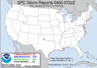
As for our local weather... according to the HWO:
NO HAZARDOUS WEATHER IS EXPECTED TODAY.Still, things are expected to moisten on Monday, and we should see some storms through the end of the work week. Perhaps, on Tuesday, I will be able to get out and shoot something. Time will tell.
Well, off to clean... Have a lovely day.
 5:00 UPDATE: We now have Tropical Storm Gabrielle. Gabby is still top heavy with her convection. She is expected to intensify before making landfall on the North Carolina coast. Her winds are now only at 40mph...
Toodles,
~Dewdrop


Gabrielle looks terrible! Her window of opportunity for strengthening before reaching the NC is closing fast. She was more vertically stacked last night than she is now. Low-level center moving more off the NNE attm. Defiantly not strengthening this afternoon.
ReplyDeleteThe eastern Atlantic looks more interesting today than Gabby. Might have to monitor the Gulf of Mexico too over the next few days.
Enjoy your cleaning! :)
I agree with everything you have said, Jeff, except for the fact that you used enjoy and cleaning in the same sentence... lol
ReplyDeleteLOL
ReplyDeleteOver the last several hours, the low-level exposed surface center has been pulled and/or tucked in more under the bursts of convection on the north-northwestern quadrant of the storm. This is a sign that possible strengthening could resume later tonight. Outflow looks to have improved as well with some expanding out the upper canopy. Will be interesting to watch overnight.
ReplyDeleteCool. Thanks for the update, Jeff.
ReplyDelete