 I hope everyone had a wonderful weekend, celebrating love and relationship on Valentine's Day. My wonderful gtb and I had plans that were sadly rained out... but we opted for a "rain check" on Valentine's Day, so we're going to have the whole day to ourselves, well outside of work and CPR training that I have that morning. lol. We did get to enjoy some romantic dancing in the misty rain. If you haven't ever done it, I highly recommend it! It was particularly cool with the birds (nightingales???) and crickets chirping, the neighbor's sprinkler going (yes, in the rain... no wonder my community well always runs dry), beautiful rain dance music. I have so much fun with that man. You never know, our Mulligan Valentine's Day might offer a real storm set-up (unlike the yucky, persistent, dreary rain we had) and give us quite a memorable date chasetunity! It could happen... (The picture above is from June during double rainbow experience from the rooftop of our hotel in Milwaukee, WI. It seems like a good one to share here.)
 Aside from that, we did do some exciting craftsman type work together yesterday. Aren't we just so cute?! My wonderful gtb is pretty big on safety, which is a good thing.
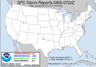
The big WEATHER story I guess right now... besides our once again approaching freezing temps, which is just annoying anymore... is the fact that I just got a mesoscale discussion for the potential for severe weather, including tornadoes!!! in southern California. They are under a slight risk!!! I'm wondering now if it's been staged by the crew of TWC's "It Could Happen Tomorrow" for the sake of weather material. I have never seen it look like that!!! Check out the wording...
 AREAS AFFECTED...WRN PARTS OF THE LOS ANGELES BASIN SWD ALONG THE COAST TO NEAR OR N OF SAN
Hot on the heels of that one is a discussion for heavy snow just to their north.
CONCERNING...SEVERE POTENTIAL...
THE POTENTIAL FOR ISOLATED SEVERE STORMS CAPABLE OF SOME HAIL...GUSTY WINDS AND PERHAPS A BRIEF TORNADO APPEARS TO BE INCREASING ACROSS THE DISCUSSION AREA.AREAS AFFECTED...SIERRA NEVADA MOUNTAINS
Southern California...?! What?! For some reason, this just makes my SDS worse.
CONCERNING...HEAVY SNOW
OROGRAPHICALLY ENHANCED ASCENT WILL FAVOR SNOWFALL RATES OF 2-3 IN/HR ALONG THE WRN SLOPES OF THE SIERRA NEVADA MOUNTAINS THIS AFTERNOON.
Have a lovely day!
~Dewdrop
Monday, February 16, 2009
A chance for Tornadoes in Los Angeles?!
Labels:
Severe weather in Los Angeles
Subscribe to:
Post Comments (Atom)


Dew, we all know it never rains in SoCal. ;) What gives!
ReplyDeleteLove the safety glasses and hearing protection! They other week I was walking from plant to plant on a job site and I had my hands in my pocket. That's a no-no when there is ice on the walkways apparently. I got busted. :)
Keep it safe!