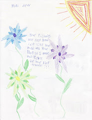
Well, the heavens opened up last night in a spectacular light show that I wasn't able to partake in because Mini-Dew has started back to school, and I got to listen to her explain scientific processes instead. Yee-haw. 
 As we watch, the future Ana traipse across the Atlantic, still just Tropical Depression 2, yet destined for Tropical Storm-ness (to the point where the mets on TWC are referring to it as Ana... oops), we note another (much larger) area of disturbed weather popping off the African coast. Sure, right now, it doesn't seem like much, but I watched the GFS model turn it into a hurricane and bring it up the coast. In fact, it almost looks like the GFS has Africa lining them up for us, but the one in question shows a minimal hurricane off the coast of North Carolina, by Sunday August 23rd...
 ... models are just models. I am not saying this will happen, but it looks like the tropics have indeed awakened, and they are ready to go!!!
The other day, I was coming back from lunch with my wonderful groom, when, out of the corner of my eye, I noticed this beautiful brilliant orange color from the garden by the picnic area behind my office. Well, of course, me being me, I had no choice but to grab my camera and investigate. Sure enough, when I got back there, I discovered this...
When I spoke about the Bacon Party! the other day, I mentioned that my wonderful groom and I won the Best Presentation, and we were awarded the ceramic Big (my wonderful groom pointed out the typo in my post about the bacon party) PIG prize. Well, in case you have been holding your breath... We're so silly... I love it!
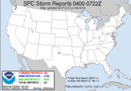
1:30 update:  The slight risk area has been expanded to include my neck of the woods, and a Mesoscale Discussion was just issued to cover the potential for severe weather here... watch unlikely...
AN ISOLATED SEVERE THREAT SHOULD DEVELOP/INCREASE THROUGH MID AFTERNOON ACROSS PORTIONS OF SOUTHERN GA/FAR NORTHERN FL. AMPLE INSOLATION HAS CONTRIBUTED TO A WELL-HEATED /LOWER 90S F/ AND WEAKLY CAPPED AIRMASS. MODIFIED 12Z OBSERVED RAOBS FROM TALLAHASSEE/JACKSONVILLE ARE SUGGESTIVE OF AS MUCH AS 2500-3500 J/KG OF MLCAPE!!!! (they didn't include the exclamation points, I did!) ISOLATED/PULSE-TYPE DAMAGING WIND/PERHAPS MARGINAL HAIL THREAT WILL EXIST THIS AFTERNOON
Weather radios on!!!
Have a splenderifous day... (I will hereby be getting my adjectives from moshi monsters...)
~Dewdrop
Wednesday, August 12, 2009
A little bit of this, and a whole lotta that
Subscribe to:
Post Comments (Atom)


Love the Anvil and the flower!
ReplyDeleteGorgeous flower, and I'm totally envious of your gorgeous thunderclouds! Wonderful photos!
ReplyDeleteMMM... Bacon!
ReplyDelete