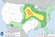
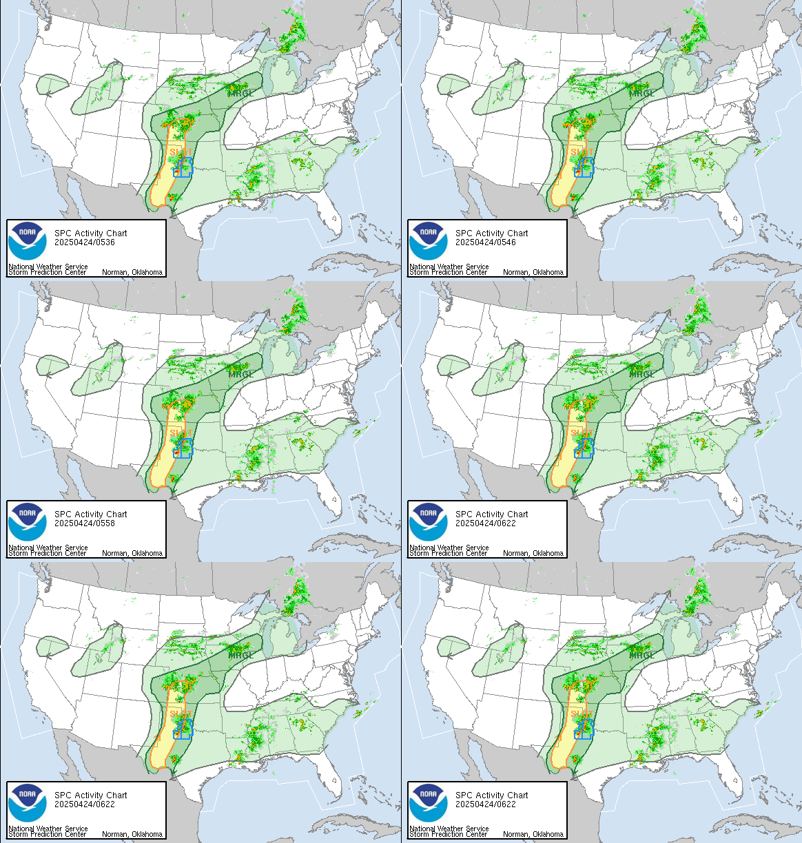
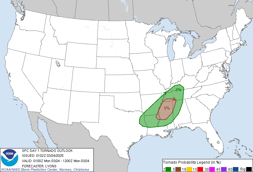
My, how quickly things change around here. The hatched moderate risk area has greatly expanded since last night's outlook, and apparently, the probability of tornadic activity has gone down. I have been told by Alabama Mike (who has gone south to chase this "beast" as TWC is calling it), "You HAVE to chase now. MOD risk there!!!!" Well, we shall see. I am thinking night. I am thinking explosive. Night and explosive is not my favorite combination.


Who's chasing?
1. Alabama Mike - central Alabama
2. Rick Lipscomb - southwest Georgia
3. Meso Mike - south central Georgia
4. Jim Edds - FL panhandle/Alabama
Who might be chasing?
1. Dew - south central Georgia
2. Jeff Gammons - north Florida I expect that by the time the storm reaches my neck of the woods, it'll be solidly lined out with bowing line segments producing damaging winds and perhaps some large hail (large hail would be a first for me). Unfortunately, I can't just leave today and go after the most tornado prone area today, as I have to manage my time off closely right now and then, there's Mini-Dew, since her dad will be busy chasing stars shooting a zombie movie (seriously)... though the weather might put that on hold. I might just have to settle with the hail and wind leftovers tonight. Wouldn't it be cool if my weather radio went off in the middle of spotter training tonight... sorry guys... gotta split. Gotta put my training to good use. What? It could happen...
This is what Mike is going after. Birmingham hardly ever forecasts tornadoes in their hazardous weather outlook products. SEVERE THUNDERSTORMS ARE EXPECTED TO DEVELOP TODAY... FROM NOON UNTIL 10 PM AHEAD OF AN APPROACHING COLD FRONT. ISOLATED SUPERCELLS WITH LARGE HAIL... DAMAGING WINDS...AND TORNADOES ARE EXPECTED TO DEVELOP ACROSS MUCH CENTRAL ALABAMA... ROUGHLY ALONG AND SOUTH OF INTERSTATE 20...FROM NOON UNTIL 6 PM. AFTER 6 PM...THUNDERSTORMS WITH DAMAGING WINDS AND HAIL ARE LIKELY IMMEDIATELY AHEAD OF THE COLD FRONT AS IT CONTINUES TO PUSH SOUTHEAST.
11AM (my time): A misplaced TVS makes an appearance in Mississippi near Forest. Alabama Mike is headed sw on I-59/20.  Finally a Public Severe Weather Outlook has been issued.
 12:15EST: MD120 for Mike's area...
THE POTENTIAL FOR SEVERE STORMS CAPABLE OF LARGE HAIL...DAMAGING WINDS AND PERHAPS A FEW TORNADOES IS EXPECTED TO INCREASE THIS AFTERNOON. CONVECTIVE TRENDS ARE BEING MONITORED FOR A POSSIBLE WW. LATEST TRENDS IN VISIBLE SATELLITE IMAGERY INDICATE DEEPENING CUMULUS BANDS.
ONCE STORMS DEVELOP AND BECOME SUSTAINED...THE PRESENCE OF 60-70 KT DEEP LAYER SHEAR AND LONG...STRAIGHT HODOGRAPHS WILL SUPPORT SUPERCELL DEVELOPMENT /SOME SPLITTING/ WITH THE THREAT FOR DAMAGING WINDS...LARGE HAIL AND PERHAPS A FEW TORNADOES.
vivisble... 12:45PM EST: Be safe!
~Dewdrop
Wednesday, February 18, 2009
Moderate risk for severe weather close to home


Friday, February 22, 2008
How will the Dewvoid interact with the severe weather risk in South Georgia... ?
 Well, if nothing else, the system that rolled through yesterday made valliant attempt at being labeled a drought buster. In less than 24 hours, my part of South Georgia saw 3.26" of rain (btw, you should consider volunteering for CoCoRaHS in your state if you haven't already.) I emptied my rain gauge early last night in case the rain kept coming, since it will only hold so much. We are actually under a flood warning as the river that I have shot relatively recently (I will post a pic here) is quickly approaching flood stage.
 Now, I am looking at a thick fog that seems to have settled in and a solid stratus deck that will most likely destroy the severe weather threat here if it sticks around. Today is the day, though. The Storm Prediction Center has continued to place me smack dab in the middle of a slight risk area for severe weather... looks like a rock solid chasetunity to me, another test of the ever-present Dewvoid.

THERE IS A SLGT RISK OF SVR TSTMS SE LA TO S GA TODAY... THE WARM SECTOR CONVECTION... CONSISTING OF SMALL SCALE BOWS OR SPLITTING SUPERCELLS... WILL POSE A THREAT FOR DAMAGING WINDS AND LARGE HAIL. HOWEVER... LOW-LEVEL SHEAR AND ANY ATTENDANT TORNADO THREAT WILL BE RELATIVELY LARGER ALONG THE WARM FRONT BY EARLY AFTERNOON ACROSS SE AL AND GA.
"Tornado threat relatively larger along the warm front across SE Alabama and GA". 

Looks like a "SKYWARN spotters ACTIVATE!" day. The guys have put the timing here as late afternoon into the overnight hours. Hopefully, Meso Mike will be off and up to chasing at that time. I will be available after 5. :O) Rick has ended up going into work today, but may not have to stay, so he MIGHT become available for storm chasing this afternoon, and Alabama Mike has offered data support. They are all members of the Southern Weather Brigade. Just a bunch of CWGs.
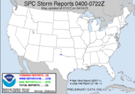
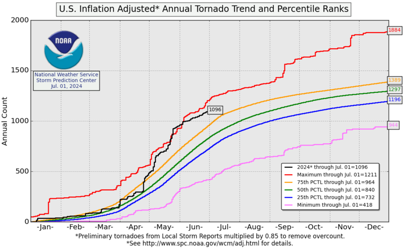
There were 5 tornado reports in Louisiana during yesterday's weather event, which should seem like a lot, but I think that the outrageous amount of tornadic activity so far this year has somehow made 5 possible tornadoes seem almost... insignificant... less than newsworthy...? It certainly isn't insignificant to the people that were affected by them... This has been an exceptional year for tornadoes.  Steve Miller in Oklahoma, included this frightening graphic in his blog the other day. For the sake of potential victims, all we can do is pray that this trend doesn't hold through the year. Rough proportional comparison would place the tally at year end near about 5,000 tornadoes (completely over-exaggerated and highly unlikely, but even 3,000...)! It's INCONCEIVABLE! With the "peak season" still yet to come... it could be a catastrophic year. Let's pray not.
I took this pic the day before yesterday and thought I would share it with the message that today is definitely the day to keep your eyes to the sky, with the weather radios in the "on" position.
 I just got a pic from bf, who is currently at the beach in Biloxi, MS, and he sent me this pic of the sign at "Hope City", where people are still "camping" after Hurricane Katrina. Thanks for sharing that (and the lovely sand art not pictured here), bf!
TGIF!!!
~Dewdrop
Wednesday, February 06, 2008
Deadly tornadoes in Arkansas, Tennessee, and Kentucky leave a wake of Destruction

 Today, a large part of the eastern CONUS (Continental US) has been placed under a slight risk for severe weather by the SPC (Storm Prediction Center). I must give kudos to the SPC; yesterday, they placed the area struck the hardest under a high risk for severe weather, and they were strikingly accurate in their forecast for this intensely dangerous weather event. Today's slight risk has already produced tornado reports in Alabama and several tornado warnings have been issued this morning in eastern Alabama and northwest Georgia. I heard from Rick that Alabama Mike had a tornado within miles of his home, and Rick was able to offer some data support for Mike. I have not spoken with Mike yet to get his first-hand account of the events that transpired this morning, but I am awaiting that update. The SPC has a discussion about the outlook for today...
MODEST INSTABILITY /MLCAPES OF 500-1000 J PER KG/ AND FORCING ALONG COLD FRONT SHOULD MAINTAIN A LINE OR CLUSTERS OF STORMS THROUGH THE MUCH OF THE DAY. THE PRESENCE OF 50-60 KT OF DEEP LAYER SHEAR SHOULD SUPPORT A CONTINUED THREAT OF SUPERCELLS AND BOWING STRUCTURES WITHIN LARGER CONVECTIVE BAND. ISOLATED TORNADOES WILL BE POSSIBLE ALONG WITH THE POTENTIAL FOR ISOLATED DAMAGING WINDS. THE TORNADO THREAT APPEARS HIGHEST THIS MORNING INTO EARLY AFTERNOON.
The most intense part of the remaining storm appears to be targeting the area further north of here, where it is likely that the outlook will be upgraded to a moderate risk for severe weather as the day continues... and there appears to be some question regarding the storm's life... HOWEVER...IT REMAINS QUESTIONABLE WHETHER ONGOING...PRE-FRONTAL LINE OF STORMS WILL CONTINUE TRANSLATING EWD OR IF STORMS WILL DIMINISH ACROSS THE CENTRAL APPALACHIANS AND ALLOW COLD FRONT TO FOCUS DEVELOPMENT LATER TODAY AND EARLY THIS EVENING.
This bit that they are referencing is more commonly known as "the Dewvoid". As a storm chaser, I have had more storms dissolve prior to getting to me than I can even mention.  In all seriousness though, this is a messy, destructive and deadly system. I don't wish this storm anywhere near any populated areas, so if the Dewvoid will save lives, I am all for it.... granted, if it holds together and makes it to my neck of the woods, I am on it. ;O) This is a look at what lies ahead for my neck of the woods. Stay tuned...
For some excellent coverage of the events of this horrific tornado outbreak, check out these sites...
Steve Miller - out of Oklahoma
Tony Laubach - out of Colorado
Jeff Gammons - out of Florida
David Drummond - out of Texas
Mike Wilhelm - out of Alabama
Chris Collura - out of Florida but temporarily in Chicago (he was in it, but he hasn't updated yet)
Michael Detwiler - out of Tennessee
This in from a blog visitor... Megan said...
If anyone has information about Angue, please get in touch with me, so I can pass the word along to Megan.
My sister in law was working at the hospital at the time of the tornado. My brother and their kids were at home and are fine, but no one in my family has heard from my sister n law. Her name is Angula McDonald. If anyone has any information about the hospital or other areas of Mtn. View, please post them here and I will check back frequently. My brother tried to get to the hospital last night, but he couldn't get past the security to make sure that Angue was okay.Donna said...
Ditto, with Sue Parracino, so I can let Donna know. Y'all might check with emergency management in those areas.
Hi my breeder of my dog lives in Mountain View her name is Sue Parracino does anyone know if she is OK. Thank you Donna 1:30 PM Update: I will be leaving shortly for a Doctor's appointment... here is a current radar snapshot of what's coming my way, just a solid squall line event, no really isolated cells worthy of storm chasing at this point. The NWS (National Weather Service) in Tallahassee issued a Special Weather Statement for the counties to my west, as a cell over that way has pulsed and bowed slightly... but otherwise, still just watching and waiting.
7:10 update: Of course, the "Dewvoid" prevails. The system fell apart, and there wasn't even one strike of lightning for me to capture... got a few drops of rain, but that is all. It seriously fell apart...
I got this comment from an anonymous reader: anonymous said...
So, feel free to check that out, and thanks a bunch to the anonymous reader for the update about Mountain View.
My mom lives in MV and she finally called me an hour or so ago. The hospital was hit, but all people from there are safe. The Chevy dealership was hit and some homes, but mostly the tornado went through open fields. She said only one lady died in MV. I guess they know no one else is dead because they have checked all damaged places. However, the power system was also hit, for the whole town. So no one has power at all and probably for a few days.
I've tried to find more info online, but it's hard. I did find a couple pictures of damage on Highway 5 at Arkansas Matters site
or just go to their homepage and scroll to the "Sever Weather Photos" and you can see more.
God be with all those affected or about to be affected.
~Dewdrop