 Sky Watch Friday post time!!! (Please visit Tom's blog to participate.) Today, I have chosen my solar halo shot to post. It is my first and only time witnessing a solar halo first hand. I had seen photographs of solar halos taken by others but had never personally caught one. I saw this one on the way to work one morning.
A halo (also known as the 22° Halo, nimbus, icebow or Gloriole) is an optical phenomenon that appears near or around the Sun or Moon. There are many types of optical halos, but they are mostly caused by ice crystals in cold cirrus clouds located high (3–6 miles) in the upper troposphere. The particular shape and orientation of the crystals is responsible for the type of halo observed. Light is reflected and refracted by the ice crystals and may split up into colors because of dispersion, similarly to the rainbow. Source.
On this specific solar halo, there were sun dogs on either side. I see sun dogs all the time, and I love them! Here is a photograph of my favorite sun dog shot.
22º radius halos are visible all over the world and throughout the year. Look out for them whenever the sky is wisped or hazed with thin cirrus clouds. These clouds are cold and contain ice crystals in even the hottest climates. The halo is always the same diameter regardless of its position in the sky. Sometimes only parts of the complete circle are visible.
When looking for halos ALWAYS shield both eyes from the sun. Never stare close to it even for a moment. Preferably, hide the sun behind the edge of a building or post. Take care when photographing halos if the unshielded sun is in the field of view. It is dangerous to look at the sun through some camera viewfinders, especially SLRs - do not take risks! Source.
A sun dog or sundog (scientific name parhelion, plural parhelia, for "beside the sun") is a common bright circular spot on a solar halo. It is an atmospheric optical phenomenon primarily associated with the reflection or refraction of sunlight by small ice crystals making up cirrus or cirrostratus clouds. Often, two sun dogs can be seen (one on each side of the sun) simultaneously. Source.
Now, let me touch on this horrific situation in Myanmar, just to offer an update. I can't imagine... I just can't imagine. Those innocent people, victims of a militaristic regime, which places absolutely no value on human life. They must not realize that their actions will wipe out their population... after this, they won't have anyone left to torture or hold captive. The much needed aid that the UN sent over was confiscated by the junta, forcing the UN to stop the aid, and now there are a million or so folks in desperate need of safe food and water. Not to mention, they are living among rotting carcasses. Horrendous. Here is an article if you are interested.
Onto yesterday's severe weather outbreak. I am struck by the one two three... four punch being offered up for the southern states by Ma Nature. Check this out...
Thursday's Outlook: Friday's Outlook:
 Saturday's Outlook (now with a moderate risk for severe weather):
 ... and Sunday's Outlook (happy Mother's Day to me!!! A chasetunity!):
IF CONVECTIVE CONTAMINATION DOES NOT OCCUR FROM DAY2 ACTIVITY...A POTENTIALLY SIGNIFICANT SEVERE EVENT COULD OCCUR ACROSS THE OUTLOOK REGION AS PROFILES FAVOR VERY FAST MOVING SUPERCELL STRUCTURES. AN UPGRADE MAY BE REQUIRED IN LATER OUTLOOKS IF MODEL DATA CONTINUES TO SUPPORT THIS EVOLUTION.
With the limited visibility yesterday, which prevented Alabama Mike from seeing anything, he sure has been given a few do-overs. Btw, he posted a youtube video that he found of the Leighton, AL tornado that passed through a parking lot tossing cars around like pieces of scrap paper. Check it out.
Now, as for yesterday's weather, there were a total of 21 tornado reports, with one tornado in NC resulting in a fatality and some injuries. 
Some reports are available for yesterday's tornadoes:
1. Storm Survey Report for northeast MS (click here), done by the
Memphis, TN - NWS office
Photographs and Local Storm Reports yesterday
2. Storm survey report for north Alabama, done by the
Huntsville, AL - NWS office
3. Nashville, TN - NWS office (no report yet)
Local Storm Reports
4. Storm survey report for western Kansas done by the
Goodland, KS - NWS office
5. Wilmington, OH - NWS office (no report yet)
6. Raleigh, NC - NWS office (no report yet) (this is the area that had a fatality reported)
Stay tuned.
Toodles,
~Dewdrop
Friday, May 09, 2008
Solar halo and sun dogs and TORNADOES... oh my...


Thursday, July 10, 2008
Another round for Hurricane Bertha, truly the come-back kid!
Happy Sky Watch Friday!! It's post time!!! (Please visit our host, Tom's blog to participate in Sky Watch Fridays. So much fun!!! I highly recommend it!) This picture was taken in metro Atlanta, around Thanksgiving of 2006. This was a beautiful sunset that produced my first ever sundogs.
 ("A sun dog or sundog (scientific name parhelion, plural parhelia, for "beside the sun") is a common bright circular spot on a solar halo. It is an atmospheric optical phenomenon primarily associated with the reflection or refraction of sunlight by small ice crystals making up cirrus or cirrostratus clouds. Often, two sun dogs can be seen (one on each side of the sun) simultaneously.")
Here is a photograph of the sun dog from that day (basically a rainbow formed in the ice crystals in cirrus clouds)...  I loved the contrails.
 ("Contrails or vapour trails are condensation trails and Artificial clouds made by the exhaust of aircraft engines or wingtip vortices which precipitate a stream of tiny ice crystals in moist, frigid upper air. However, vapour trails or contrails generated by engine exhaust are inevitably linked with typical fuel combustion pollutants.")
I loved the way the sky lit up with a golden color... (Why are sunsets sometimes golden in color???? Far on the horizon, to the West, it is daylight. The distant clouds and dust create a diffuse white glow (Mie scattering) with all wavelengths of light. As the daylight travels east toward your eye, the blue hues are scattered toward to ground (Rayleigh scattering). Sun rays have to traverse long distances through the dense parts of the atmosphere until they reach the eye of the observer with the sun close to or even below the horizon. The traversed layer of the atmosphere is more than 30 times longer compared to the sun standing directly above the observer.The violets and blues are lost (they make the sky blue to the West of you). The light you see is missing the violets and blues... leaving you with various shades of yellows and reds.")~source
... and silhouetted the house. Well, I was just studying the track of category 2 (expected to increase to category 3 soon) Hurricane Bertha. Looks like during the last couple of captures, she took more of a western track than the northwestern track she had been on. Many more westerward jumps like that could largely impact her interaction with Bermuda. The current forecast puts Hurricane Bertha to the east of Bermuda, but her westward movement during the last hour might change that. As it stands, she is a beautiful category 2 hurricane, with better looking symmetry as she works out some of the dry air that worked at her southern portion yesterday.
1100 PM AST WED JUL 09 2008
Another round at category 3 is potentially in her future... crazy storm.
...BERTHA EXPECTED TO MOVE MORE SLOWLY BUT COULD REGAIN MAJOR HURRICANE STATUS...
An update: 3:15PM Looking pretty-ful... again. Update 7/11 Hurricane Bertha still a category 1 hurricane... 12:45 pic...
 Looks like she's taking aim at Bermuda to me... What the heck is Bermuda doing out in the middle of the ocean anyhow?!
Have a lovely day!
~Dewdrop
Wednesday, January 30, 2008
Windy day... sun dogs.... chasing the sun
Well, my suspicions were accurate... no weather for me. I got a decent rain last night, I think (still no operational rain gauge... I need to remember to get that fixed before CoCoRaHS starts up in Georgia). The ground was wet, but I did not awaken to any thunderous claps in the night (not that I am an easy one to awaken). It was fun to watch the temperature fall this morning. It dropped 9 degrees during the hour that I watched TWC this morning. 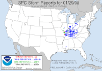
 Since Ma Nature hasn't given me any weather to chase, I have taken to chasing the sun, once again. It's nice when it sets a little bit later, so I have time to get to a good viewing point, and when it's not so late that I am busy with Mini-Dew when it happens. My location for shooting sunsets is constantly changing because of development in the area. My beautiful views are being overtaken by "growth". As it is, my current view has an eye sore of a billboard smack dab in the middle of it. I might have to seek out some western views this weekend. At my current location, I have truck drivers looking at me like I am a fool. Maybe, I am... I was able, once again, to see sun dogs, not as impressive as some others I have been able to see, but I did get to see the faint sun dog on the other side this time, and I had a nice display of colors in the remnant of a contrail. You might have to click on the image and view it larger in order to see it well.
 Of course, I have to give kudos to Mike Hollingshead, who has shot the best sun dog with halo, I have ever seen (It's at almost the bottom of the page of several other pics that are equally impressive and awesome). I don't know how he does it, but I wish I had the talent for it, like he does... maybe it's another matter of my geographic misplacement. Great work, Mike. I love sun dogs.
 Then, there is this morning. I mentioned that there was a nice rain last night... well, that cleared up, leaving cool air and wind, and a beautifully magnificent field of altocumulus clouds, covering the sky like a warm cottony blanket.
  For some reason, altocumulus clouds remind me of my favorite clouds, mammatus, so I always photograph them, when I see them. The fluffy white altocumulus against the crisp blue sky was a nice contrast. Of course, I was sitting at the stop sign in my neighborhood shooting pics out my window, when a neighbor drove by sharing the all too common "What-on-Earth-are-you-doing?! look" that I have come to know and love. I responded with a big cheeser grin. Do people not see the same sky I see? How can they not stop to appreciate it once in a while? God's canvas. Too magnificent of an art display to miss out, imo.
As for weather... well, it looks like tomorrow is forecast to be a big day, well to my west, and then an encore presentation, well to my east. Here I sit, in the middle basking in the nothingness of the Dewvoid... seriously, the slight risk covers everything far west of here, then things picks back up on the Georgia coast. Nothing I can Dew about it. ...CSTL CAROLINAS/GA... A LWR SVR PROBABILITY AREA WILL LIKELY EVOLVE ALONG THE CSTL PLAINS OF SERN GA NEWD INTO ERN NC THU NIGHT. ISOLD TORNADOES COULD ACCOMPANY THE STRONGER STORMS BEFORE THEY BECOME ELEVATED.
It's laughable how the weather seems to go around me... Trust me, if I chase it, it will vanish.
Have a great day!
~Dewdrop
Thursday, January 15, 2009
Just chillin'
 It was so good to be back last week for Sky Watch Friday, but I guess I was way out of practice because I totally botched my link on Mr. Linky! UGH! I couldn't figure out what was going on until I clicked on what I had done... I linked to the SWF site!!!! 2nd listing, and so few visits... sigh. Thanks to those of you who found me anyhow, and a humongous thank you to Klaus, who saved the day by fixing the link! Please visit Klaus, Sandy, Ivar, Wren, Louise and Fishing Guy's SKY WATCH BLOG to participate in Sky Watch Fridays, which is WELL WORTH YOUR WHILE!! Thanks to Dot, the mother of this fabulous blogging event, and to the "retired" Tom (appreciated the visit!), who brought it to full bloom. I, personally, love visiting the skies all over the world!!! You should definitely come fly with us! I have decided to post this morning's sky as I was leaving my neighborhood this morning, headed for work.
 .JPG)
Anyways, with all that said, the main story today in the US, remains the Arctic blast of cold air sweeping across the nation, which was pushed in by the parade of Alberta clippers, bringing in the coldest temperatures some of these areas have seen in over 10 years, some more years than that! High temperatures capping out in the NEGATIVES! Then, you pile on the wind and you get wind chills nearing -50°F in some places!!! School and business closures have helped protect folks from the very real danger of going out into such weather. Several deaths have already been attributed to the harsh cold, and many warm shelters have opened up to give folks a place to go to be safe from the deathly cold temperatures. A new threat develops with a deep freeze such as this... the ground freezes to about 5 and 6 feet deep, which puts underground pipes in danger of rupture, so people are without water. This is an amazing cold weather outbreak. It's so intense, that 20 of the 50 states are under wind chill advisories. Many of the northern states are forecast to have s#@w; some are expected to get about 1 1/16" of s#@w, which should not be confused with the 13" of s#@w that other areas are dealing with. My neck of the woods is still expected to remain s#@wless... WHEW!

I know it seems less impressive to talk about south Georgia and parts of Florida, which are just dipping into freezing temps (we actually are under a hard freeze warning), but our part of the country is about as equipped to deal with extreme cold as the far north is prepared for extremely high temperatures. This morning, our thermometers dove below 32°F, but we have yet to see the worst of it. We are heading into the TEENS, in the wind chill forecast for the early morning and as an actual forecasted low of 18°F for Friday night! UGH!  Can you say: DEWDROPCICLE!!!?
All of you United States based Sky watchers need to bundle up, stay indoors, dress in MANY layers if you MUST go out, and enjoy the warmth of your sky watching via SWF... here's a little ray of sunshine to help warm you up... Warm blessings,
~Dewdrop
Tuesday, September 30, 2008
The Quest Continues...
 Well, Subtropical Storm Laura is persisting in making her way into the north Atlantic Ocean. She was trying all day yesterday to go tropical, but it is doubtful that she will become tropical in the cold environment she has now entered. Looks like she will only amount to a sub-storm, and most likely, she will soon be forgotten as the nothing storm. With much of the country still struggling to overcome all sorts of storms (not just those occurring in nature), Laura, the subtropical fish, offers us a collective sigh of relief.
Yesterday, I had the wonderful pleasure of seeing a sun dog as I was leaving the office. It was a brilliant one initially but quickly faded into nothingness as the sun dipped lower into the horizon, and I watched as it slowly drifted away.
 The coolest part, in my opinion, was that you could almost make out the faint halo in the area just below the sun dog. Sun dogs are amazingly beautiful, and I am always amazed to see them, but I was really amazed when I saw my first (and only... so far) complete solar halo, which wasn't yesterday. It was AMAZING.
 Speaking of amazing natural occurrences, my wonderful gtb, my fabulous bf (that's the same person, in case you were confused) and I are planning a trip this weekend to visit 8, well, 9 waterfalls in north Georgia for consideration as the perfect spot for our nuptials. As I posted, back in August... we were looking for ideas for our ideal wedding spot. We have gotten loads of incredible suggestions from so many of our dear friends and family members. This weekend, we will visit 9 of the many spots that we found through those suggestions and our own research. We will visit waterfalls in north Georgia, north Alabama and southwest North Carolina until we find THE PERFECT SPOT. I am certain that we'll know it instantly when we see it, and we are holding out for "the feeling". In the meantime, it has been wonderful sharing thoughts and ideas with my wonderful gtb about the trip, plotting our route and narrowing down the search. At this point, all we know for certain is that we want a beautiful waterfall, and we want it to be one that we can get close to... We are looking at the following:
Looks like a full trip, huh? 8 (well, technically 9) waterfalls in two days. I'll keep you posted, and... of course, I should be able to offer a full photographic study. It should be an exciting and action packed weekend! Stay tuned!The Falls on Ward Creek near Justus Gap... unless someone can tell me how to get there...
Have an incredibly wonderful day!
~Dewdrop
P.S. 11AM Update... looks like I spoke too soon...1100 AM AST TUE SEP 30 2008
WHILE SOMEWHAT OF A PARADOX...LAURA BECOMES TROPICAL...BUT NOT FOR LONG...
Tuesday, January 15, 2008
Sun dog, Rainbows in the Clouds
 I had the rare opportunity to see sun dogs yesterday afternoon. This time, I was able to see both of them, which is a first for me. I have always looked for one on the opposing side, but I have never seen it. This time I was able to see them on both sides, but the north side sun dog was much more pronounced and more easily photograhable, so that is the one you see here.
 Sundogs are formed when light passes through crystal side faces inclined at 60° to each other. The rays, like those of the 22° halo, are deviated by up to 50° but those near to the minimum deviation condition of near to 22° are the most numerous, and they form the very bright sundog on the inner edges. Sundogs are often brightly colored because the crystals refract each color by a different amount.
Since I am a huge fan of rainbows, sun dogs are right up my alley. They look like a distorted rainbow in the clouds. They are actually on my list of favorite sky occurences, right there with mammatus clouds. Weather for South Central Georgia was downright cold this morning. I am not a fan of cold weather, and that is disturbing when we consider the "modified" Arctic (Polar) airmass working its way down the country toward this area. There exists some dissention between the models, as GFS MOS forecasts a hard freeze Sunday and possibly Monday, whereas, the more reliably accurate GFS BIAS presents a less drastic drop in temperatures. My vote goes to the BIAS. Either way, it should be a quick recovery, as clouds should move in, bringing rain chances and a warm front should arrive from the southeast. Mind you, it will still get COLD before it gets warm again, so don't go packing up those long johns just yet. The question is HOW COLD? Time will tell. We currently sit north of the warm sector, and the low forming in the Gulf should cut across well to the south bringing a chance of severe weather, including a chance for isolated tornadoes, to the coast, but we aren't expecting it here. The SPC doesn't seem all that impressed, but they have offered up some "text" on the matter.
 VERTICAL WIND PROFILES WILL STRENGTHEN AS RESULT OF THE UPPER WAVE AND PROVIDE SUFFICIENT DEEP LAYER SHEAR FOR POSSIBLE ROTATING STORMS. DESPITE THE FAVORABLE WIND PROFILES...INSTABILITY IS FORECAST TO BE VERY WEAK... AS THE SURFACE LOW APPROACHES THE FL PANHANDLE...RICHER BOUNDARY LAYER MOISTURE FROM THE WRN/CENTRAL GULF COULD REACH THE FL PANHANDLE COAST TOWARD 17/12Z...AND IF IT DOES...AN ISOLATED TORNADO WOULD BE POSSIBLE.
It looks like it all comes down to timing with this one. Bottom line being that it won't happen here. Was there any doubt?
I had to chuckle this morning. On TWC, they flashed a picture by one of their "weather warriors", who took a pic of a tree that had broken under the weight of the snow up north. The "weather warrior" who submitted the pic was 8 years old, and they got on a tangent about how he was a future "weather weenie". That cracked me up, so I figured I'd share it with you. I have another funny to share with you... apparently, someone found my blog using a google search for "people getting sucked up by tornadoes". I was number 5 on that search. LOL! When I just checked again, moments ago... I noticed that someone found the blog by typing in "cool chaser". When I checked the search, google had me at the number 2 spot for that!!! Now, that's pretty cool!
Ciao,
~Dewdrop
Monday, November 12, 2007
Doggone Mediacom...
Well, after a full weekend, with no internet, and no real desire to do much about it... looks like I will be spending my evening fighting with Mediacom "customer support"... cough, cough.... hard to say and mean it. I have gone round and round with those morons, so I was really hoping this problem would resolve itself. No such luck. We'll see what happens. As for the weekend... mostly quiet and relaxing for me. It was quite nice. I went to an improv show on Friday night and had a great time laughing with some dear friends, even got called up to "pose" one of the performers, not as easy as it looks on TV. Apparently, the improv group, only 3 on Friday night, is a full group of 8. I would love to see them all performing. Saturday was a lazy, relaxing day, which was nice. I even performed intense lawn maintenance without incident. Go Dew! It was so cute because the little neigbor boy (you know, the one who was shocked by the frost the other morning?) was riding on the mower with his dad... His dad had the blades up and was allowing his son to steer around on the yard. It was so cute. He was so proud. He would just wave like crazy at me each time we passed. It made me smile big.
 On Sunday, I woke up well before the butt crack of dawn and drove up to Vidalia, GA. If you're wondering, where in the world is Vidalia, GA, and who in their right mind would want to go there, better yet leaving well before the butt crack of dawn? You are in good company. Vidalia is in Central GA, about 150 miles from South Central Georgia, and there is absolutely nothing there... except possibly shopping for onions... Mini-Dew had something going on up there though, so that's where I ended up... The sunrise above was captured on my way there... some great open fields on the way up, and I even drove over Hurricane Creek... Pretty cool, huh? The great part of it was that on my return trip, I got to see yet another sun dog. I know that I was freaking out the driver behind me... who it turned out was a friend of mine. I was doing a little bit of "driving by braille" getting my camera all ready. I shot the doggone sun dog though and still made it home in under 2 hours... much to Mr. X's surprise. At least Mini-Dew had faith in me.
Weatherwise, it was a beautiful weekend... The previously discussed upcoming severe weather potential looks to me moving away from here; strong Dewvoid shear is moving it up and away. You know how that goes... Slight POPS mid-week, but definitely not anything to write home about. We can certainly use the rain... that persistent sun and drought is tearing up my yard.
And for my parting message, let me just go ahead and open up this can of worms. Don't hate me because I'm a Democrat. ;-) Thanks Jess, for sharing the pic. Not mine folks... but it certainly earned a good chuckle out of me. Toodaloo,
~Dewdrop
Friday, June 05, 2009
Random sun dog
I hate it when I am right... storm reportsTORNADO WARNING
Though, I agree with Meso Mike... didn't look like it on radar. I saw little swirly spin-ups throughout the afternoon and evening, and the inflow towers were spectacular, so I guess anything is possible. At least Tally was on the ball warning, if there was nothing.
NATIONAL WEATHER SERVICE TALLAHASSEE FL
850 PM EDT THU JUN 4 2009
THE NATIONAL WEATHER SERVICE IN TALLAHASSEE HAS ISSUED A
* TORNADO WARNING FOR... SOUTHERN WORTH COUNTY IN SOUTH CENTRAL GEORGIA...
* UNTIL 915 PM EDT
* AT 850 PM EDT...LOCAL LAW ENFORCEMENT REPORTED A TORNADO 10 MILES SOUTHWEST OF POULAN...OR 9 MILES SOUTHWEST OF SYLVESTER...MOVING EAST AT 10 MPH.
The cool thing for me happened last night while I was leaving work. I was driving along minding my own business, and I looked up to notice a sun dog... but unlike the normal cirrus strewn sky which offers up the colorful phenomena, this was actually the top of a cumulonimbus structure on the western horizon. It was gorgeous. There were various cloud layers, and at the height cirrus, but it was right at the top of those beautiful cumulus tops.

 It was a spectacular event.
 Another low is spinning on by today popping up some random thunderstorms... another "see text" has been offered. We'll see what happens.
Happy weekend!!!
~Dewdrop
Monday, November 24, 2008
Sun dogs in a cold looking sky...
 Doesn't that look like a cold weather sky?! Well, it is! That photograph was taken this morning, while I was on my way to work. Mini-Dew was very cooperative and didn't even complain when I stopped, and she almost got a little excited when she actually saw what I was talking about... the sun dog, the rainbow in the clouds is how I described it to her. Since she has been quickly approaching the teen years... mothers of tweens can appreciate what I am saying... she is generally too cool or perhaps I am too uncool to inspire much interest in her for things that interest me. Perhaps, she was too tired to play her normal role, but she actually looked and acted interested this morning. There was one on each side of the sun this morning when I looked up, but by the time I got my camera ready, one had faded.
In weather today, as I mentioned... cold, but mild as the day wears on, with some slight rain (RAIN?! Yes, rain) chance tonight, of course, preceding another cold front... sheesh. Can't we get a break?! I'm tired of this misplaced winter.
I almost forgot to talk about our weekend. I had told you that we were going to rent "Tropic Thunder" which, as it turns out, was NOTHING like its name... why it wasn't about weather at all. It wasn't about the tropics and there was no thunder... well, that is, I guess not any... sadly, it put me to sleep during the first 10 minutes or so, only to be awakened several times at my wonderful gtb's bursts of laughter. He enjoyed it and agreed that I choose next time. Twister!!! :O) lol.JPG) Aside from that, a dear friend invited me to her close friend's Cuban restaurant where they offered free lessons in Latin dancing. We had a blast learning the salsa, the merenge and some other dance that I can't remember the name of... I also got to partake in my favorite Cuban dessert, tres leches. YUMMY! We had a blast, but called it an early night since he had to be at work first thing in the morning.
Aside from that, a dear friend invited me to her close friend's Cuban restaurant where they offered free lessons in Latin dancing. We had a blast learning the salsa, the merenge and some other dance that I can't remember the name of... I also got to partake in my favorite Cuban dessert, tres leches. YUMMY! We had a blast, but called it an early night since he had to be at work first thing in the morning.
I am excited about a short work week, thanks to the wonderful Thanksgiving holiday. We will be visiting with lots of family and friends over the holiday, and hopefully, I will have some great shots to share when I get back!
Have a lovely Monday!
~Dewdrop
Monday, May 19, 2008
Just another manic Monday...
 Another Monday, another "Odd Shots Monday" shot. In order to participate in "Odd Shots", visit Katney's blog. Today, I am posting a pic from a pool party that I attended this weekend. I was taking pics of the kids playing and diving at the pool, and I turned around to see this...
 Someone had left their goggles in the flowerpot. I found it odd. It was certainly my first time seeing it. Here are a couple of my favorite shots from the pool party (the child is just an arbitrary child who I found precious... that itty bitty actually dove in...)
 I also took several shots of the sky between Friday, when I was privileged to have the base of a flanking line approach and pass over... I watched the whole process, totally mesmerized by it, taking pic the whole time... very cool.
 Then, on Saturday, bf let me know that he was on the look out for sun dogs within the significant cirrus patch that was setting up around the sun... never did see a sun dog, but it was a terrific sky.
  Thanks, bf, for pointing that out to me... I was so engrossed in the pool party, I almost missed it. Then, on Sunday, offering the most magnificent sunset illuminating a flanking line off to the west northwest. Bf also sent me a note and some supporting pics on his phone of this one... It was picturesque, and lucky me... I had my camera ready, so I set myself up for some shots on the way home from Mini-Dew's friend's house.
 That was my favorite, but there were some others that I have decided to share, as well...

 Revisiting the Mothers' Day tornado outbreak... I got this note about one of the tornadoes that day. I watched this one on radar...
 The most amazing tornado occurred in Darien, Georgia in McIntosh County. Darien is the city with the big outlet mall you see along I-95 when you’re driving to Florida. An EF-4 tornado with winds of 170-180mph was on the ground for 5.5 miles and injured nine people as it moved from west to east.
No weather here for a few days, but a slight risk appears in central Georgia through North Carolina tomorrow.
Happy Monday!
~Dewdrop






















